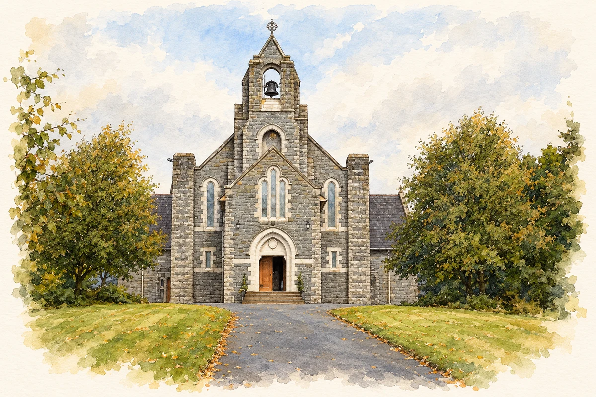
Saint Michael’s limestone church and the former national school anchor Annayalla’s built heritage, while nearby Cloghan has become a county centre for Gaelic games.
Illustration, St Michael Church, Annayalla, County Monaghan
⊕Recorded locationAnnayalla54.16044° N · 6.78670° WInteractive map supplied by OpenStreetMap.
These Irish name elements are associated with this record in the Logainm glossary.
An element’s translation is a clue, rather than a complete explanation of the name. Its form and meaning depend on local history and the full Irish name.
Recorded forms
Eanaigh Gheala· Irish · main form · validated name
Annayalla· English · main form
Anyalla· English · main form · local name
Place & story
Saint Michael’s church
William Scott designed Saint Michael’s Catholic church, a cruciform limestone building with a prominent belfry, buttresses and an open timber roof. Inside, pointed arches rest on stone pillars between the nave and side aisles. The parish’s centenary account records the laying of its foundation stone on 6 May 1923 by Cardinal Michael Logue and Bishop Patrick McKenna, followed by dedication in May 1927. The surrounding burial grounds preserve an earlier layer of worship: the older cemetery belonged to a church dating to about 1800.[2][3]
The former national school
Annyalla National School opened in 1929 opposite the burial ground beside Saint Michael’s. Its symmetrical layout provided separate classrooms for boys and girls. A projecting entrance porch, a carved date plaque and surviving timber sash windows distinguish the building, while a sheltered yard provided outdoor space behind it. The National Inventory of Architectural Heritage identifies it as a characteristic example of the rural schools built to Office of Public Works designs during the early twentieth century.[4]
Gaelic games at nearby Cloghan
Nearby Cloghan, in the wider Annyalla area, is home to Monaghan GAA’s county training centre. Its official opening took place in May 2008. Five floodlit pitches provided space for county teams, and an extension in November 2013 enlarged the building accommodation. In its 2018 account, Monaghan GAA described eight dressing rooms alongside meeting rooms, canteens and offices for coaching and administrative staff. The centre brought county training facilities together just off the N 2 between Castleblayney and Clontibret.[5]
Both counts use the 2016 settlement boundary, allowing like-for-like comparison. CSO supplies the 2022 count on this older boundary for comparison only. The official 2022 Built Up Area has different boundaries.
View population figures
Annayalla — Census 2016 settlement footprint — census population
These figures use different area definitions. Read the boundary note before comparing them.
Annayalla, Monaghan
Published census settlement populations
228people · 2016
Settlement boundaries changed during this period. Differences may reflect boundary changes as well as population change. Where a 2011 legal-town-and-environs count is shown, it has not been recalculated onto the 2016 settlement boundary.
St Michael Church, Annayalla, County Monaghan illustration: based on a St. Michael's Church, Annyalla, Co. Monaghan by Brian Lenehan. AI-assisted watercolour and ink adaptation; cream paper margins added, incidental clutter omitted and fine details simplified. Licence: CC BY-SA 2.0.
 placenames