 placenames
Ceann an Bhathla
Ceann an Bhathla lies within Heilbhic in the Waterford Gaeltacht, where the harbour’s structures and recorded Irish speech preserve different parts of local history.
The name
These Irish name elements are associated with this record in the Logainm glossary.
An element’s translation is a clue, rather than a complete explanation of the name. Its form and meaning depend on local history and the full Irish name.
Recorded forms
- Ceann an Bhathla · Irish · main form
Place & story
Alfred Delap’s new pier at Heilbhic
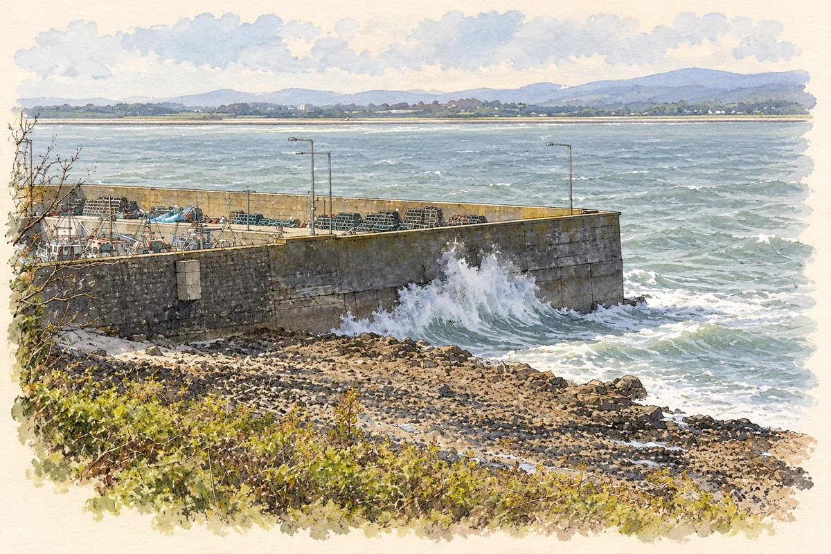
The new pier at Heilbhic was built between 1912 and 1915 to designs by engineer Alfred Dover Delap. Its angled L-shaped plan extends into Dungarvan Harbour, with battered concrete walls, chamfered coping and concrete mooring posts. The architectural inventory identifies it as an important early twentieth-century structure. Its construction provided durable harbour works for the coastal community around Ceann an Bhathla. [2]
The Naomh Garbhán memorial
A plaque at the pier commemorates John Griffin senior, John Griffin junior and Nicholas Cuddihy. Their fishing boat, Naomh Garbhán, struck a mine and sank off Helvick Head on 2 May 1945. Patrick Whelan survived. The inscription, recorded by the architectural inventory, gives the harbour a specific connection with the continuing dangers of wartime mines to local fishermen at the end of the Second World War. [2]
Jack Ó Corraoin’s recorded Irish
The Repository of Irish Dialects preserves a 1974 interview between Pádraig Tyers and Jack Ó Corraoin, identifying the speaker's home as Ceann an Bhathla. The recording includes discussion of school, agricultural work and Heilbhic's new pier. Its presentation pairs traditional local forms with standard Irish equivalents, preserving evidence of the spoken dialect alongside recollections of everyday life in this coastal district. [3]
Geographic information
- Place type
- Population centre
- County
- Waterford
- Barony
- Decies-within-Drum
- Civil parish
- Ringagonagh
- Within
- Helvick
- Coordinates
- 52.04751, -7.55156
- Logainm ID
- 1416058 ↗
Sources & further reading
- Logainm.ie — Ceann an Bhathla. Place names and geographic record, licensed under CC BY 4.0.
- Cé Heilbhic,Helvick New Pier,registration22825009 · National Inventory of Architectural Heritage
- Jack Ó Corraoin,Ceann an Bhathla,1974,QQTRIN016168 · RTÉ Archives and Fiontar and Scoil na Gaeilge,DCU,Repository of Irish Dialects
- Helvick New Pier at Heilbhic, near Ceann an Bhathla illustration: based on a Helvick New Pier by Hywel Williams. AI-assisted watercolour and ink adaptation; cream paper margins added, incidental clutter omitted and fine details simplified. Licence: CC BY-SA 2.0.
Name record retrieved 2026-10-25 · Source record modified 2026-08-24. How this page was prepared.