These Irish name elements are associated with this record in the Logainm glossary.
An element’s translation is a clue, rather than a complete explanation of the name. Its form and meaning depend on local history and the full Irish name.
Recorded forms
Cill Choca· Irish · main form · validated name
Kilcock· English · main form
Place & story
A market beside the Rye Water
Kilcock’s streets converge on a market square beside the Rye Water, which Lewis’s 1837 account identifies as a county boundary. The Galway road and Royal Canal brought different kinds of traffic through the settlement. Coal arrived by canal, while corn and potatoes bought at the Wednesday market travelled towards Dublin. A distillery, brewery and livestock fairs added to the town’s commercial activity.[2]
Lewis also records annual races on the common and surrounding pasture used to fatten cattle for Dublin and export markets. His town contained 330 houses in 1831. Courtown, associated with the Aylmer family, and Laragh, the seat of James Gannon, stood within wooded demesnes in the wider parish.[2]
A church built by local contributions
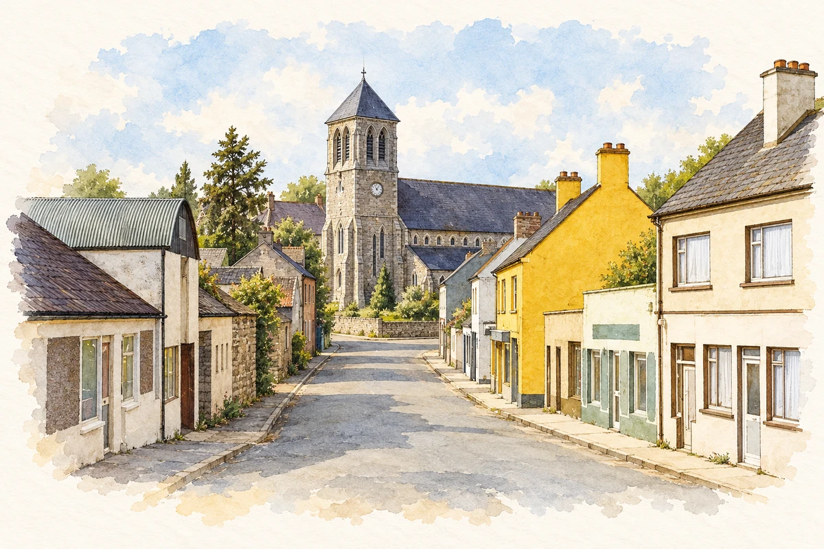
Saint Coca’s Catholic Church was built between 1861 and 1867. The National Inventory of Architectural Heritage describes a Gothic Revival nave with side aisles, a four-stage square tower and elaborate cut-stone detailing. Inside, granite columns carry the arcades beneath an exposed timber roof; carved altar furniture and stained glass contribute to the interior. Voluntary contributions funded the building.[3]
People & connections
McCarthy’s design and its builders
The Irish Architectural Archive identifies James Joseph McCarthy as the architect and Campbell and Dunn as the contractors. It records a construction cost of £6,175 and consecration in September 1867. These names connect Kilcock’s church with the wider nineteenth-century Catholic building movement while preserving the contribution of the people who executed the design.[4]
Both counts use the 2016 settlement boundary, allowing like-for-like comparison. CSO supplies the 2022 count on this older boundary for comparison only. The official 2022 Built Up Area has different boundaries.
View population figures
Kilcock — Census 2016 settlement footprint — census population
These are the historical areas published in the 2006 census report. Boundaries may differ between censuses and from modern settlements. Legal towns, environs and suburbs are shown separately; none has been combined into a modern settlement total.
View population figures
Kilcock, Kildare — Census town, CSO 2006 report — census population
These are the historical areas published in the 1996 census report. Boundaries may differ between censuses and from modern settlements. Legal towns, environs and suburbs are shown separately; none has been combined into a modern settlement total.
View population figures
Kilcock, Kildare — Census town, CSO 1996 report — census population
Figures cover the historical town area printed in the 1986 report. Boundaries may have changed between censuses. Legal town, environs and suburb totals remain separate and differ from modern settlement boundaries.
View population figures
Kilcock, Kildare — Census town, CSO 1986 report — census population
These figures use different area definitions. Read the boundary note before comparing them.
Kilcock, Kildare
Published census settlement populations
6,093people · 2016
Settlement boundaries changed during this period. Differences may reflect boundary changes as well as population change. Where a 2011 legal-town-and-environs count is shown, it has not been recalculated onto the 2016 settlement boundary.
Saint Coca's Church viewed from New Lane, Kilcock, County Kildare illustration: based on a Kilcock, Co. Kildare by Ben Brooksbank. AI-assisted watercolour and ink adaptation; cream paper margins added, incidental clutter omitted and fine details simplified. Licence: CC BY-SA 2.0.
 placenames