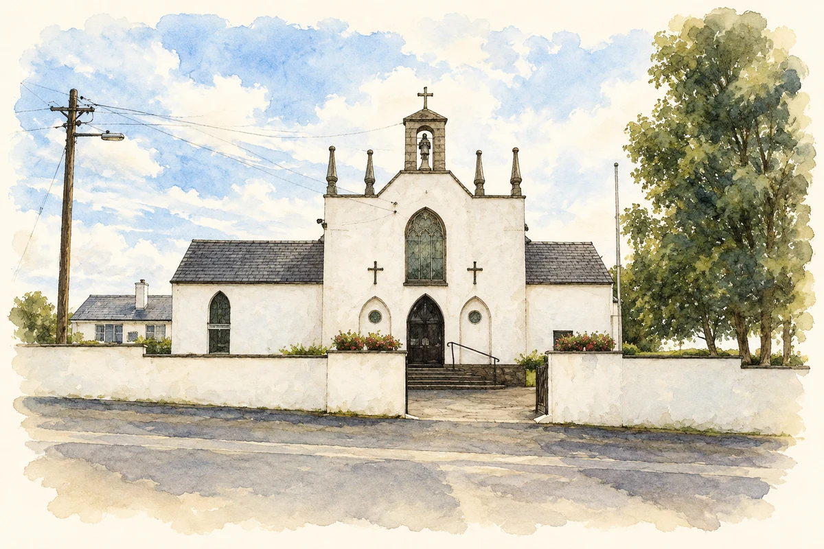
St Ita's gives Kilmead a distinctive skyline of pinnacles and a bellcote. The village's buildings preserve a history of worship, schooling and farming in south Kildare.
Illustration, St Ita's Church, Kilmead
⊕Recorded locationKilmead53.03499° N · 6.89833° WInteractive map supplied by OpenStreetMap.
These Irish name elements are associated with this record in the Logainm glossary.
An element’s translation is a clue, rather than a complete explanation of the name. Its form and meaning depend on local history and the full Irish name.
Recorded forms
Cill Míde· Irish · main form · validated name
Kilmead· English · main form
Place & story
The church at the village centre
St Ita's has served Kilmead since the late eighteenth century, before Catholic Emancipation. It is a chapel of ease in Narraghmore parish. The church's simple main elevations are punctuated by lancet windows, while the entrance gable is more elaborate: blind openings and glazed openings are combined beneath a parapet, bellcote and slender pinnacles. The parish's architectural description notes surviving early windows and a slate roof. Its restrained interior continues the plain treatment of the exterior, giving the village a substantial religious building whose strongest decoration is concentrated at the entrance.[2]
From two rooms to an enlarged school
Scoil Íde Naofa was built in 1949 as a two-room school serving Kilmead and its surrounding district. In 1976, Skerries National School closed and amalgamated with it. Prefabricated classrooms accommodated the extra children while successive school boards and local supporters campaigned for an extension. Approval came in 1996 for three classrooms, a staffroom, a library and medical room, and a general-purpose room. The school's history records a long interval between amalgamation and permanent expansion, showing how changes in the local school network shaped the village's educational buildings.[3]
Kilmead House and its courtyard
Kilmead House represents the domestic architecture of the surrounding farming country. The architectural inventory dates the rubble-stone house to around 1850 and describes a low, five-bay frontage with an attic. Its L-shaped plan includes a rear range and a carriageway leading into an internal courtyard. Renovation around 1980 altered the windows and added a porch and rear infill. The older arrangement of house, working ranges and enclosed yard remains useful evidence of the form of a nineteenth-century rural household.[4]
Both counts use the 2016 settlement boundary, allowing like-for-like comparison. CSO supplies the 2022 count on this older boundary for comparison only. The official 2022 Built Up Area has different boundaries.
View population figures
Kilmead — Census 2016 settlement footprint — census population
These are the historical areas published in the 2006 census report. Boundaries may differ between censuses and from modern settlements. Legal towns, environs and suburbs are shown separately; none has been combined into a modern settlement total.
View population figures
Kilmead, Kildare — Census town, CSO 2006 report — census population
These figures use different area definitions. Read the boundary note before comparing them.
Kilmead, Kildare
Published census settlement populations
309people · 2016
Settlement boundaries changed during this period. Differences may reflect boundary changes as well as population change. Where a 2011 legal-town-and-environs count is shown, it has not been recalculated onto the 2016 settlement boundary.
 placenames