Whitegate in northeast Clare is set between the Slieve Aughty uplands and Lough Derg. A 1943 survey preserves unusually practical details of village work, recreation and travel on the lake.
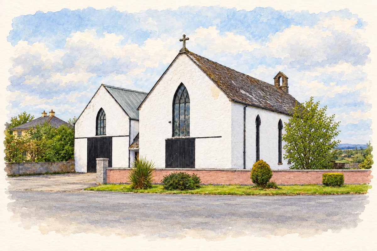
Illustration, Former Catholic church, Whitegate
⊕Recorded locationWhitegate52.95059° N · 8.37291° WInteractive map supplied by OpenStreetMap.
These Irish name elements are associated with this record in the Logainm glossary.
An element’s translation is a clue, rather than a complete explanation of the name. Its form and meaning depend on local history and the full Irish name.
Recorded forms
An Geata Bán· Irish · main form · validated name
Whitegate· English · main form
Place & story
Milk separating and fishing boats
Surveyor James Henchy visited Whitegate on 8 May 1943. He recorded a branch creamery which separated milk before sending the cream to Scariff, together with five pubs, three other businesses, a post office and a hall. The parish had fourteen timber fishing boats, and a visitor could hire a boat with a boatman or cross the Shannon to Tipperary. The survey connects the village's inland services with work and transport on Lough Derg, beyond the main street itself.[2]
Three dances paid for the field
Henchy recorded that three fundraising dances had paid the £200 purchase price of the parish recreation field. A second rented field also hosted sporting fixtures. Card parties and whist drives took place in the village hall. The school, a quarter-mile east, had three teaching rooms and about a hundred pupils on its rolls. At the time of the visit, Whitegate was also changing from four annual fairs to a fair on the 28 th of every month. These details show villagers organising recreation, education and trading space together.[2]
A chapel put to other uses
Saint Flannan's former chapel dates to 1874. Its gabled front, stone bellcote and lancet windows retain the outline of a nineteenth-century place of worship. After deconsecration, a matching gabled block was added beside it around 1970 for factory use. An archaeological building survey records subsequent boatbuilding and furniture manufacture, with the entrance widened for loading. The surviving structure therefore carries two histories: its original religious role and the practical changes made when a large village building became a workplace.[3][4]
Both counts use the 2016 settlement boundary, allowing like-for-like comparison. CSO supplies the 2022 count on this older boundary for comparison only. The official 2022 Built Up Area has different boundaries.
View population figures
Whitegate — Census 2016 settlement footprint — census population
These are the historical areas published in the 2006 census report. Boundaries may differ between censuses and from modern settlements. Legal towns, environs and suburbs are shown separately; none has been combined into a modern settlement total.
View population figures
Whitegate, Clare — Census town, CSO 2006 report — census population
These are the historical areas published in the 1996 census report. Boundaries may differ between censuses and from modern settlements. Legal towns, environs and suburbs are shown separately; none has been combined into a modern settlement total.
View population figures
Whitegate, Clare — Census town, CSO 1996 report — census population
Figures cover the historical town area printed in the 1986 report. Boundaries may have changed between censuses. Legal town, environs and suburb totals remain separate and differ from modern settlement boundaries.
View population figures
Whitegate, Clare — Census town, CSO 1986 report — census population
These figures use different area definitions. Read the boundary note before comparing them.
Whitegate, Clare
Published census settlement populations
168people · 2016
Settlement boundaries changed during this period. Differences may reflect boundary changes as well as population change. Where a 2011 legal-town-and-environs count is shown, it has not been recalculated onto the 2016 settlement boundary.
 placenames