These Irish name elements are associated with this record in the Logainm glossary.
An element’s translation is a clue, rather than a complete explanation of the name. Its form and meaning depend on local history and the full Irish name.
Recorded forms
An Fearann· Irish · main form · validated name
Farran· English · main form
Place & story
The Penrose and Clarke house
Farran House was occupied by Samuel Penrose in 1837 and remained his property at the time of Griffith’s Valuation. William Clarke bought it in 1868; the University of Galway’s Landed Estates research records three generations of the family living there until 1970. Clarke was a Cork tobacco merchant whose business became a major producer. The estate thus connects Farran with the commercial fortunes of nineteenth-century Cork, while the house’s successive owners provide a documented thread through its history.[2][3]
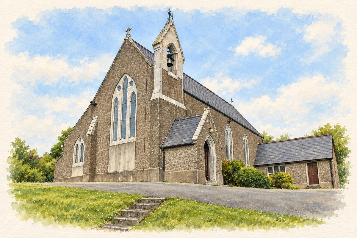
A church with a single side aisle
Farran’s Catholic church dates to 1860 and was designed by the Sheffield partnership Hadfield and Goldie, with John Crean as contractor. Its elevated position gives it a prominent place in the village. The architectural inventory draws attention to its unusual single side aisle, separated from the nave by pointed arches on carved limestone columns. A timber roof with scissor braces, stained glass and stone detailing enrich the interior. Outside, a limestone bellcote and pointed windows identify its Gothic Revival design.[4]
From estate woodland to lakeside park
Nearby Farran Forest Park occupies part of the former estate on the southern shore of Inniscarra reservoir. Coillte describes earlier planting for game cover alongside conifers and broadleaved trees, with a hunting lodge and ornamental water feature. The much larger reservoir came later: agricultural land was flooded in the mid 1950s to supply the Inniscarra hydroelectric station. Woodland paths now meet this engineered waterscape, where rowing is a conspicuous part of the lake’s recreational life.[5]
Both counts use the 2016 settlement boundary, allowing like-for-like comparison. CSO supplies the 2022 count on this older boundary for comparison only. The official 2022 Built Up Area has different boundaries.
View population figures
Farran — Census 2016 settlement footprint — census population
These are the historical areas published in the 2006 census report. Boundaries may differ between censuses and from modern settlements. Legal towns, environs and suburbs are shown separately; none has been combined into a modern settlement total.
View population figures
Farran, Cork — Census town, CSO 2006 report — census population
These are the historical areas published in the 1996 census report. Boundaries may differ between censuses and from modern settlements. Legal towns, environs and suburbs are shown separately; none has been combined into a modern settlement total.
View population figures
Farran, Cork — Census town, CSO 1996 report — census population
Figures cover the historical town area printed in the 1986 report. Boundaries may have changed between censuses. Legal town, environs and suburb totals remain separate and differ from modern settlement boundaries.
View population figures
Farran, Cork — Census town, CSO 1986 report — census population
These figures use different area definitions. Read the boundary note before comparing them.
Farran, Cork
Published census settlement populations
345people · 2016
Settlement boundaries changed during this period. Differences may reflect boundary changes as well as population change. Where a 2011 legal-town-and-environs count is shown, it has not been recalculated onto the 2016 settlement boundary.
 placenames