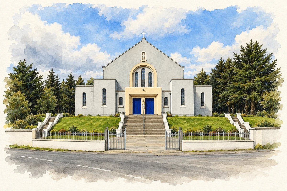
Gortahork’s Irish-language college brought teachers and cultural revivalists into the Donegal Gaeltacht, while its hillside church reflects a later architectural moment.
Illustration, Church of Christ the King, Gortahork
⊕Recorded locationGortahork55.11819° N · 8.13798° WInteractive map supplied by OpenStreetMap.
These Irish name elements are associated with this record in the Logainm glossary.
An element’s translation is a clue, rather than a complete explanation of the name. Its form and meaning depend on local history and the full Irish name.
Recorded forms
Gort an Choirce· Irish · main form · validated name
Gortahork· English · main form
Place & story
Training teachers through Irish
Coláiste Uladh began in 1906 as an Irish-language summer college for teachers, initially called Ardscoil Cholmcille. Donegal County Archives’ education pack explains that its founders sought to remedy a shortage of qualified teachers of Irish. It first occupied a dwelling house, then a purpose-built hall funded by Roger Casement. Local households provided lodgings, and locally made furniture equipped the college: language education also brought work and income into the district.[2]
People & connections
Úna Ní Fhaircheallaigh and the college visitors
Úna Ní Fhaircheallaigh served as principal until 1917. The county archives records a broad curriculum encompassing language study, teaching methods, literature, history, music and dancing. Among those who attended were Patrick Pearse, Roger Casement, Douglas Hyde, Carl Hardebeck and writer Séamus Ó Grianna. Gortahork therefore became a meeting place between local Irish-speaking culture and a wider network of teachers, writers and language activists.[2][3]
Christ the King above the village
The Catholic Church of Christ the King was built in 1949–54 to designs by Derry architect William James Doherty. Its geometric exterior combines a tall pitched-roof nave with low flat-roofed aisles and entrance projections. Inside, the National Inventory of Architectural Heritage records a coffered ceiling, marble and gold mosaic in the apse, and stained glass including a Nativity scene. The building’s raised position and flights of entrance steps give its modern forms a prominent setting in Gortahork.[4]
Gort An Choirce — Census 2016 settlement footprint
Population within 2016 settlement boundaries
212people · 2022
Both counts use the 2016 settlement boundary, allowing like-for-like comparison. CSO supplies the 2022 count on this older boundary for comparison only. The official 2022 Built Up Area has different boundaries.
View population figures
Gort An Choirce — Census 2016 settlement footprint — census population
Gort an Choirce, Donegal — Census town, CSO 2006 report
2002–2006: census town
149people · 2006
These are the historical areas published in the 2006 census report. Boundaries may differ between censuses and from modern settlements. Legal towns, environs and suburbs are shown separately; none has been combined into a modern settlement total.
View population figures
Gort an Choirce, Donegal — Census town, CSO 2006 report — census population
Gort an Choirce, Donegal — Census town, CSO 1996 report
1991–1996: census town
152people · 1996
These are the historical areas published in the 1996 census report. Boundaries may differ between censuses and from modern settlements. Legal towns, environs and suburbs are shown separately; none has been combined into a modern settlement total.
View population figures
Gort an Choirce, Donegal — Census town, CSO 1996 report — census population
These figures use different area definitions. Read the boundary note before comparing them.
Gort an Choirce, Donegal
Published census settlement populations
185people · 2016
Settlement boundaries changed during this period. Differences may reflect boundary changes as well as population change. Where a 2011 legal-town-and-environs count is shown, it has not been recalculated onto the 2016 settlement boundary.
Church of Christ the King, Gortahork illustration: based on a Christ the King RC Church, Gortahork by Kenneth Allen. AI-assisted watercolour and ink adaptation; cream paper margins added, incidental clutter omitted and fine details simplified. Licence: CC BY-SA 2.0.
 placenames