A reliable full-name meaning has not been established here. The recorded Irish and English forms are given without an unsupported translation.
Recorded forms
An Lathaigh· Irish · main form · validated name
Laghy· English · main form
Place & story
A bridge built and enlarged
Laghy Bridge, also called the Seven Arch Bridge, was built about 1768, extended at its northern end around 1775 and repaired in 1797. The National Inventory of Architectural Heritage connects it with the former Dublin/Sligo–Derry mail-coach route. Its segmental arches and stone cutwaters survive, although the southernmost arch has been filled in and later strengthening added. The sequence of alterations shows the crossing being maintained and adapted, rather than surviving wholly unchanged from its first construction.[2]
The church’s elaborate west front
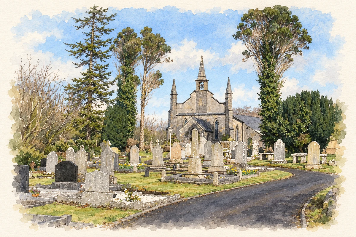
Laghy’s Church of Ireland church was built in 1834–37 with money raised by private subscription. Its small nave contrasts with an elaborate entrance front, where diagonal buttresses rise towards stone pinnacles and a central bellcote. Later work in 1911–19 added a shallow chancel and a northern transept. The building stands beside the bridge near the village’s northern end, with a graveyard completing the riverside group. The original architect has not been identified.[3]
The former rectory at Raneany West
North of the church, the former rectory at Raneany West dates from about 1840. Its two-storey house retains sash windows, a central entrance porch and timber finials, with stone outbuildings behind. The architectural inventory associates it with the church as a related group of buildings. Its domestic scale and enclosed grounds give a different expression to the parish’s nineteenth-century presence from the church’s public-facing pinnacles and bellcote.[4]
Both counts use the 2016 settlement boundary, allowing like-for-like comparison. CSO supplies the 2022 count on this older boundary for comparison only. The official 2022 Built Up Area has different boundaries.
View population figures
Laghy — Census 2016 settlement footprint — census population
These are the historical areas published in the 2006 census report. Boundaries may differ between censuses and from modern settlements. Legal towns, environs and suburbs are shown separately; none has been combined into a modern settlement total.
View population figures
Laghy, Donegal — Census town, CSO 2006 report — census population
These are the historical areas published in the 1996 census report. Boundaries may differ between censuses and from modern settlements. Legal towns, environs and suburbs are shown separately; none has been combined into a modern settlement total.
View population figures
Laghy, Donegal — Census town, CSO 1996 report — census population
Figures cover the historical town area printed in the 1986 report. Boundaries may have changed between censuses. Legal town, environs and suburb totals remain separate and differ from modern settlement boundaries.
View population figures
Laghy, Donegal — Census town, CSO 1986 report — census population
These figures use different area definitions. Read the boundary note before comparing them.
Laghy, Donegal
Published census settlement populations
183people · 2016
Settlement boundaries changed during this period. Differences may reflect boundary changes as well as population change. Where a 2011 legal-town-and-environs count is shown, it has not been recalculated onto the 2016 settlement boundary.
Laghy Church of Ireland church illustration: based on a Church of Ireland, Laghey Co Donegal by Dennis Reynolds. AI-assisted watercolour and ink adaptation; cream paper margins added, incidental clutter omitted and fine details simplified. Licence: CC BY-SA 2.0.
 placenames