A reliable full-name meaning has not been established here. The recorded Irish and English forms are given without an unsupported translation.
Recorded forms
Leifear· Irish · main form · validated name
Lifford· English · main form
Place & story
From stronghold to chartered town
Samuel Lewis's 1837 account describes Lifford as an earlier O'Donnell stronghold, followed by an English fortified post and a growing town. He records the 1611 grant to Richard Hansard, with conditions to provide house plots and gardens for sixty inhabitants and land for common use. These requirements show settlement planning as part of the plantation grant. Hansard's later benefactions included a school endowment. Lewis also notes the older parish name, Clonleigh, a useful distinction when tracing records associated with the town and its surrounding parish.[2]
Michael Priestley’s courthouse
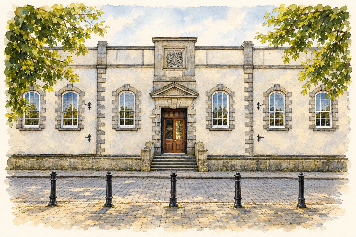
The courthouse was completed in 1746 to designs by Michael Priestley. Its original basement gaol confined prisoners beneath the courtroom, before a larger adjoining prison was built in 1793. The courthouse's own history records trials continuing until 1938 and its eventual restoration as a heritage centre in 1994. The building therefore preserves a long sequence of public uses. Its cells and courtroom belong to a working system of imprisonment and county justice, rather than having been constructed as a later historical attraction.[3]
A famous execution story with a disputed location
John MacNaghten's execution in 1761 is often associated with Lifford's courthouse, whose visitor history includes the story. The Dictionary of Irish Biography, however, places his trial in Strabane and the gallows on the road from Strabane towards Lifford. It records that the rope broke before the execution was completed, giving rise to the enduring nickname Half-Hanged MacNaghten. His conviction followed the killing of Mary Anne Knox during an attempted abduction. The conflicting locations should be kept visible rather than turning a regional story into a certain event at the courthouse door.[4][3]
Both counts use the 2016 settlement boundary, allowing like-for-like comparison. CSO supplies the 2022 count on this older boundary for comparison only. The official 2022 Built Up Area has different boundaries.
View population figures
Lifford — Census 2016 settlement footprint — census population
These are the historical areas published in the 2006 census report. Boundaries may differ between censuses and from modern settlements. Legal towns, environs and suburbs are shown separately; none has been combined into a modern settlement total.
View population figures
Lifford, Donegal — Census town, CSO 2006 report — census population
These are the historical areas published in the 1996 census report. Boundaries may differ between censuses and from modern settlements. Legal towns, environs and suburbs are shown separately; none has been combined into a modern settlement total.
View population figures
Lifford, Donegal — Census town, CSO 1996 report — census population
Figures cover the historical town area printed in the 1986 report. Boundaries may have changed between censuses. Legal town, environs and suburb totals remain separate and differ from modern settlement boundaries.
View population figures
Lifford, Donegal — Census town, CSO 1986 report — census population
These figures use different area definitions. Read the boundary note before comparing them.
Lifford, Donegal
Published census settlement populations
1,626people · 2016
Settlement boundaries changed during this period. Differences may reflect boundary changes as well as population change. Where a 2011 legal-town-and-environs count is shown, it has not been recalculated onto the 2016 settlement boundary.
Central facade of Lifford Courthouse, County Donegal illustration: based on a Museum and tea rooms, Lifford by Kenneth Allen. AI-assisted watercolour and ink adaptation; cream paper margins added, incidental clutter omitted and fine details simplified. Licence: CC BY-SA 2.0.
 placenames