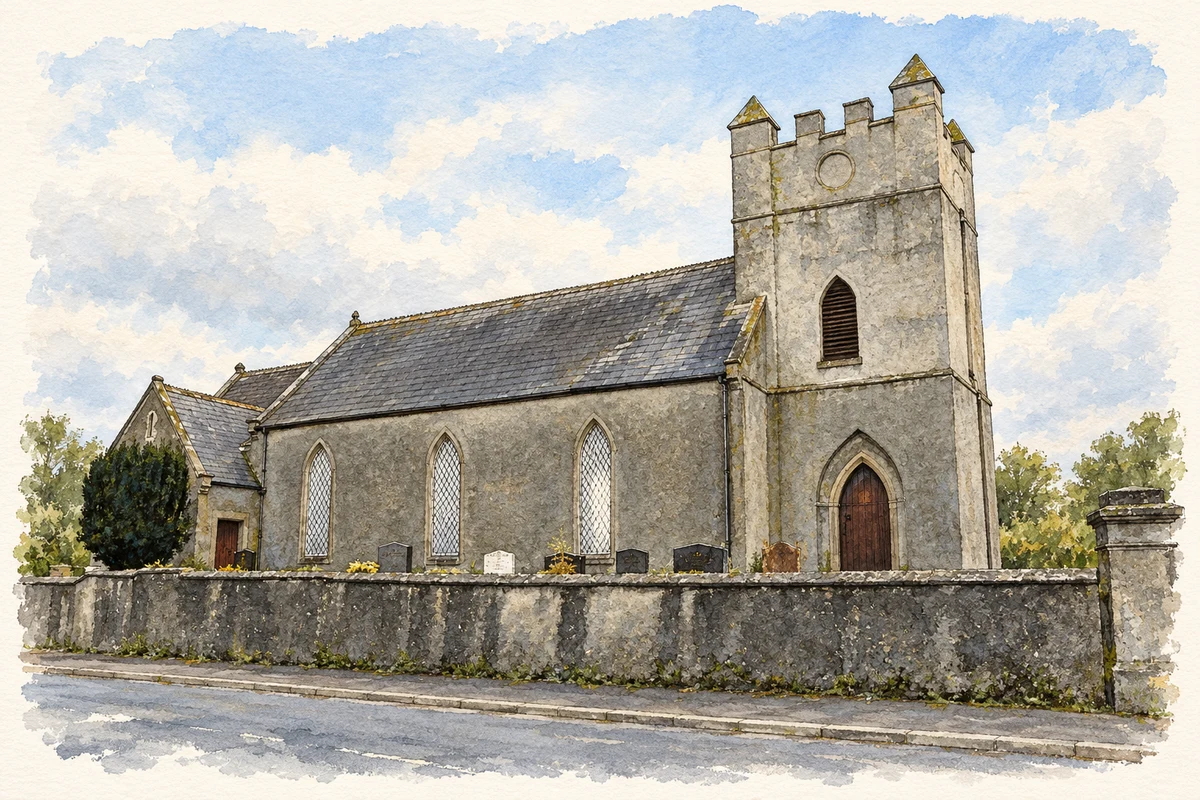
Manorcunningham’s name recalls the Cunningham settlers, while Raymochy church preserves the history of a parish once served by the philosopher William Archer Butler.
These Irish name elements are associated with this record in the Logainm glossary.
An element’s translation is a clue, rather than a complete explanation of the name. Its form and meaning depend on local history and the full Irish name.
Recorded forms
Mainéar Uí Chuinneagáin· Irish · main form · validated name
Manorcunningham· English · main form
Place & story
The Cunningham settlement
The library history project Ask About Ireland places Manorcunningham within the plantation of the Laggan district after the departure of the earls in 1607. James Cunningham and his relatives received lands in the Portlough area, and the settlement was known as the Manor of Fort Cunningham. The project traces the movement of tenants from Scotland alongside the grants to the landholders. That context connects the town's name with a documented phase of settlement and land redistribution, rather than with an assumed translation assembled from modern word fragments.[2]
Raymochy church and its memorial glass
Raymochy's Church of Ireland church was built in 1792. A new chancel and vestry, designed by the Derry architect William Edward Pinkerton, were added in the early twentieth century, and the church reopened in August 1910. The chancel window depicts the Transfiguration and was made by Curtis, Ward and Hughes of London. Its dedication records John Mills of Listillion and the gift of his son in Australia. The building thus preserves an eighteenth-century parish foundation, later architectural work and an emigrant family's continuing connection with home.[3]
People & connections
William Archer Butler’s final years
William Archer Butler became rector of Raymoghy in 1841 while also holding the chair of moral philosophy at Trinity College Dublin. He lived in the parish when his university duties allowed and worked on sermons, philosophical lectures and theological controversy. During the Famine he devoted himself to local relief work. He died of fever in July 1848 and was buried in the churchyard. His biographer records that he kept detailed notes on parish families, but that their whereabouts are unknown: they should not be assumed to survive as an accessible genealogy collection.[4]
Manorcunningham — Census 2016 settlement footprint
Population within 2016 settlement boundaries
785people · 2022
Both counts use the 2016 settlement boundary, allowing like-for-like comparison. CSO supplies the 2022 count on this older boundary for comparison only. The official 2022 Built Up Area has different boundaries.
View population figures
Manorcunningham — Census 2016 settlement footprint — census population
Manorcunningham, Donegal — Census town, CSO 2006 report
2002–2006: census town
414people · 2006
These are the historical areas published in the 2006 census report. Boundaries may differ between censuses and from modern settlements. Legal towns, environs and suburbs are shown separately; none has been combined into a modern settlement total.
View population figures
Manorcunningham, Donegal — Census town, CSO 2006 report — census population
Manorcunningham, Donegal — Census town, CSO 1996 report
1991–1996: census town
404people · 1996
These are the historical areas published in the 1996 census report. Boundaries may differ between censuses and from modern settlements. Legal towns, environs and suburbs are shown separately; none has been combined into a modern settlement total.
View population figures
Manorcunningham, Donegal — Census town, CSO 1996 report — census population
Manorcunningham, Donegal — Census town, CSO 1986 report
1981–1986: census town
441people · 1986
Figures cover the historical town area printed in the 1986 report. Boundaries may have changed between censuses. Legal town, environs and suburb totals remain separate and differ from modern settlement boundaries.
View population figures
Manorcunningham, Donegal — Census town, CSO 1986 report — census population
These figures use different area definitions. Read the boundary note before comparing them.
Manorcunningham, Donegal
Published census settlement populations
675people · 2016
Settlement boundaries changed during this period. Differences may reflect boundary changes as well as population change. Where a 2011 legal-town-and-environs count is shown, it has not been recalculated onto the 2016 settlement boundary.
Raymochy Parish Church, Manorcunningham illustration: based on a Raymochy Parish Church of Ireland, Manorcunningham by Kenneth Allen. AI-assisted watercolour and ink adaptation; cream paper margins added, incidental clutter omitted and fine details simplified. Licence: CC BY-SA 2.0.
 placenames