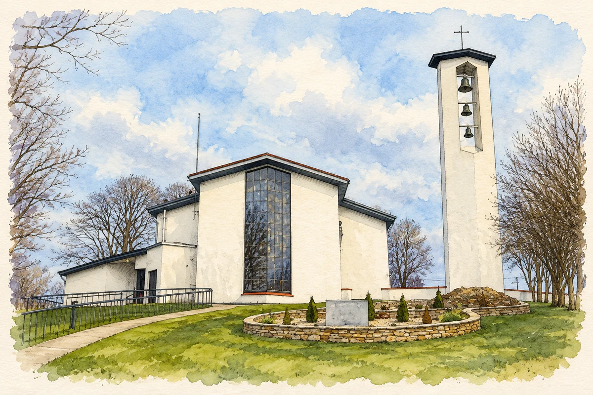
Milford's nineteenth-century expansion left records of poor relief, neighbouring Presbyterian congregations and a church by Joseph Welland that survives only in part.
Illustration, St Peter's Church, Milford
⊕Recorded locationMillford55.08908° N · 7.69950° WInteractive map supplied by OpenStreetMap.
These Irish name elements are associated with this record in the Logainm glossary.
An element’s translation is a clue, rather than a complete explanation of the name. Its form and meaning depend on local history and the full Irish name.
Recorded forms
Baile na nGallóglach· Irish · main form · validated name
Millford· English · main form
Milford· English · main form
Place & story
Choosing land for the workhouse
The search for Milford's workhouse site shows how poor-relief administration depended on property negotiations. In December 1841 an assistant architect, Mr Doolan, examined proposed locations and favoured three: on the Kilmacrennan, Quay and Ramelton roads. None became the selected site. Donegal County Archives' account of the guardians' minutes records a different arrangement in April 1842, when six acres at Drumbarn were to be leased from Lord Leitrim for twelve pounds a year. Legal difficulties over the land complicated the process of providing the new institution.[2]
The Covenanters' meeting house
The former Reformed Presbyterian meeting house on Kilmacrennan Road is dated 1837. A second Presbyterian church was built beside it, making their neighbouring sites a distinctive feature of Milford's religious history. The Reformed Presbyterian building's long, plain elevations and pointed windows reflect a restrained approach to church design. The architectural survey records later alterations in 1927 and 2005, while noting how much of its earlier form remained. Its history belongs to the Covenanter tradition, whose congregations maintained a separate organisation from other Presbyterians.[3]
People & connections
Joseph Welland's lost church
Joseph Welland designed St Columba's Church of Ireland church, commissioned in 1855 and consecrated on 7 August 1860. His design included a five-bay nave, bellcote, chancel and projecting porch, with a king-post roof inside. A lightning strike in 1982 damaged the church, and demolition followed around 1984. The surviving porch preserves finely worked sandstone, buttresses and carved details from this commission. The survey notes that it may have been rebuilt or repositioned. It stands within the former church grounds as a small surviving part of a much larger building.[4]
Both counts use the 2016 settlement boundary, allowing like-for-like comparison. CSO supplies the 2022 count on this older boundary for comparison only. The official 2022 Built Up Area has different boundaries.
View population figures
Milford — Census 2016 settlement footprint — census population
These are the historical areas published in the 2006 census report. Boundaries may differ between censuses and from modern settlements. Legal towns, environs and suburbs are shown separately; none has been combined into a modern settlement total.
View population figures
Milford, Donegal — Census town, CSO 2006 report — census population
These are the historical areas published in the 1996 census report. Boundaries may differ between censuses and from modern settlements. Legal towns, environs and suburbs are shown separately; none has been combined into a modern settlement total.
View population figures
Milford, Donegal — Census town, CSO 1996 report — census population
Figures cover the historical town area printed in the 1986 report. Boundaries may have changed between censuses. Legal town, environs and suburb totals remain separate and differ from modern settlement boundaries.
View population figures
Milford, Donegal — Census town, CSO 1986 report — census population
These figures use different area definitions. Read the boundary note before comparing them.
Milford, Donegal
Published census settlement populations
1,037people · 2016
Settlement boundaries changed during this period. Differences may reflect boundary changes as well as population change. Where a 2011 legal-town-and-environs count is shown, it has not been recalculated onto the 2016 settlement boundary.
 placenames