 placenames
Ballygowan
Baile Mhic Gabhann
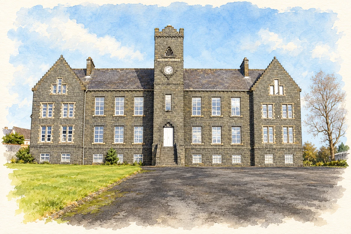
Ballygowan's most prominent historic building began as an orphanage and later served as a school and church halls, reflecting changing community needs.
The name
These Irish name elements are associated with this record in the Logainm glossary.
An element’s translation is a clue, rather than a complete explanation of the name. Its form and meaning depend on local history and the full Irish name.
Recorded forms
- Baile Mhic Gabhann · Irish · main form · validated name
- Ballygowan · English · main form
Place & story
Alexander Orr Reid’s memorial
The Olivet Home was funded by Alexander Orr Reid as a memorial to his son. Its large stone building became a conspicuous landmark in Ballygowan in the 1880s. Ards and North Down's heritage account records its original role as an orphanage and its purchase by the Presbyterian church in 1918. Later use as the village primary school, before the opening of the Alexander Dickson School, gave the former residential institution a new place in local education. It subsequently became church halls. [2]
The village in a 1910 directory
Ballygowan's Saturday market and post office appear in the 1910 Ulster directory. Telegraph and money-order facilities, together with two daily postal deliveries and despatches, show the communication services available to its surrounding rural district. [3]
A settlement between other towns
Ballygowan developed between Comber and Saintfield, with road connections towards Belfast and Newtownards. The borough council's village plan describes later growth as a commuter settlement while locating commercial activity around the Square and Belfast Road. This position helps explain the village's changing role: local farming services were joined by daily travel towards larger employment centres. Its historic buildings remain within a settlement shaped increasingly by those regional connections. [4]
Geographic information
- Place type
- Town
- County
- Down
- Barony
- Castlereagh Lower
- Civil parish
- Comber
- Civil parish
- Killinchy and Islands
- Coordinates
- 54.49517, -5.79265 (approximate)
- Logainm ID
- 1416626 ↗
Sources & further reading
- Logainm.ie — Ballygowan. Place names and geographic record, licensed under CC BY 4.0.
- Ballygowan: the Olivet Home · Visit Ards and North Down
- Ballygowan: Belfast and Ulster Towns Directory 1910 · Belfast and Ulster Towns Directory, reproduced by LibraryIreland
- Ballygowan Integrated Village Plan · Ards and North Down Borough Council
- Former Olivet Home, Ballygowan, County Down illustration: based on a Church building, Ballygowan by Kenneth Allen. AI-assisted watercolour and ink adaptation; cream paper margins added, incidental clutter omitted and fine details simplified. Licence: CC BY-SA 2.0.
Name record retrieved 2026-10-25 · Source record modified 2019-10-08. How this page was prepared.