These Irish name elements are associated with this record in the Logainm glossary.
An element’s translation is a clue, rather than a complete explanation of the name. Its form and meaning depend on local history and the full Irish name.
Recorded forms
Baile Átha an Róine· Irish · main form · validated name
Ballyroan· English · main form
Place & story
A village of fairs and farming
Samuel Lewis's 1837 account describes Ballyroan as a village with a constabulary station and several annual fairs, chiefly for cattle and pigs. Although it possessed a market patent, no market was then being held. Agriculture dominated the surrounding parish, with both tillage and dairying important. Lewis separately records mills at Cullinagh rather than placing every parish industry inside the village. His description offers a dated account of local economic life, including the difference between a legal market entitlement and actual trading activity.[2]
The school that moved to Abbeyleix
Ballyroan's endowed school benefited from lands bequeathed by Alderman Preston. Lewis described a substantial slated schoolhouse where boys received classical and English instruction. The Representative Church Body Library preserves later minute books, accounts and papers concerning its transfer from Ballyroan to Abbeyleix during the 1890s. There it operated as the Preston School at Beechfield from 1895. Those surviving records connect the two locations and help explain why research into a Ballyroan educational institution may lead to papers catalogued under Abbeyleix.[2][3]
Folklore & tradition
Moll Harding’s answer to a guest
In his 1827 Personal Sketches, Sir Jonah Barrington places an inn run by Moll Harding at Ballyroan, near his father's house. He recounts a guest complaining that his sheets had not been aired. Harding supposedly reassured him by explaining that every visiting gentleman during the previous fortnight had already slept in them. The joke belongs to Barrington's humorous memoir and should be read as an attributed anecdote, not a verified inspection of the inn. It preserves a local character through the storytelling habits of its author.[4]
Saint Patrick’s octagonal tower
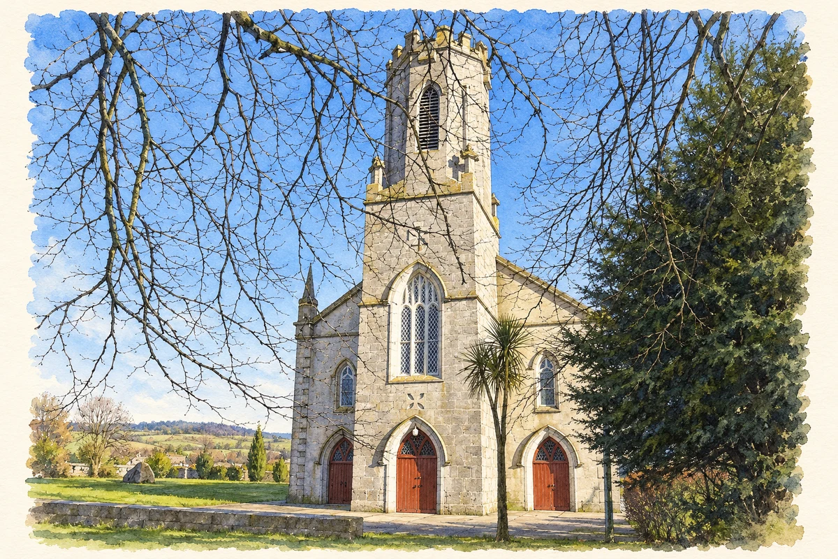
Saint Patrick's Catholic Church is dated 1840 in the architectural inventory. Its Gothic Revival design includes an unusual octagonal tower and stained glass by Mayer and Company of Munich. The building adds a substantial nineteenth-century architectural landmark to the village. The inventory's national rating recognises its architectural, artistic and technical interest, while its surviving form provides a more tangible record of Ballyroan's past than the buildings known chiefly through written accounts.[5]
Both counts use the 2016 settlement boundary, allowing like-for-like comparison. CSO supplies the 2022 count on this older boundary for comparison only. The official 2022 Built Up Area has different boundaries.
View population figures
Ballyroan — Census 2016 settlement footprint — census population
These are the historical areas published in the 2006 census report. Boundaries may differ between censuses and from modern settlements. Legal towns, environs and suburbs are shown separately; none has been combined into a modern settlement total.
View population figures
Ballyroan, Laois — Census town, CSO 2006 report — census population
These are the historical areas published in the 1996 census report. Boundaries may differ between censuses and from modern settlements. Legal towns, environs and suburbs are shown separately; none has been combined into a modern settlement total.
View population figures
Ballyroan, Laois — Census town, CSO 1996 report — census population
These figures use different area definitions. Read the boundary note before comparing them.
Ballyroan, Laois
Published census settlement populations
563people · 2016
Settlement boundaries changed during this period. Differences may reflect boundary changes as well as population change. Where a 2011 legal-town-and-environs count is shown, it has not been recalculated onto the 2016 settlement boundary.
 placenames