These Irish name elements are associated with this record in the Logainm glossary.
An element’s translation is a clue, rather than a complete explanation of the name. Its form and meaning depend on local history and the full Irish name.
Recorded forms
Baile an Bharúnaigh· Irish · main form · validated name
Barntown· English · main form
Place & story
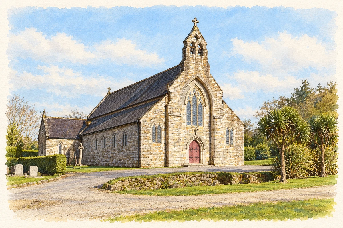
Pugin’s Saint Alphonsus
Saint Alphonsus's church was designed by Augustus Welby Northmore Pugin, drawing on a medieval church at Stanton in Cambridgeshire. The Dictionary of Irish Architects records the foundation stone in 1844, the first Mass in October 1848 and dedication in September 1851. Consecration followed much later, in 1899. An east window made by Hardman and Company to Pugin's design was presented by John Hyacinth Talbot. The sequence of dates captures the gradual process of building, furnishing and formally establishing a parish church.[2]
Remembering the Battle of Three Rocks
The Three Rocks battlefield near Barntown commemorates a rebel victory during the 1798 rising. Wexford County Council's record of the 2023 anniversary describes a ceremony at the monument and battlefield, with historian Ronan O'Flaherty explaining the defeat of government troops by forces led by Thomas Cloney and John Kelly. The event linked the battle with the subsequent rebel occupation of Wexford. Wreaths and a performance of the song The Rocks formed part of the commemoration, showing how the episode remains present in local public memory.[3]
Forth Mountain’s rocky skyline
Forth Mountain is a quartzite hill with prominent outcrops, or tors, rising above the surrounding lowlands. Geological Survey Ireland identifies Cambrian bedrock and features shaped during the much later Ice Age, including frost cracks and spreads of broken stone. Carrigfoyle Rock and other named outcrops belong to this landscape. The survey also notes that differences in the weathering of quartzite and shale may help explain the tors. The rocky skyline is therefore the product of several geological processes, long preceding the historical events associated with it.[4]
Both counts use the 2016 settlement boundary, allowing like-for-like comparison. CSO supplies the 2022 count on this older boundary for comparison only. The official 2022 Built Up Area has different boundaries.
View population figures
Barntown — Census 2016 settlement footprint — census population
These are the historical areas published in the 2006 census report. Boundaries may differ between censuses and from modern settlements. Legal towns, environs and suburbs are shown separately; none has been combined into a modern settlement total.
View population figures
Barntown, Wexford — Census town, CSO 2006 report — census population
These are the historical areas published in the 1996 census report. Boundaries may differ between censuses and from modern settlements. Legal towns, environs and suburbs are shown separately; none has been combined into a modern settlement total.
View population figures
Barntown, Wexford — Census town, CSO 1996 report — census population
Figures cover the historical town area printed in the 1986 report. Boundaries may have changed between censuses. Legal town, environs and suburb totals remain separate and differ from modern settlement boundaries.
View population figures
Barntown, Wexford — Census town, CSO 1986 report — census population
These figures use different area definitions. Read the boundary note before comparing them.
Barntown, Wexford
Published census settlement populations
459people · 2016
Settlement boundaries changed during this period. Differences may reflect boundary changes as well as population change. Where a 2011 legal-town-and-environs count is shown, it has not been recalculated onto the 2016 settlement boundary.
 placenames