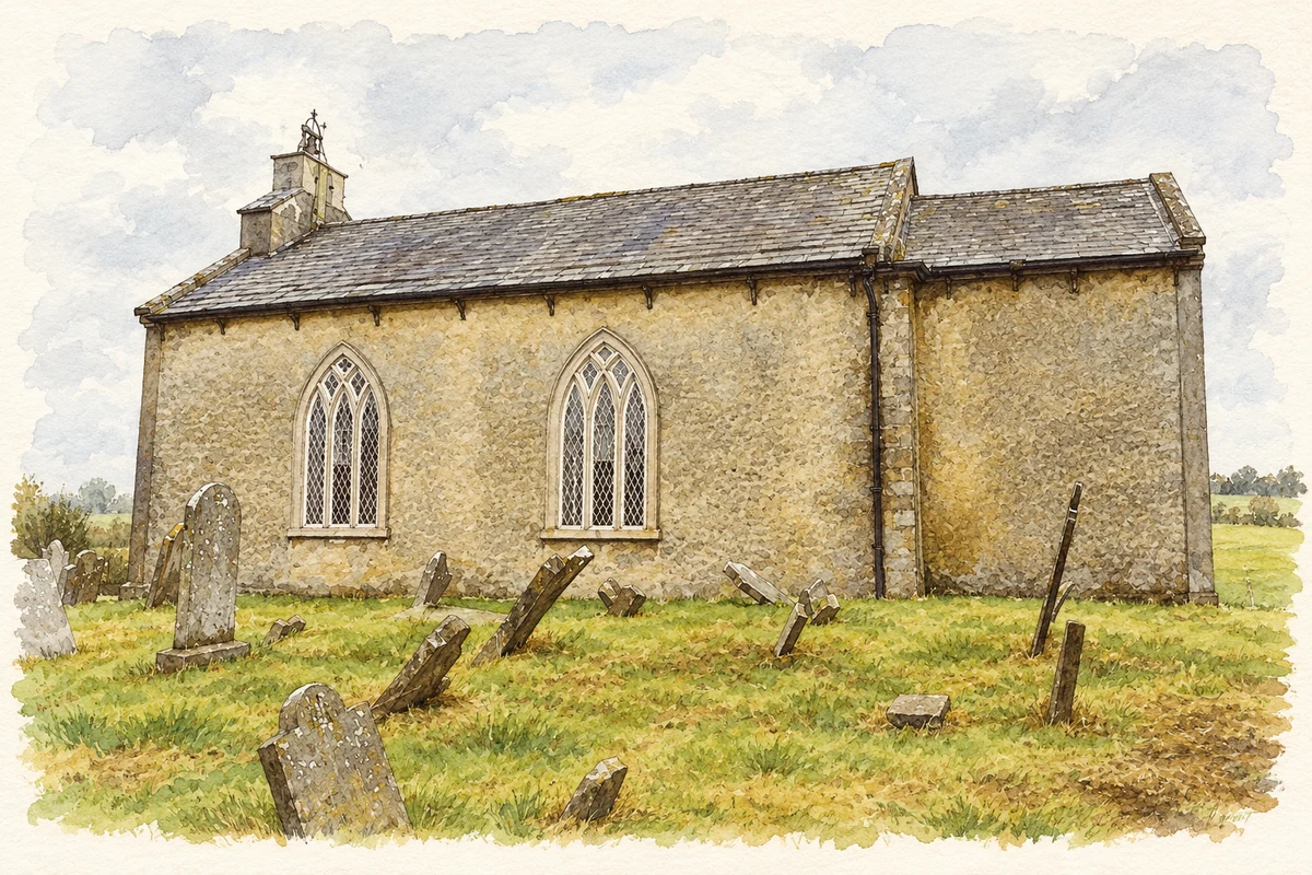
Drumconrath, also recorded as Drumcondra, preserves the shape of an older settlement beneath its later village streets. A prominent motte and the churchyard keep that medieval landscape visible.
Illustration, Saint Peter's Church, Drumcondra (Drumconrath), County Meath
⊕Recorded locationDrumcondra53.84782° N · 6.65589° WInteractive map supplied by OpenStreetMap.
These Irish name elements are associated with this record in the Logainm glossary.
An element’s translation is a clue, rather than a complete explanation of the name. Its form and meaning depend on local history and the full Irish name.
Recorded forms
Droim Conrach· Irish · main form · validated name
Drumcondra· English · main form
Drumconrath· English · main form · local name
Place & story
The medieval village in the modern plan
Drumconrath's earlier settlement can still be traced in its street pattern. The long plots running back from the main street, the churchyard and the motte north of the street all belong to a landscape with medieval origins. Meath County Council identifies medieval field patterns and settlement remains within and adjoining the village. Views between the buildings towards the motte preserve a particularly clear connection between the later village and the earthworks above it.[2]
The mail road and the village post
Samuel Lewis described Drumconrath in 1837 as a village on the mail road between Dublin and Londonderry. He counted 420 inhabitants in the village, within a much larger rural parish, and recorded a police station and a penny post to Ardee. The surrounding economy included grazing, tillage and limestone quarrying, with a building-stone quarry near the village. Lewis also noticed the large earthwork nearby, which had recently been planted with trees by H. Corbet Singleton and offered extensive views towards Dundalk Bay.[3]
A carefully carved church doorway
Saint Peter's Church is an eighteenth-century building with a bellcote over its western gable. Its principal doorway is a particularly distinctive feature: a carved limestone surround with alternating projecting blocks supports a pediment above the paired timber doors. Pointed windows introduce Gothic details, including stone tracery. A small chancel and vestry extend the building eastwards. The church, graveyard, entrance steps and gates form a related group with the former rectory nearby, preserving the architectural setting of the Church of Ireland parish.[4]
Both counts use the 2016 settlement boundary, allowing like-for-like comparison. CSO supplies the 2022 count on this older boundary for comparison only. The official 2022 Built Up Area has different boundaries.
View population figures
Drumconrath — Census 2016 settlement footprint — census population
These are the historical areas published in the 2006 census report. Boundaries may differ between censuses and from modern settlements. Legal towns, environs and suburbs are shown separately; none has been combined into a modern settlement total.
View population figures
Drumconrath, Meath — Census town, CSO 2006 report — census population
These are the historical areas published in the 1996 census report. Boundaries may differ between censuses and from modern settlements. Legal towns, environs and suburbs are shown separately; none has been combined into a modern settlement total.
View population figures
Drumconrath, Meath — Census town, CSO 1996 report — census population
Figures cover the historical town area printed in the 1986 report. Boundaries may have changed between censuses. Legal town, environs and suburb totals remain separate and differ from modern settlement boundaries.
View population figures
Drumconrath, Meath — Census town, CSO 1986 report — census population
These figures use different area definitions. Read the boundary note before comparing them.
Drumconrath, Meath
Published census settlement populations
345people · 2016
Settlement boundaries changed during this period. Differences may reflect boundary changes as well as population change. Where a 2011 legal-town-and-environs count is shown, it has not been recalculated onto the 2016 settlement boundary.
 placenames