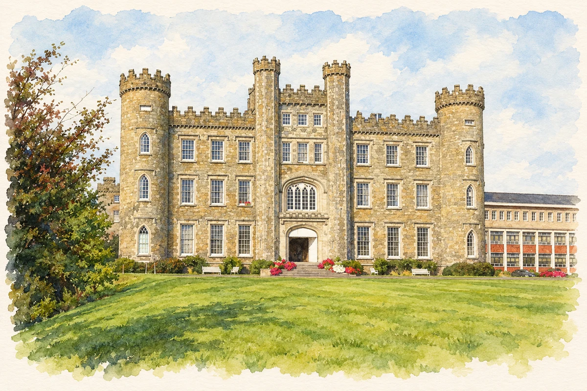
Gormanston's great castellated house brings together medieval family history, a nineteenth-century rebuilding and a tradition in which foxes warned of a death in the Preston family.
Illustration, Gormanston Castle (Gormanston College), County Meath
⊕Recorded locationGormanston53.63470° N · 6.23194° WInteractive map supplied by OpenStreetMap.
These Irish name elements are associated with this record in the Logainm glossary.
An element’s translation is a clue, rather than a complete explanation of the name. Its form and meaning depend on local history and the full Irish name.
Recorded forms
Baile Mhic Gormáin· Irish · main form · validated name
Gormanston· English · main form
Gormanstown· English · main form
Place & story
A medieval house in nineteenth-century dress
Gormanston Castle has medieval origins, but its present appearance owes much to rebuilding around 1820. The architectural survey describes a nine-bay house, three storeys above a basement, with a taller central entrance and castellated towers at either end. Stepped parapets, corbels and pointed window openings give the long frontage its fortified character. The survey associates the design with Thomas Wogan Browne and Richard Morrison, while treating their involvement as an attribution. It is a country house shaped by the nineteenth-century taste for medieval architecture, incorporating an older family seat.[2]
People & connections
The Prestons and a painter
The Preston family held Gormanston for centuries. Local historian Noel French records that the twelfth viscount's rebuilding was interrupted after his wife's death in 1820. A later family connection brought the military painter Elizabeth Butler to the castle: her daughter Eileen married the fifteenth viscount in 1911, and Butler spent her later years there. The house thus connected an old Meath estate with an artist celebrated for paintings of soldiers and military campaigns.[3]
From family seat to school
The Franciscans bought the castle in 1947, and the school opened in 1954. New school buildings followed in 1955–56, adding a substantial educational use to the estate. Gormanston College describes itself as a coeducational Catholic school owned by the Irish Franciscan Province. Its presence explains why the castle is now widely known through the college name, and why a house built for one family became part of the education of successive generations of pupils.[3][4]
Folklore & tradition
Foxes at the walls
A tradition printed in The Theosophist in August 1900 held that foxes gathered and howled around Gormanston Castle before the death of the head of the family. The account placed this Meath story among traditions of household death warnings, alongside Scottish ancestral apparitions. Its publication provides an early dated attestation of the Preston fox tradition.[5]
Both counts use the 2016 settlement boundary, allowing like-for-like comparison. CSO supplies the 2022 count on this older boundary for comparison only. The official 2022 Built Up Area has different boundaries.
View population figures
Gormanston — Census 2016 settlement footprint — census population
These are the historical areas published in the 2006 census report. Boundaries may differ between censuses and from modern settlements. Legal towns, environs and suburbs are shown separately; none has been combined into a modern settlement total.
View population figures
Gormanston, Meath — Census town, CSO 2006 report — census population
These are the historical areas published in the 1996 census report. Boundaries may differ between censuses and from modern settlements. Legal towns, environs and suburbs are shown separately; none has been combined into a modern settlement total.
View population figures
Gormanston, Meath — Census town, CSO 1996 report — census population
Figures cover the historical town area printed in the 1986 report. Boundaries may have changed between censuses. Legal town, environs and suburb totals remain separate and differ from modern settlement boundaries.
View population figures
Gormanston, Meath — Census town, CSO 1986 report — census population
These figures use different area definitions. Read the boundary note before comparing them.
Gormanston, Meath
Published census settlement populations
375people · 2016
Settlement boundaries changed during this period. Differences may reflect boundary changes as well as population change. Where a 2011 legal-town-and-environs count is shown, it has not been recalculated onto the 2016 settlement boundary.
Gormanston Castle (Gormanston College), County Meath illustration: based on a Gormanston Castle front facade by Kieran Campbell. AI-assisted watercolour and ink adaptation; cream paper margins added, incidental clutter omitted and fine details simplified. Licence: CC BY-SA 2.0.
 placenames