These Irish name elements are associated with this record in the Logainm glossary.
An element’s translation is a clue, rather than a complete explanation of the name. Its form and meaning depend on local history and the full Irish name.
Recorded forms
Maigh Dearmhaí· Irish · main form · validated name
Longwood· English · main form
Place & story
The green at the end of the street
Longwood's historic centre follows an east–west main street, with a large triangular green at its western end and a graveyard towards the east. Meath County Council identifies this older core as an architectural conservation area. The pattern remains legible within a settlement that expanded considerably in recent decades. Its geography also explains the relationship with surrounding waterways: the Boyne lies to the west, while the Royal Canal passes outside the village. The canal structures belong to Longwood's wider setting rather than its central green.[2]
Schools and a changing church site
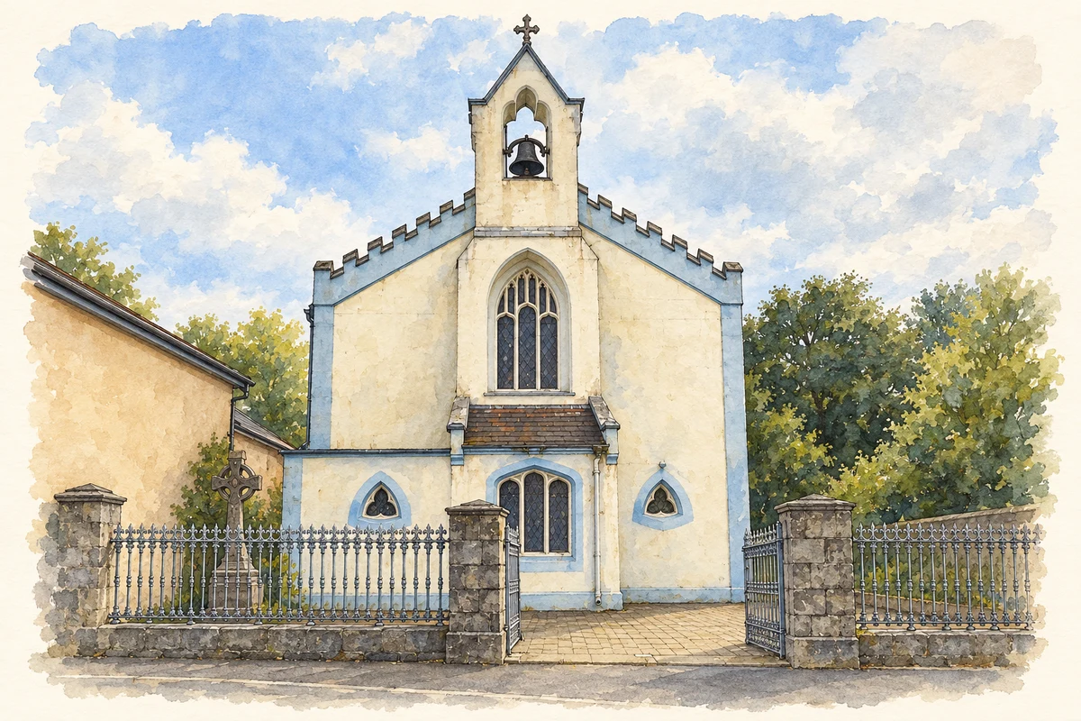
The council's conservation study records two Longwood schools in 1824, operating in mud-walled, thatched buildings. It also contrasts the older Catholic church, set back from the road, with its replacement of 1841, which faces the street behind gates and railings. Battlements and a buttress-like bellcote give the later building a distinctive Gothic outline. Nearby, the former parochial house was built or remodelled around 1845. These buildings preserve the development of parish facilities around a village whose early schools were much more modest structures.[3]
Carrying the Royal Canal across the Boyne
West of Longwood, the Boyne Aqueduct carries the Royal Canal over the river on three arches. The National Inventory of Architectural Heritage dates it to around 1795 and records cutwaters, carved plaques and carefully worked masonry. An adjacent railway bridge adds another layer of transport engineering to the crossing. Together with a canal bridge, lock and workers' house, the aqueduct forms a connected group of structures. It made the canal's passage across the river possible without bringing boats down to river level.[4][2]
Both counts use the 2016 settlement boundary, allowing like-for-like comparison. CSO supplies the 2022 count on this older boundary for comparison only. The official 2022 Built Up Area has different boundaries.
View population figures
Longwood — Census 2016 settlement footprint — census population
These are the historical areas published in the 2006 census report. Boundaries may differ between censuses and from modern settlements. Legal towns, environs and suburbs are shown separately; none has been combined into a modern settlement total.
View population figures
Longwood, Meath — Census town, CSO 2006 report — census population
These are the historical areas published in the 1996 census report. Boundaries may differ between censuses and from modern settlements. Legal towns, environs and suburbs are shown separately; none has been combined into a modern settlement total.
View population figures
Longwood, Meath — Census town, CSO 1996 report — census population
These figures use different area definitions. Read the boundary note before comparing them.
Longwood, Meath
Published census settlement populations
1,581people · 2016
Settlement boundaries changed during this period. Differences may reflect boundary changes as well as population change. Where a 2011 legal-town-and-environs count is shown, it has not been recalculated onto the 2016 settlement boundary.
 placenames