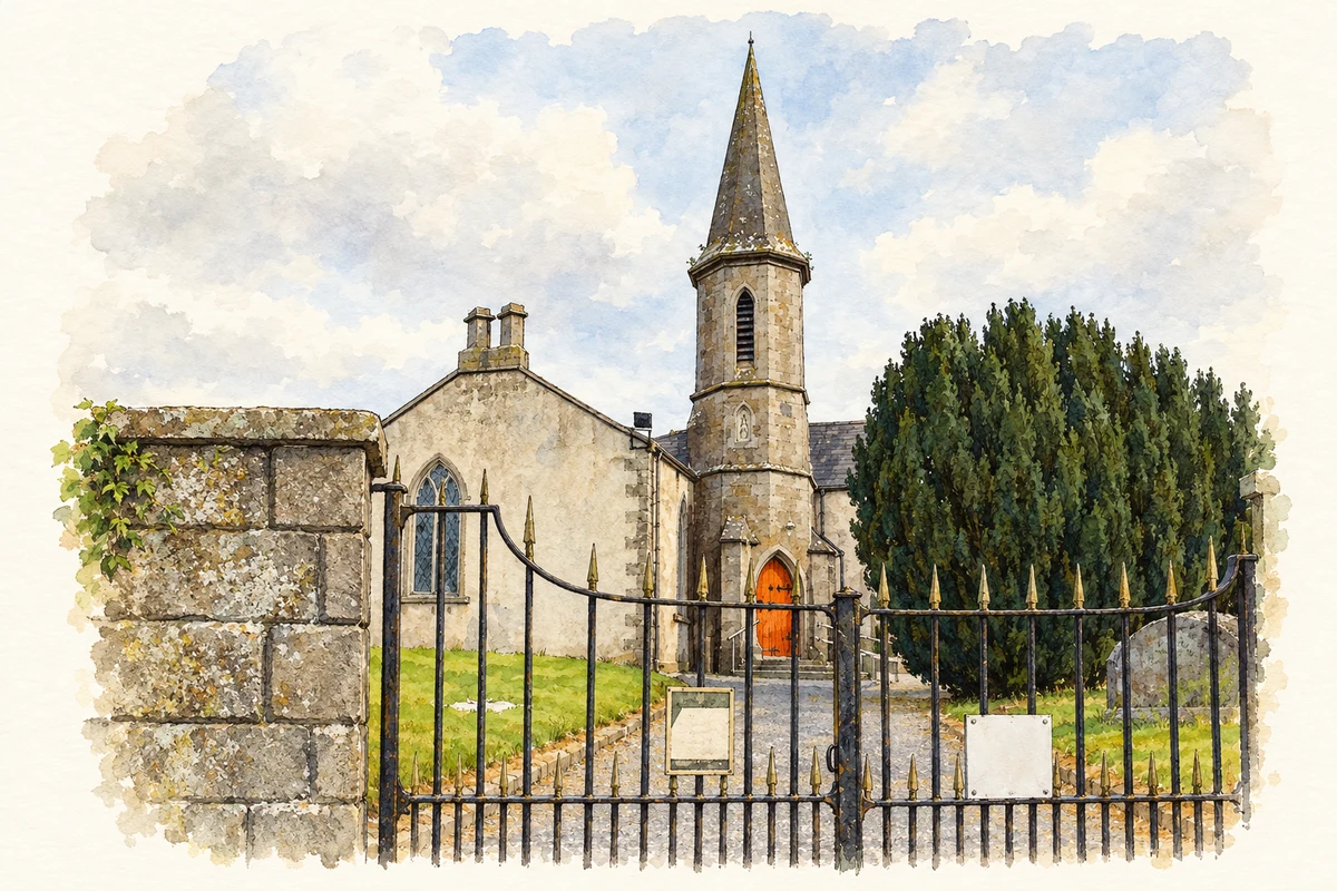
Rathmolyon grew around intersecting roads south of Trim. Its churches preserve a nineteenth-century family memorial and the story of a much later parish building campaign.
Illustration, Church of Saint Michael and All Angels, Rathmolyon
⊕Recorded locationRathmolyon53.48723° N · 6.80369° WInteractive map supplied by OpenStreetMap.
These Irish name elements are associated with this record in the Logainm glossary.
An element’s translation is a clue, rather than a complete explanation of the name. Its form and meaning depend on local history and the full Irish name.
Recorded forms
Ráth Moliain· Irish · main form · validated name
Rathmolyon· English · main form
Place & story
Growth from the junction
Rathmolyon developed where the Dunboyne–Mullingar and Trim–Enfield roads meet. Meath County Council describes a village whose traditional buildings retain a rural character, with later housing spreading along the roads from that junction. Church View developed on the Enfield road and Cherry Valley on the road towards Ballivor. The crossroads therefore remains the organising feature of a settlement that has grown beyond its older centre.[2]
A tower built in memory of a bishop
The Church of Saint Michael and All Angels dates from 1797, with later additions producing its L-shaped plan. Its northwest tower and limestone spire belong to a different phase. An interior plaque records that Robert Fowler of Rahinston erected them in 1857 in memory of his father, the late Bishop of Ossory and Ferns. Pointed windows, stained glass and contrasting stone and rendered surfaces distinguish the successive parts of the building. The churchyard and entrance gates complete the historic setting recorded by the architectural inventory.[3]
A church paid for over decades
The Catholic parish’s account traces the new St Michael’s to Bishop John D’Alton’s proposal in 1945, when he opened a building fund with £100. Collections, concerts, dances and other events sustained the campaign. In 1966 Elizabeth Sweeny and her daughter Ann donated a site on the Rathmolyon–Ballivor road. Simon Leonard designed the church, and building began that September. Its foundation stone was laid in July 1967; Bishop John McCormack dedicated the completed church on 14 July 1968. Vessels, fonts and statues brought from the old chapel at Kill connected the new building with its predecessor.[4]
Both counts use the 2016 settlement boundary, allowing like-for-like comparison. CSO supplies the 2022 count on this older boundary for comparison only. The official 2022 Built Up Area has different boundaries.
View population figures
Rathmolyon — Census 2016 settlement footprint — census population
These are the historical areas published in the 2006 census report. Boundaries may differ between censuses and from modern settlements. Legal towns, environs and suburbs are shown separately; none has been combined into a modern settlement total.
View population figures
Rathmolyon, Meath — Census town, CSO 2006 report — census population
These are the historical areas published in the 1996 census report. Boundaries may differ between censuses and from modern settlements. Legal towns, environs and suburbs are shown separately; none has been combined into a modern settlement total.
View population figures
Rathmolyon, Meath — Census town, CSO 1996 report — census population
Figures cover the historical town area printed in the 1986 report. Boundaries may have changed between censuses. Legal town, environs and suburb totals remain separate and differ from modern settlement boundaries.
View population figures
Rathmolyon, Meath — Census town, CSO 1986 report — census population
These figures use different area definitions. Read the boundary note before comparing them.
Rathmolyon, Meath
Published census settlement populations
334people · 2016
Settlement boundaries changed during this period. Differences may reflect boundary changes as well as population change. Where a 2011 legal-town-and-environs count is shown, it has not been recalculated onto the 2016 settlement boundary.
 placenames