These Irish name elements are associated with this record in the Logainm glossary.
An element’s translation is a clue, rather than a complete explanation of the name. Its form and meaning depend on local history and the full Irish name.
Recorded forms
Fiodh Ard· Irish · main form · validated name
Fethard· English · main form
Place & story
A town enclosed in stone
Fethard received its first charter for building town walls in 1292. Construction and repairs continued into the sixteenth century, and much of the circuit survives. North Gate remains from the five original gateways. Chapel Lane marks part of the boundary of the earlier, smaller thirteenth-century settlement. At Madam's Bridge, the river approach once passed a gate tower beside the crossing, linking the town's circulation with its defences.[2]
Fortified houses and a medieval church
Court Castle, dating from around 1400 with later alterations, is the largest fortified townhouse in Fethard. Edmond's Castle belongs to the later fifteenth century and is associated with the Everard family. The Augustinian church, founded in 1305, retains its medieval building beneath later changes. Its nineteenth-century front followed the demolition of the old tower. These monuments show how domestic status, defence and religious life occupied the same closely built town.[2]
People & connections
The Everards and the common hall
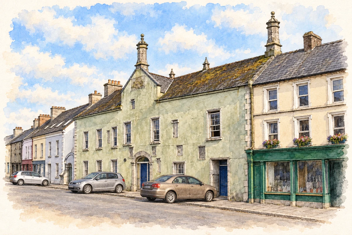
The town's 1608 charter required a tholsel, or common hall, for its corporation. The surviving Town Hall probably fulfilled that role, although portions may be earlier. Plaques on the front commemorate the Everards, important local patrons. Later remodelling changed the windows and frontage, while octagonal limestone chimneys with ball finials preserve distinctive older details. A weighing deck outside recalls the building's subsequent market function, keeping civic administration and trade close together in the street.[3]
Both counts use the 2016 settlement boundary, allowing like-for-like comparison. CSO supplies the 2022 count on this older boundary for comparison only. The official 2022 Built Up Area has different boundaries.
View population figures
Fethard — Census 2016 settlement footprint — census population
Fethard, South Tipperary — Census town, CSO 2006 report
2002–2006: census town
1,374people · 2006
These are the historical areas published in the 2006 census report. Boundaries may differ between censuses and from modern settlements. Legal towns, environs and suburbs are shown separately; none has been combined into a modern settlement total.
View population figures
Fethard, South Tipperary — Census town, CSO 2006 report — census population
Fethard, South Tipperary — Census town, CSO 1996 report
1991–1996: census town
1,397people · 1996
These are the historical areas published in the 1996 census report. Boundaries may differ between censuses and from modern settlements. Legal towns, environs and suburbs are shown separately; none has been combined into a modern settlement total.
View population figures
Fethard, South Tipperary — Census town, CSO 1996 report — census population
Figures cover the historical town area printed in the 1986 report. Boundaries may have changed between censuses. Legal town, environs and suburb totals remain separate and differ from modern settlement boundaries.
View population figures
Fethard, Tipperary — Legal town, CSO 1986 report — census population
Fethard, Tipperary — Town environs only, CSO 1986 report
1981–1986: town environs only
409people · 1986
Figures cover the historical town area printed in the 1986 report. Boundaries may have changed between censuses. Legal town, environs and suburb totals remain separate and differ from modern settlement boundaries.
View population figures
Fethard, Tipperary — Town environs only, CSO 1986 report — census population
These figures use different area definitions. Read the boundary note before comparing them.
Fethard, South Tipperary
Published census settlement populations
1,545people · 2016
Settlement boundaries changed during this period. Differences may reflect boundary changes as well as population change. Where a 2011 legal-town-and-environs count is shown, it has not been recalculated onto the 2016 settlement boundary.
The Tholsel, Fethard, 2006 illustration: based on a Town Hall, Fethard, Co. Tipperary by Humphrey Bolton. AI-assisted watercolour and ink adaptation; cream margins added, fine details simplified; original parked cars retained to preserve occlusions, wires and signage omitted. Licence: CC BY-SA 2.0.
 placenames