These Irish name elements are associated with this record in the Logainm glossary.
An element’s translation is a clue, rather than a complete explanation of the name. Its form and meaning depend on local history and the full Irish name.
Recorded forms
Béal Átha Póirín· Irish · main form · validated name
Ballyporeen· English · main form
Place & story
A village on the coach road
Tipperary’s county development plan identifies Ballyporeen as a planned settlement, developing along the former main road between Cork and Dublin. Its broad streets and predominantly two-storey buildings preserve that linear arrangement. The River Duag runs south of the village, within the Lower River Suir Special Area of Conservation. The surrounding Galty Vee Valley lies between the Galty and Knockmealdown mountains; the village has served the farming district around it.[2]
The Church of the Assumption
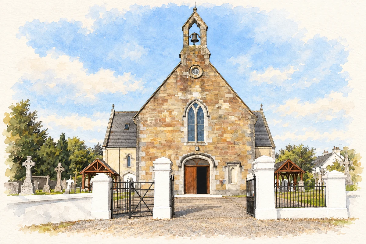
The Church of the Assumption combines a sandstone entrance front with limestone dressings and a bellcote. Its cruciform interior has pointed arcades, decorative capitals, carved heads and a timber scissors-truss roof. The National Inventory of Architectural Heritage particularly notes stained glass depicting Saints Carthage and Otteran with Celtic interlace. These details reward attention beyond the building’s association with Reagan’s visit: they record the work of stone masons, woodworkers and glass artists.[3]
People & connections
The visit of 3 June 1984
Ronald and Nancy Reagan visited Ballyporeen on 3 June 1984. The presidential library’s documentary exhibition records his inspection of great-grandfather Michael Reagan’s baptismal entry, attendance at a parish prayer service, a stop at O’Farrell’s pub and a speech to local people. He also received a family tree. The surviving audio, photographs and official records document an ancestral visit in which parish records and family research became central features of a presidential journey.[4]
Both counts use the 2016 settlement boundary, allowing like-for-like comparison. CSO supplies the 2022 count on this older boundary for comparison only. The official 2022 Built Up Area has different boundaries.
View population figures
Ballyporeen — Census 2016 settlement footprint — census population
Ballyporeen, South Tipperary — Census town, CSO 2006 report
2002–2006: census town
304people · 2006
These are the historical areas published in the 2006 census report. Boundaries may differ between censuses and from modern settlements. Legal towns, environs and suburbs are shown separately; none has been combined into a modern settlement total.
View population figures
Ballyporeen, South Tipperary — Census town, CSO 2006 report — census population
Ballyporeen, South Tipperary — Census town, CSO 1996 report
1991–1996: census town
293people · 1996
These are the historical areas published in the 1996 census report. Boundaries may differ between censuses and from modern settlements. Legal towns, environs and suburbs are shown separately; none has been combined into a modern settlement total.
View population figures
Ballyporeen, South Tipperary — Census town, CSO 1996 report — census population
Ballyporeen, Tipperary — Census town, CSO 1986 report
1981–1986: census town
319people · 1986
Figures cover the historical town area printed in the 1986 report. Boundaries may have changed between censuses. Legal town, environs and suburb totals remain separate and differ from modern settlement boundaries.
View population figures
Ballyporeen, Tipperary — Census town, CSO 1986 report — census population
These figures use different area definitions. Read the boundary note before comparing them.
Ballyporeen, South Tipperary
Published census settlement populations
318people · 2016
Settlement boundaries changed during this period. Differences may reflect boundary changes as well as population change. Where a 2011 legal-town-and-environs count is shown, it has not been recalculated onto the 2016 settlement boundary.
Church of the Assumption, Ballyporeen illustration: based on a Ballypooreen Church by liam murphy. AI-assisted watercolour and ink adaptation; cream paper margins added, incidental clutter omitted and fine details simplified. Licence: CC BY-SA 2.0.
 placenames