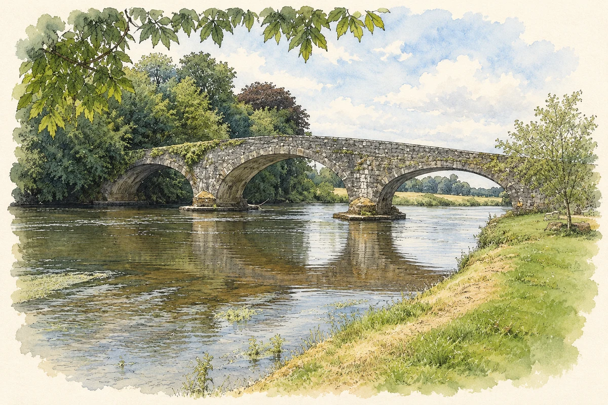
Kilsheelan’s bridge links the Tipperary village with the Waterford bank of the Suir, where Gurteen Le Poer gives a much later architectural form to the idea of a castle.
Illustration, Kilsheelan Bridge over the River Suir
⊕Recorded locationKilsheelan52.36284° N · 7.57831° WInteractive map supplied by OpenStreetMap.
These Irish name elements are associated with this record in the Logainm glossary.
An element’s translation is a clue, rather than a complete explanation of the name. Its form and meaning depend on local history and the full Irish name.
Recorded forms
Cill Síoláin· Irish · main form · validated name
Kilsheelan· English · main form
Place & story
The village beside the crossing
Samuel Lewis's 1837 description counted fifty-seven houses and 290 inhabitants in Kilsheelan village. His account distinguished that small settlement from the larger parish, which extended across the Suir into County Waterford. It noted the bridge, a police station, schools and the remains of an older church and castle. The surviving bridge's humpback profile and large arches remain prominent beside the village. Its architectural inventory also identifies a dry arch serving the riverside walk, a detail linking the crossing with movement along the bank as well as over the water.[2][3]
Gurteen Le Poer across the river
Gurteen Le Poer was built in 1866 for Edmond, first Count de la Poer, to designs by Samuel Ussher Roberts. The National Inventory of Architectural Heritage classifies it as an Elizabethan Revival country house. Towers, turrets, gables and carefully worked limestone give it a castle-like silhouette, while ornamental gateways and garden structures extend the architectural display into the grounds. The date matters: its medieval appearance belongs to a nineteenth-century revival design. The building stands on the Waterford side of the Suir, across from Kilsheelan's Tipperary village.[4]
Evidence below the modern ground
Excavations by Eachtra Archaeological Projects near Kilsheelan in January 2006 revealed a much earlier layer of activity. In one area, shallow pits contained Early Neolithic pottery, including fragments of carinated bowls and a cup. Charred hazelnut shell, wheat grains and a worked flint fragment added evidence of food and tool use. The report dated the pottery broadly to 4000–3600 BC and interpreted the features as an outdoor activity area. It found no associated buildings there, so the discoveries support prehistoric activity without establishing a continuously occupied village from that period.[5]
Both counts use the 2016 settlement boundary, allowing like-for-like comparison. CSO supplies the 2022 count on this older boundary for comparison only. The official 2022 Built Up Area has different boundaries.
View population figures
Kilsheelan — Census 2016 settlement footprint — census population
Kilsheelan, South Tipperary — Census town, CSO 2006 report
2002–2006: census town
520people · 2006
These are the historical areas published in the 2006 census report. Boundaries may differ between censuses and from modern settlements. Legal towns, environs and suburbs are shown separately; none has been combined into a modern settlement total.
View population figures
Kilsheelan, South Tipperary — Census town, CSO 2006 report — census population
Kilsheelan, South Tipperary — Census town, CSO 1996 report
1991–1996: census town
461people · 1996
These are the historical areas published in the 1996 census report. Boundaries may differ between censuses and from modern settlements. Legal towns, environs and suburbs are shown separately; none has been combined into a modern settlement total.
View population figures
Kilsheelan, South Tipperary — Census town, CSO 1996 report — census population
Kilsheelan, Tipperary — Census town, CSO 1986 report
1981–1986: census town
424people · 1986
Figures cover the historical town area printed in the 1986 report. Boundaries may have changed between censuses. Legal town, environs and suburb totals remain separate and differ from modern settlement boundaries.
View population figures
Kilsheelan, Tipperary — Census town, CSO 1986 report — census population
These figures use different area definitions. Read the boundary note before comparing them.
Kilsheelan, South Tipperary
Published census settlement populations
812people · 2016
Settlement boundaries changed during this period. Differences may reflect boundary changes as well as population change. Where a 2011 legal-town-and-environs count is shown, it has not been recalculated onto the 2016 settlement boundary.
Kilsheelan Bridge over the River Suir illustration: based on a Kilsheelan Bridge on the River Suir by John M. AI-assisted watercolour and ink adaptation; cream paper margins added, incidental clutter omitted and fine details simplified. Licence: CC BY-SA 2.0.
 placenames