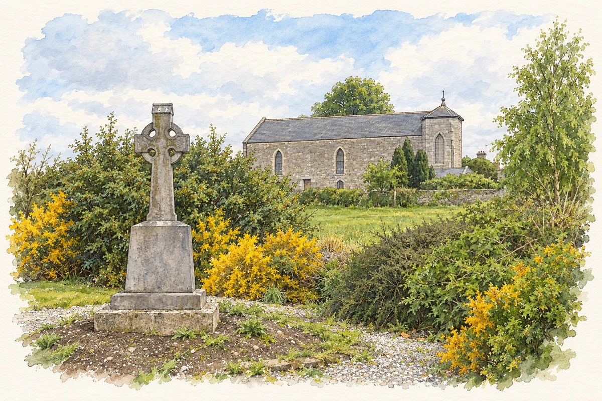
Ballyboughal's old church preserves medieval carving and a rare triple bellcote, while the nineteenth-century village developed around a new chapel and school.
Illustration, Church of Our Lady of the Assumption, Ballyboughal
⊕Recorded locationBallyboghil53.51686° N · 6.26629° WInteractive map supplied by OpenStreetMap.
These Irish name elements are associated with this record in the Logainm glossary.
An element’s translation is a clue, rather than a complete explanation of the name. Its form and meaning depend on local history and the full Irish name.
Recorded forms
Baile Bachaille· Irish · main form · validated name
Ballyboghil· English · main form
Ballyboughal· English · main form · local name
Place & story
The medieval church and Patrick's staff
Ballyboughal's medieval church has an unusual triple bellcote above its western gable. A large east window dates from around 1300, and a carved head survives on a stop to its arch. Fingal County Council's archaeological guide cites a 1302 reference stating that Patrick's staff, the bachall, had been kept here for a period. That record connects the church with the custody of a venerated relic. The surviving fabric, including the window and distinctive bellcote, preserves a substantial part of the setting in which medieval parish worship took place.[2]
A small village in 1837
Samuel Lewis counted 144 people in Ballyboughal village in 1837, within a parish population of 664. It lay on the road from Dublin through Naul towards Drogheda and had a police station. By then the older church was already ruined. Catholic worship belonged to the Naul district, whose chapel Lewis described as a neat building. A schoolhouse had been provided through local subscriptions, and two private schools also operated in the parish. The entry records a modest rural settlement connected to wider transport, religious and educational networks.[3]
The chapel dated 1836
The present Church of Our Lady of the Assumption carries 1836 above its entrance. The community heritage guide records later changes, including a gallery and steeple added around 1890; the unstable timber steeple was removed in 1968. The neighbouring former national school opened in 1834 and served until its replacement in 1964. It was subsequently refurbished for community use. These two buildings preserve the parish's nineteenth-century provision for worship and education, alongside the older churchyard that remained part of the village landscape.[4]
Both counts use the 2016 settlement boundary, allowing like-for-like comparison. CSO supplies the 2022 count on this older boundary for comparison only. The official 2022 Built Up Area has different boundaries.
View population figures
Ballyboghil — Census 2016 settlement footprint — census population
Ballyboghil, Fingal — Census town, CSO 2006 report
2002–2006: census town
321people · 2006
These are the historical areas published in the 2006 census report. Boundaries may differ between censuses and from modern settlements. Legal towns, environs and suburbs are shown separately; none has been combined into a modern settlement total.
View population figures
Ballyboghil, Fingal — Census town, CSO 2006 report — census population
Ballyboghil, Fingal — Census town, CSO 1996 report
1991–1996: census town
296people · 1996
These are the historical areas published in the 1996 census report. Boundaries may differ between censuses and from modern settlements. Legal towns, environs and suburbs are shown separately; none has been combined into a modern settlement total.
View population figures
Ballyboghil, Fingal — Census town, CSO 1996 report — census population
These figures use different area definitions. Read the boundary note before comparing them.
Ballyboghil, Fingal
Published census settlement populations
447people · 2016
Settlement boundaries changed during this period. Differences may reflect boundary changes as well as population change. Where a 2011 legal-town-and-environs count is shown, it has not been recalculated onto the 2016 settlement boundary.
Church of Our Lady of the Assumption, Ballyboughal illustration: based on a Church at Ballyboughal, Co. Dublin by Kieran Campbell. AI-assisted watercolour and ink adaptation; cream paper margins added, incidental clutter omitted and fine details simplified. Licence: CC BY-SA 2.0.
 placenames