 placenames
Drimnagh
Droimeanach
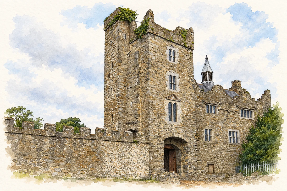
Drimnagh's medieval castle survives within a district transformed by twentieth-century housing. Large new schools, community organisations and a local restoration project marked different stages of that transformation.
The name
A reliable full-name meaning has not been established here. The recorded Irish and English forms are given without an unsupported translation.
Recorded forms
- Droimeanach · Irish · main form · validated name
- Drimnagh · English · main form
Place & story
The castle within the suburbs
Drimnagh Castle's surviving buildings developed over several centuries. The National Inventory of Architectural Heritage describes a great hall and gallery above a vaulted undercroft, with a tower at the southern end and a moat enclosing the site. Eighteenth-century additions included an entrance porch and steps to the hall. Its reconstructed oak roof and tracery sit alongside older stonework, making the building a record of successive alteration as well as medieval construction. [2]
Peter Pearson and the restoration
Peter Pearson began campaigning for the derelict castle's repair in 1985. The castle's own restoration account records work starting in June 1986, involving more than 200 workers and organisations including An Taisce and FÁS, alongside the Drimnagh and Crumlin communities. Craftspeople rebuilt the roof using Roscommon oak and laid the great hall's floor with tiles from St Andrew's Church on Suffolk Street. President Mary Robinson opened the restored castle to the public in 1991. [3]
Schools for the growing district
Our Lady of Good Counsel's school history describes Drimnagh as largely farmland in 1939, when plans envisaged 5,000 public and private houses. The school complex was planned at the new parish's centre, with separate boys', girls' and infants' schools. The boys' school opened on 1 July 1943 with 1,094 pupils enrolled that day. The convent schools followed with their formal opening in January 1944, despite wartime shortages of building materials. [4]
Building places to meet
As the neighbourhood developed, residents created facilities beyond the classroom. The local residents' history records the Mother McAuley Girls Club beginning in 1950 with cookery, art and choral classes. Our Lady's Hall opened in 1954 after parishioners sought support for a community centre. The Good Counsel Musical Society was formed in 1959 and began with The Mikado. These organisations gave the growing district spaces for social life, practical learning and performance. [5]
Geographic information
- Place type
- Population centre
- County
- Dublin
- Barony
- Uppercross
- Civil parish
- Drimnagh
- Coordinates
- 53.32662, -6.33384 (approximate)
- Logainm ID
- 17392 ↗
Sources & further reading
- Logainm.ie — Drimnagh. Place names and geographic record, licensed under CC BY 4.0.
- Drimnagh Castle, NIAH50080451 · National Inventory of Architectural Heritage
- Drimnagh Castle: restoration history · Drimnagh Castle
- Our Lady of Good Counsel National Schools: history · Our Lady of Good Counsel Boys National School
- Development of community facilities · Drimnagh Residents Association
- Drimnagh Castle, as photographed in2013 illustration: based on a Castles of Leinster: Drimnagh, Dublin (1) by Garry Dickinson. AI-assisted watercolour and ink adaptation; cream paper margins added, incidental clutter omitted and fine details simplified. Licence: CC BY-SA 2.0.
Name record retrieved 2026-10-25 · Source record modified 2011-07-11. How this page was prepared.