 placenames
Ballyboden
Baile Baodáin
River-powered industry, a Carnegie library and a growing Gaelic games club mark successive stages in Ballyboden’s development.
The name
These Irish name elements are associated with this record in the Logainm glossary.
An element’s translation is a clue, rather than a complete explanation of the name. Its form and meaning depend on local history and the full Irish name.
Recorded forms
- Baile Baodáin · Irish · main form · validated name
- Ballyboden · English · main form
Place & story
The millraces of the Owendoher
Milling helped shape Ballyboden from the eighteenth century. The county council’s village plan records industries producing paper, textiles and flour, as well as laundries, using water drawn from the Owendoher. Although many mill buildings disappeared or deteriorated after the industries declined, the network of millraces remained an important trace of that landscape. Newbrook House and Bolton Hall survived as substantial houses associated with the milling area. [2]
Whitechurch’s Carnegie library
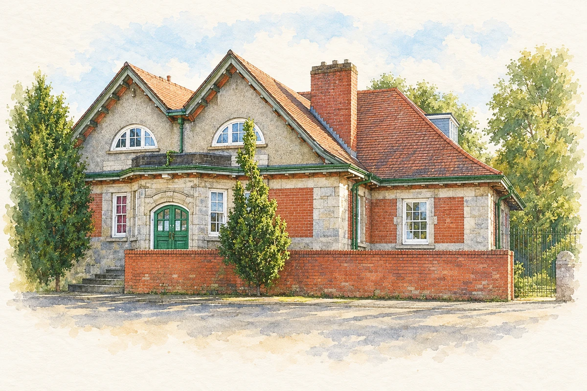
The library on Taylor’s Lane was built in 1911 to a design by T. J. Byrne. Its granite lower walls, red brick above and roughcast gables create the contrasting surfaces characteristic of the building. A projecting porch, timber windows and red-tiled roof give this modest public building considerable architectural presence. The NIAH identifies it as a Carnegie library and values its surviving Arts and Crafts details. [3]
Ballyboden St Enda’s
Founded in 1969, Ballyboden St Enda’s developed alongside the expanding estates, schools and churches of south Dublin. In a 2019 GAA interview, club activist Gerry O’Sullivan recalled its early emphasis on intermediate football and juvenile hurling, followed by adult hurling and senior status in both codes during the 1970s. Camogie and ladies’ football became major parts of the club’s growth in the 1990s. His account places volunteer work and the new local population at the heart of that development. [4]
Geographic information
- Place type
- Population centre
- County
- Dublin
- Barony
- Rathdown
- Civil parish
- Whitechurch
- Coordinates
- 53.28984, -6.27528 (approximate)
- Logainm ID
- 17472 ↗
Sources & further reading
- Logainm.ie — Ballyboden. Place names and geographic record, licensed under CC BY 4.0.
- Proposed Draft Ballyboden Village Plan: an historical perspective · South Dublin County Council
- Whitechurch Branch Library, NIAH11216029 · National Inventory of Architectural Heritage
- Ballyboden St Enda’s celebrating50years in existence,22January2019 · Cian O’Connell / Gerry O’Sullivan, GAA
- Whitechurch Carnegie Library, Ballyboden illustration: based on a County Dublin - Whitechurch Branch Library - 20171011214552 by HighKing. AI-assisted watercolour and ink adaptation; cream paper margins added, incidental clutter omitted and fine details simplified. Licence: CC BY-SA 4.0.

Name record retrieved 2026-10-25 · Source record modified 2023-02-02. How this page was prepared.