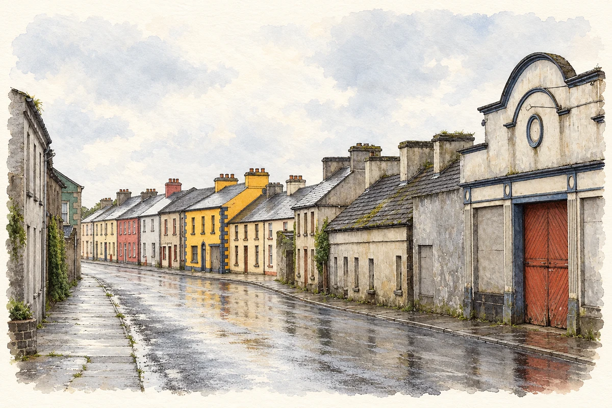
Ahascragh's mills grew from the grain-producing countryside of east Galway. Its history also survives in parish records, restored industrial buildings and Philip Treacy's memories of watching village weddings.
Reconstruction illustration of Ahascragh’s streetscape, based on a 2008 photograph.
⊕Recorded locationAhascragh53.39998° N · 8.33392° WInteractive map supplied by OpenStreetMap.
These Irish name elements are associated with this record in the Logainm glossary.
An element’s translation is a clue, rather than a complete explanation of the name. Its form and meaning depend on local history and the full Irish name.
Recorded forms
Áth Eascrach· Irish · main form
Ahascragh· English · main form
Place & story
A town in corn country
Samuel Lewis counted about 120 houses and 851 townspeople in Ahascragh in 1837. Large oatmeal mills served what he described as good corn-growing country. Four annual fairs and fortnightly petty sessions brought regular gatherings to the settlement. A branch of the Grand Canal approached within six miles, and its company allowed a transport rebate on goods. His description connects the village's market functions with the practical business of moving grain and other produce beyond the district.[2]
The mill's new purpose
The Bell family's mill complex opened around 1810. Water diverted from the river powered the machinery, and milling continued until the 1950s. The substantial limestone buildings, arranged around a four-storey mill, remained an important industrial landmark after production ended. Gareth and Michelle McAllister later restored the complex as Ahascragh Distillery. Their project brought a new manufacturing use to buildings whose scale and stonework had been shaped by the earlier grain trade.[3][4]
The church fire and the surviving records
St Catherine's Church was burned on 9 July 1922. Ethel Dillon's contemporary account survives among the parish papers, alongside records of the subsequent rebuilding. Architect Richard Orpen oversaw that work, and the restored church was consecrated on 7 September 1926. Other documents reveal quieter forms of local administration: the vestry appointed overseers for deserted children in 1813 and established a district Board of Health during the 1832 cholera emergency. Together, these papers show a parish concerned with welfare and public health as well as its own building.[5]
People & connections
Philip Treacy and the weddings across the road
Hat designer Philip Treacy grew up in Ahascragh opposite the church. In an interview with Aekta Kapoor, he recalled watching wedding parties arrive and being fascinated by their elaborate clothes. Those village occasions provided an early encounter with the spectacle of fashion. He moved to Dublin to study at the National College of Art and Design in 1985 and later continued at London's Royal College of Art. His recollection gives a precise local setting to the beginnings of an international design career.[6]
Both counts use the 2016 settlement boundary, allowing like-for-like comparison. CSO supplies the 2022 count on this older boundary for comparison only. The official 2022 Built Up Area has different boundaries.
View population figures
Ahascragh — Census 2016 settlement footprint — census population
These are the historical areas published in the 2006 census report. Boundaries may differ between censuses and from modern settlements. Legal towns, environs and suburbs are shown separately; none has been combined into a modern settlement total.
View population figures
Ahascragh, Galway — Census town, CSO 2006 report — census population
These are the historical areas published in the 1996 census report. Boundaries may differ between censuses and from modern settlements. Legal towns, environs and suburbs are shown separately; none has been combined into a modern settlement total.
View population figures
Ahascragh, Galway — Census town, CSO 1996 report — census population
Figures cover the historical town area printed in the 1986 report. Boundaries may have changed between censuses. Legal town, environs and suburb totals remain separate and differ from modern settlement boundaries.
View population figures
Ahascragh, Galway — Census town, CSO 1986 report — census population
These figures use different area definitions. Read the boundary note before comparing them.
Ahascragh, Galway
Published census settlement populations
195people · 2016
Settlement boundaries changed during this period. Differences may reflect boundary changes as well as population change. Where a 2011 legal-town-and-environs count is shown, it has not been recalculated onto the 2016 settlement boundary.
 placenames