These Irish name elements are associated with this record in the Logainm glossary.
An element’s translation is a clue, rather than a complete explanation of the name. Its form and meaning depend on local history and the full Irish name.
Recorded forms
Baile Chláir· Irish · main form · validated name
Claregalway· English · main form
Place & story
People & connections
John de Cogan and the Franciscan foundation
John de Cogan founded Claregalway's Franciscan friary around 1240. By 1252 he had permission for a weekly market and annual fair. Later protectors included the O'Flahertys and the earls of Clanricarde. Crown suppression interrupted the religious community; Richard Bingham used the friary as barracks in 1589. The friars subsequently returned in the early seventeenth century. The last two departed at the end of 1847, giving the site a much longer religious history than the medieval walls alone suggest.[2]
Windows and a family tomb
The friary's surviving fabric spans several centuries. Lancet windows in the chancel belong to the thirteenth century, while the tower, northern aisle and transept date to the fifteenth. A canopied tomb recess houses a monument bearing the Burke arms and a Latin inscription dated 1646. South of the church lay the cloister and domestic buildings, with a watermill farther south. The remains preserve both the ceremonial spaces and the working organisation of the friars' household.[2]
A tower house brought back into use
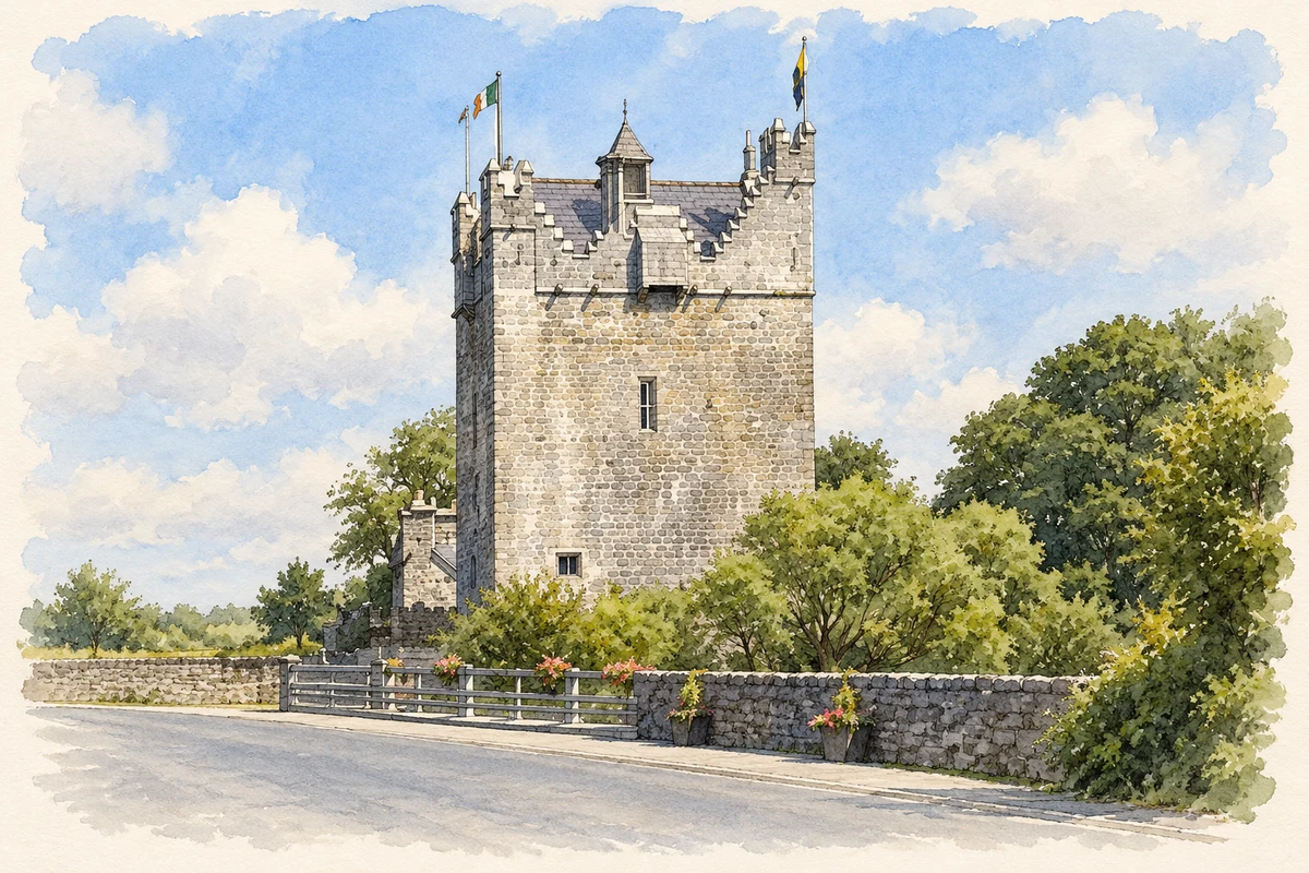
The fifteenth-century castle beside the Clare underwent a major modern restoration after its purchase in 2000. Trees had rooted in the exposed upper levels, threatening its masonry. Conservation architect David Johnson directed the reconstruction programme, working with specialist stonemasons and craftspeople. The restored roof and interior returned a long-ruinous tower to use. Its revived silhouette now provides a substantial counterpart to the open-air remains of the friary across the riverside landscape.[3]
Both counts use the 2016 settlement boundary, allowing like-for-like comparison. CSO supplies the 2022 count on this older boundary for comparison only. The official 2022 Built Up Area has different boundaries.
View population figures
Baile Chláir — Census 2016 settlement footprint — census population
Baile Chláir, Galway — Census town, CSO 2006 report
2002–2006: census town
741people · 2006
These are the historical areas published in the 2006 census report. Boundaries may differ between censuses and from modern settlements. Legal towns, environs and suburbs are shown separately; none has been combined into a modern settlement total.
View population figures
Baile Chláir, Galway — Census town, CSO 2006 report — census population
These figures use different area definitions. Read the boundary note before comparing them.
Baile Chláir, Galway
Published census settlement populations
1,248people · 2016
Settlement boundaries changed during this period. Differences may reflect boundary changes as well as population change. Where a 2011 legal-town-and-environs count is shown, it has not been recalculated onto the 2016 settlement boundary.
Restored Claregalway Castle illustration: based on a Claregalway Castle by Darrin Antrobus. AI-assisted watercolour and ink adaptation; cream paper margins added, incidental clutter omitted and fine details simplified. Licence: CC BY-SA 2.0.
 placenames