These Irish name elements are associated with this record in the Logainm glossary.
An element’s translation is a clue, rather than a complete explanation of the name. Its form and meaning depend on local history and the full Irish name.
Recorded forms
Baile Átha an Rí· Irish · main form · validated name
Athenry· English · main form
Place & story
People & connections
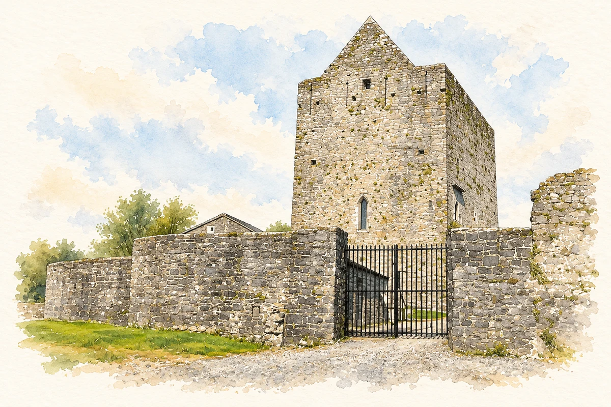
Meiler de Bermingham’s castle
Meiler de Bermingham began his castle at Athenry in 1235. Its position guarded a ford on the Clareen River within a strategically important east–west route. The castle formed part of the defences of the developing town. By the fifteenth century the family had moved into a more comfortable townhouse, leaving the older stronghold to serve as a garrison. The change reflects a shift in domestic expectations within the same urban setting.[3]
The Great Hall’s carved entrance
The hall-keep’s substantial basement supported the Great Hall above. Floral carving decorates the entrance and two window openings, work associated with the local School of the West. These details give the principal room a ceremonial character as well as providing light and access. They belong to a regional tradition poised between Romanesque and Gothic forms, unusually expressed within a castle.[2][3]
Defence in the masonry
The lower walls slope outward in a batter, increasing their strength. Deep cruciform arrow loops and the battlements provided positions for defenders, while the surrounding bawn enclosed the household’s outer space. The restored building lets the basement, hall and upper levels be read together. Its carved openings and defensive fabric preserve two connected purposes: a place to exercise lordship and a protected residence for the people who sustained it.[2]
Both counts use the 2016 settlement boundary, allowing like-for-like comparison. CSO supplies the 2022 count on this older boundary for comparison only. The official 2022 Built Up Area has different boundaries.
View population figures
Athenry — Census 2016 settlement footprint — census population
These are the historical areas published in the 2006 census report. Boundaries may differ between censuses and from modern settlements. Legal towns, environs and suburbs are shown separately; none has been combined into a modern settlement total.
View population figures
Athenry, Galway — Census town, CSO 2006 report — census population
These are the historical areas published in the 1996 census report. Boundaries may differ between censuses and from modern settlements. Legal towns, environs and suburbs are shown separately; none has been combined into a modern settlement total.
View population figures
Athenry, Galway — Census town, CSO 1996 report — census population
Figures cover the historical town area printed in the 1986 report. Boundaries may have changed between censuses. Legal town, environs and suburb totals remain separate and differ from modern settlement boundaries.
View population figures
Athenry, Galway — Census town, CSO 1986 report — census population
These figures use different area definitions. Read the boundary note before comparing them.
Athenry, Galway
Published census settlement populations
4,445people · 2016
Settlement boundaries changed during this period. Differences may reflect boundary changes as well as population change. Where a 2011 legal-town-and-environs count is shown, it has not been recalculated onto the 2016 settlement boundary.
Restored Athenry Castle, County Galway illustration: based on a Athenry castle by Graham Horn. AI-assisted watercolour and ink adaptation; cream paper margins added, incidental clutter omitted and fine details simplified. Licence: CC BY-SA 2.0.
 placenames