These Irish name elements are associated with this record in the Logainm glossary.
An element’s translation is a clue, rather than a complete explanation of the name. Its form and meaning depend on local history and the full Irish name.
Recorded forms
Teach Srafáin· Irish · main form · validated name
Straffan· English · main form
Place & story
People & connections
The Bartons arrive from the wine trade
Hugh Barton purchased the Straffan estate in 1831 after building a career in the Bordeaux wine trade. Wicklow County Archives' Barton collection history records his imprisonment during the French revolutionary Terror and subsequent return to Ireland. The family's French business connections continued alongside life at Straffan. Kildare Library's account, drawing on Derrick Barton's memoir, describes childhood journeys from the local railway station through Dublin, London and Paris to the vineyards. This was a household whose annual routines linked the Liffey valley with the grape harvest in France.[2][3]
A house altered across generations
Straffan House dates from 1832, but the building visible today includes substantial later additions and alterations. The National Inventory of Architectural Heritage identifies French and Italian influences, including mansard roofs and an Italianate tower. It also records twentieth-century truncation, restoration and large hotel extensions. The stable courtyard belongs to the same early nineteenth-century estate. Reading these different phases separately helps explain the complex: the present hotel is not an untouched 1832 mansion, and its silhouette reflects changing tastes and uses over nearly two centuries.[4][5]
A railway church becomes the power hall
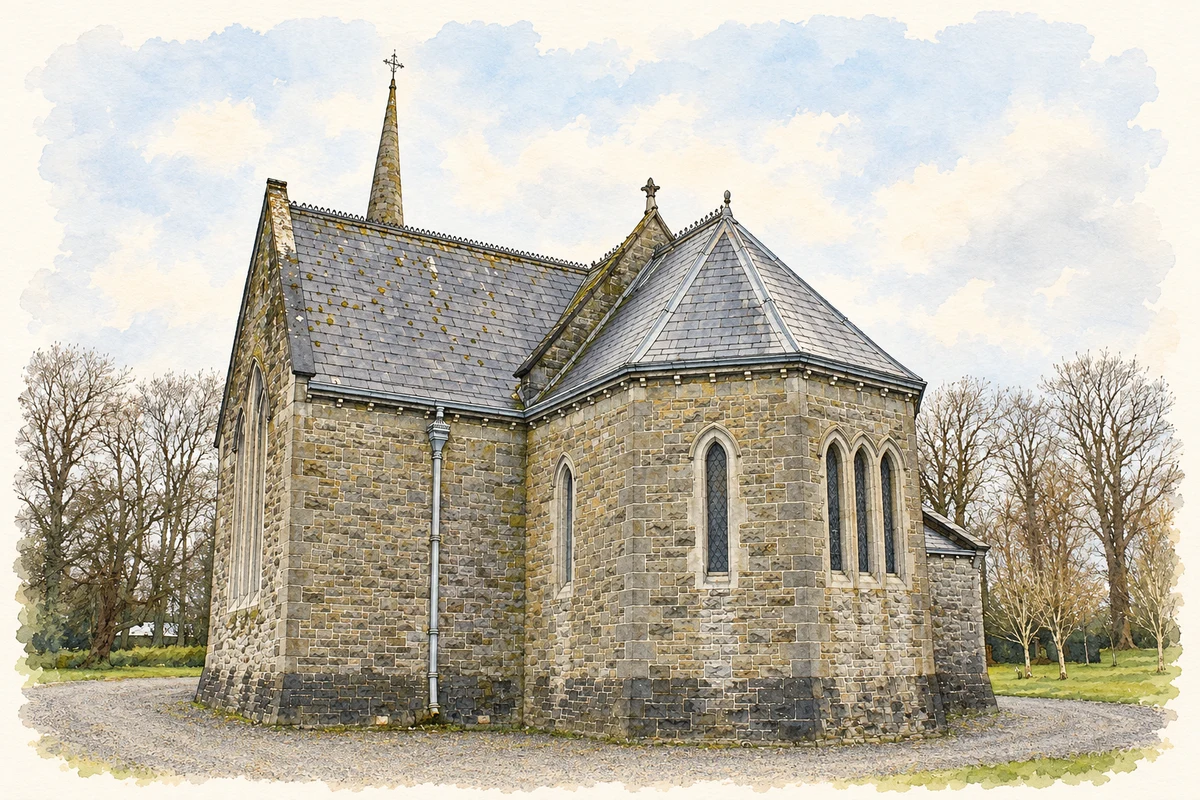
The Steam Museum at Lodge Park occupies a Victorian Gothic building moved from Dublin. It had served as a place of worship for engineers at the Inchicore railway works before museum founder Robert C. Guinness proposed its relocation. The Michael Owens Power Hall now contains stationary steam engines, including machinery associated with laundry work and belt-driven power transmission. The collection also includes engineering models and material connected with transatlantic telegraph cables. The building's own journey is part of the museum's story: a structure associated with railway workers was preserved to interpret the machinery of industrial life.[6]
Both counts use the 2016 settlement boundary, allowing like-for-like comparison. CSO supplies the 2022 count on this older boundary for comparison only. The official 2022 Built Up Area has different boundaries.
View population figures
Straffan — Census 2016 settlement footprint — census population
These are the historical areas published in the 2006 census report. Boundaries may differ between censuses and from modern settlements. Legal towns, environs and suburbs are shown separately; none has been combined into a modern settlement total.
View population figures
Straffan, Kildare — Census town, CSO 2006 report — census population
These are the historical areas published in the 1996 census report. Boundaries may differ between censuses and from modern settlements. Legal towns, environs and suburbs are shown separately; none has been combined into a modern settlement total.
View population figures
Straffan, Kildare — Census town, CSO 1996 report — census population
Figures cover the historical town area printed in the 1986 report. Boundaries may have changed between censuses. Legal town, environs and suburb totals remain separate and differ from modern settlement boundaries.
View population figures
Straffan, Kildare — Census town, CSO 1986 report — census population
These figures use different area definitions. Read the boundary note before comparing them.
Straffan, Kildare
Published census settlement populations
853people · 2016
Settlement boundaries changed during this period. Differences may reflect boundary changes as well as population change. Where a 2011 legal-town-and-environs count is shown, it has not been recalculated onto the 2016 settlement boundary.
 placenames