 placenames
Kilmaganny
Cill Mogeanna
Kilmaganny’s nineteenth-century buildings preserve evidence of worship, clergy life and the local grain economy.
The name
These Irish name elements are associated with this record in the Logainm glossary.
An element’s translation is a clue, rather than a complete explanation of the name. Its form and meaning depend on local history and the full Irish name.
Recorded forms
- Cill Mogeanna · Irish · main form · validated name
- Kilmaganny · English · main form
Place & story
Saint Eoghan’s church
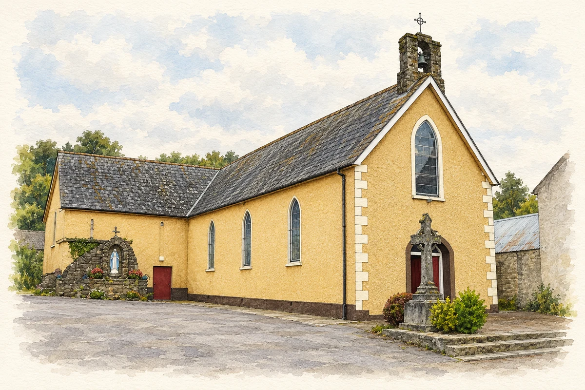
Saint Eoghan's Catholic church dates from 1883. Its cross-shaped plan brings nave and transepts together around a shallow chancel, while a small bellcote marks the entrance gable. The National Inventory of Architectural Heritage notes the rose window and exposed timber roof among its distinctive features. The survey cautiously suggests that the building may incorporate an earlier chapel shown on nineteenth-century Ordnance Survey mapping. [2]
A clergy house from 1819
The former Church of Ireland glebe house was built in 1819 with support from the Board of First Fruits. Its compact two-storey form, central fanlight and sash windows preserve the character of that period. The architectural survey also records surviving interior shutters and door surrounds. Census records connect the house with successive clergymen Robert Madden in 1901 and Charles Angus Cutts Purkis in 1911. [3]
A trace of the milling economy
A small stone corn mill survives in the village from around 1825. It had ceased working before 1903 and was recorded as an outbuilding in the architectural survey. Though its windows have changed, the slate roof, rubble walls and dressed limestone corners preserve much of its earlier form. It is a modest reminder of the processing of local grain that once supported Kilmaganny's agricultural economy. [4]
Geographic information
- Place type
- Town
- County
- Kilkenny
- Barony
- Kells
- Civil parish
- Kilmaganny
- Coordinates
- 52.46204, -7.32783
- Logainm ID
- 26327 ↗
Sources & further reading
- Logainm.ie — Kilmaganny. Place names and geographic record, licensed under CC BY 4.0.
- Saint Eoghan's Catholic Church, 12320006 · National Inventory of Architectural Heritage
- Kilmaganny glebe house, 12320007 · National Inventory of Architectural Heritage
- Kilmaganny corn mill, 12320008 · National Inventory of Architectural Heritage
- St Eoghan Catholic Church, Kilmaganny illustration: based on a St Eoghan's Roman Catholic Church, Kilmaganny by Humphrey Bolton. AI-assisted watercolour and ink adaptation; cream paper margins added, incidental clutter omitted and fine details simplified. Licence: CC BY-SA 2.0.
Name record retrieved 2026-10-25 · Source record modified 2026-09-19. How this page was prepared.