These Irish name elements are associated with this record in the Logainm glossary.
An element’s translation is a clue, rather than a complete explanation of the name. Its form and meaning depend on local history and the full Irish name.
Recorded forms
Droichead Binéid· Irish · main form · validated name
Bennettsbridge· English · main form
Bennetsbridge· English · main form · local name
Place & story
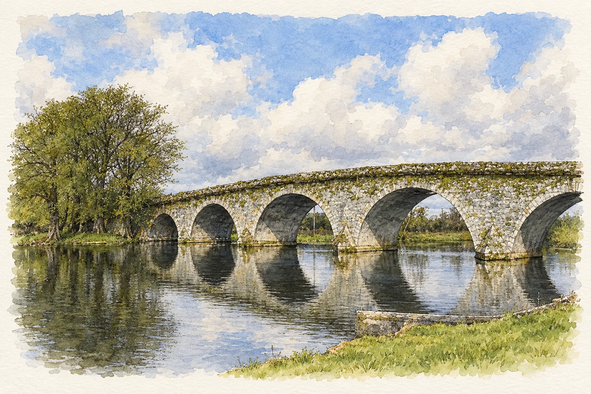
The seven-arched bridge
The architectural inventory dates the seven-arched bridge over the River Nore to 1763 and attributes its design to George Smith. Rubble limestone walls contrast with more carefully worked stone around the arches, while triangular cutwaters divide the current at the piers. Its construction belongs to a wider period of eighteenth-century bridge building in County Kilkenny. The bridge is therefore both a practical crossing and a surviving example of the masonry skills used to create substantial transport infrastructure in the river valley.[2]
The mill beside the water
The tall mill now associated with Nicholas Mosse Pottery dates approximately to 1800. Kilkenny County Council's architectural appraisal notes that early Ordnance Survey maps describe it as a corn mill, while later nineteenth-century mapping identifies a flour mill. It formed part of an industrial group that included another mill across the river, the weir and the bridge. As an important employer, it connected the village to the processing of grain from the surrounding agricultural area. Its later commercial adaptation preserved that prominent industrial building.[3]
People & connections
Nicholas and Susan Mosse’s pottery
Nicholas and Susan Mosse established their pottery business in 1976, initially working from a small shed on the family land. Their own history describes the later purchase of the family mill and restoration of its hydroelectric power, followed by rebuilding after a fire in 1985. Susan's botanical designs were translated into patterns applied with cut sponges, using a decorating technique with eighteenth-century precedents. The enterprise gave the old milling site a new manufacturing purpose while connecting its products to the plants and countryside that informed the designs.[4]
Both counts use the 2016 settlement boundary, allowing like-for-like comparison. CSO supplies the 2022 count on this older boundary for comparison only. The official 2022 Built Up Area has different boundaries.
View population figures
Bennettsbridge — Census 2016 settlement footprint — census population
Bennettsbridge, Kilkenny — Census town, CSO 2006 report
2002–2006: census town
685people · 2006
These are the historical areas published in the 2006 census report. Boundaries may differ between censuses and from modern settlements. Legal towns, environs and suburbs are shown separately; none has been combined into a modern settlement total.
View population figures
Bennettsbridge, Kilkenny — Census town, CSO 2006 report — census population
Bennettsbridge, Kilkenny — Census town, CSO 1996 report
1991–1996: census town
601people · 1996
These are the historical areas published in the 1996 census report. Boundaries may differ between censuses and from modern settlements. Legal towns, environs and suburbs are shown separately; none has been combined into a modern settlement total.
View population figures
Bennettsbridge, Kilkenny — Census town, CSO 1996 report — census population
Bennettsbridge, Kilkenny — Census town, CSO 1986 report
1981–1986: census town
601people · 1986
Figures cover the historical town area printed in the 1986 report. Boundaries may have changed between censuses. Legal town, environs and suburb totals remain separate and differ from modern settlement boundaries.
View population figures
Bennettsbridge, Kilkenny — Census town, CSO 1986 report — census population
These figures use different area definitions. Read the boundary note before comparing them.
Bennettsbridge, Kilkenny
Published census settlement populations
745people · 2016
Settlement boundaries changed during this period. Differences may reflect boundary changes as well as population change. Where a 2011 legal-town-and-environs count is shown, it has not been recalculated onto the 2016 settlement boundary.
Bennettsbridge Bridge over the River Nore illustration: based on a Bennett's Bridge by kevin higgins. AI-assisted watercolour and ink adaptation; cream paper margins added, incidental clutter omitted and fine details simplified. Licence: CC BY-SA 2.0.
 placenames