Fedamore’s village church and burial ground offer precise links with local religious life, while nineteenth-century records describe its farming economy.
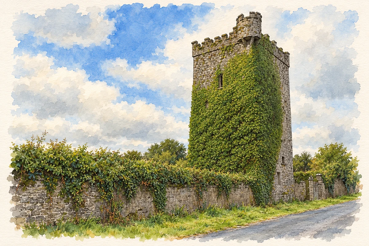
Illustration, Williamstown Castle near Fedamore
⊕Recorded locationFedamore52.54473° N · 8.60093° WInteractive map supplied by OpenStreetMap.
A reliable full-name meaning has not been established here. The recorded Irish and English forms are given without an unsupported translation.
Recorded forms
Feadamair· Irish · main form · validated name
Fedamore· English · main form
Place & story
A fair village on the Bruff road
Samuel Lewis’s 1837 description separates Fedamore village, with twenty-six houses and 277 inhabitants, from the much larger parish. Fairs on 5 May and 9 October chiefly traded cattle and pigs, with horses sold occasionally. Pasture and meadow occupied much of the parish, although flooding from the Commogue could sweep away hay crops. Lewis also recorded a police station and two public schools. This is a dated account of a small service village within an agricultural district, rather than a description of present conditions.[2]
The font that predates the church
The Limerick Diocesan Heritage Project dates Fedamore’s Catholic church to 1830 and credits Father Timothy MacCarthy and his curate Father O’Rourke with its construction. A font carries an inscription recording that Dr John Hanrahan had it made in 1756; the project identifies it as coming from the earlier parish church. A later plaque records the dedication to the Beheading of Saint John the Baptist and renovation in 1980. These fittings preserve evidence of successive generations within the same worshipping community.[3]
People & connections
William P. Clifford’s local memorial
The old Fedamore graveyard contains the burial of William P. Clifford, president of the Gaelic Athletic Association from 1926 to 1928. The diocesan heritage survey records his death on 16 February 1949, aged seventy-three, from his headstone. His memorial connects the locality with the organisation’s national leadership. The graveyard also preserves older family tombs, placing that twentieth-century commemoration within a much longer sequence of local burials.[3]
From Fedamore Cottage to Fedamore House
The University of Galway’s Landed Estates research follows a house in Fedamore townland across maps and valuation records. Called Fedamore Cottage on the first Ordnance Survey map, it was occupied by John and Edward Synan in the early 1850s and held from Colonel Wyndham. By the 1890s map it appeared as Fedamore House, associated with J. G. Kelly. Changes in name and occupancy make the property a useful example of how maps and valuation records reveal different stages in a house’s history.[4]
Both counts use the 2016 settlement boundary, allowing like-for-like comparison. CSO supplies the 2022 count on this older boundary for comparison only. The official 2022 Built Up Area has different boundaries.
View population figures
Fedamore — Census 2016 settlement footprint — census population
These are the historical areas published in the 2006 census report. Boundaries may differ between censuses and from modern settlements. Legal towns, environs and suburbs are shown separately; none has been combined into a modern settlement total.
View population figures
Fedamore, Limerick — Census town, CSO 2006 report — census population
These figures use different area definitions. Read the boundary note before comparing them.
Fedamore, Limerick
Published census settlement populations
329people · 2016
Settlement boundaries changed during this period. Differences may reflect boundary changes as well as population change. Where a 2011 legal-town-and-environs count is shown, it has not been recalculated onto the 2016 settlement boundary.
Williamstown Castle near Fedamore illustration: based on a Castles of Munster: Williamstown, Limerick (1) by Mike Searle. AI-assisted watercolour and ink adaptation; cream paper margins added, incidental clutter omitted and fine details simplified. Licence: CC BY-SA 2.0.
 placenames