These Irish name elements are associated with this record in the Logainm glossary.
An element’s translation is a clue, rather than a complete explanation of the name. Its form and meaning depend on local history and the full Irish name.
Recorded forms
Cill Mocheallóg· Irish · main form · validated name
Kilmallock· English · main form
Place & story
Streets, plots and town defences
Kilmallock occupied a strategic route between Cork and Limerick, protected by the Loobagh to the east and a former lake to the west. Its broad main street and branching lanes developed within the medieval defences. Early earthworks gave way to stone walls, supported by grants that allowed the town to collect money for building and repairs. The walled area enclosed about thirteen hectares. Its streets and long property plots preserve the structure of the trading settlement within the modern town.[2]
A merchant's limestone frontage
The surviving Merchant House on Sarsfield Street belonged to a group of substantial houses built in the later sixteenth century. Its limestone frontage retains pointed door openings, carved surrounds and a band of projecting stone supports beneath the upper storey. Three first-floor windows give the street elevation a regular rhythm. Rooms connected directly with one another, with storage behind. The house preserves the combination of domestic accommodation and practical space expected by a prosperous urban merchant.[3]
A tower with several working lives
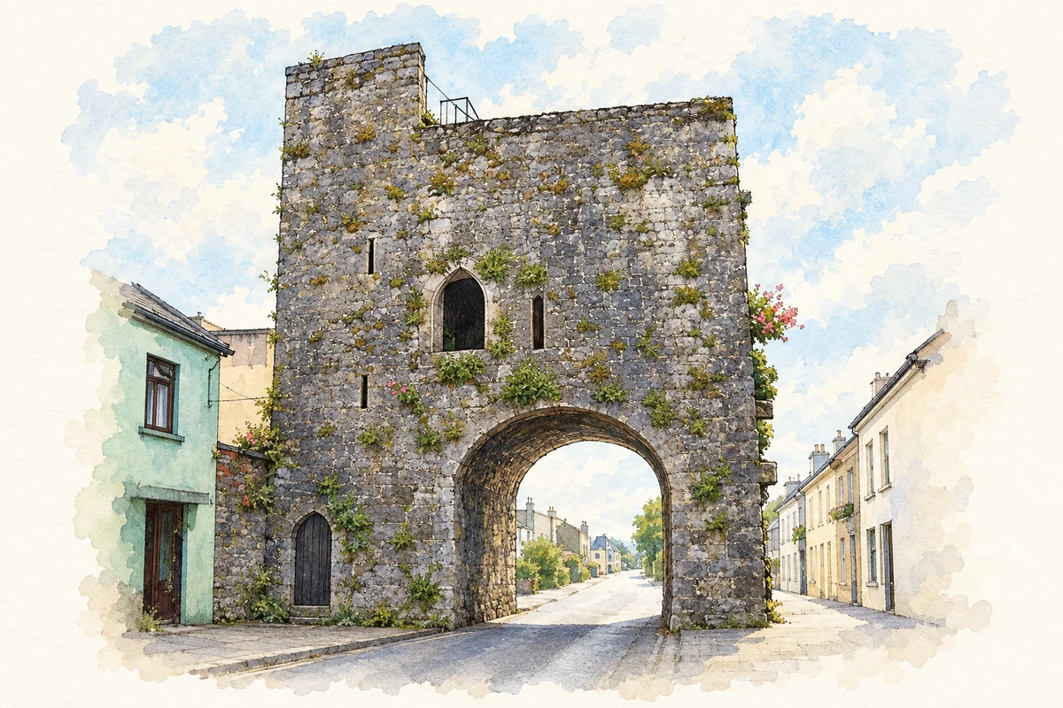
King John's Castle is generally dated to the fifteenth century, long after the king whose name it carries. The four-storey tower may have formed part of the northern town entrance. Later pointed windows and nineteenth-century repairs altered its appearance. Its recorded uses included an arsenal under Lord Castlehaven in 1645 and a hospital for Parliamentary forces in 1651; it subsequently accommodated a blacksmith's forge. Those changes show a defensive building repeatedly adapted to the needs of later occupants.[4]
Both counts use the 2016 settlement boundary, allowing like-for-like comparison. CSO supplies the 2022 count on this older boundary for comparison only. The official 2022 Built Up Area has different boundaries.
View population figures
Kilmallock — Census 2016 settlement footprint — census population
Kilmallock, Limerick — Census town, CSO 2006 report
2002–2006: census town
1,443people · 2006
These are the historical areas published in the 2006 census report. Boundaries may differ between censuses and from modern settlements. Legal towns, environs and suburbs are shown separately; none has been combined into a modern settlement total.
View population figures
Kilmallock, Limerick — Census town, CSO 2006 report — census population
Kilmallock, Limerick — Census town, CSO 1996 report
1991–1996: census town
1,231people · 1996
These are the historical areas published in the 1996 census report. Boundaries may differ between censuses and from modern settlements. Legal towns, environs and suburbs are shown separately; none has been combined into a modern settlement total.
View population figures
Kilmallock, Limerick — Census town, CSO 1996 report — census population
Kilmallock, Limerick — Census town, CSO 1986 report
1981–1986: census town
1,424people · 1986
Figures cover the historical town area printed in the 1986 report. Boundaries may have changed between censuses. Legal town, environs and suburb totals remain separate and differ from modern settlement boundaries.
View population figures
Kilmallock, Limerick — Census town, CSO 1986 report — census population
These figures use different area definitions. Read the boundary note before comparing them.
Kilmallock, Limerick
Published census settlement populations
1,668people · 2016
Settlement boundaries changed during this period. Differences may reflect boundary changes as well as population change. Where a 2011 legal-town-and-environs count is shown, it has not been recalculated onto the 2016 settlement boundary.
 placenames