Ballinalee preserves reminders of two revolutionary periods: the burial ground associated with 1798 and places linked to Seán MacEoin's flying column during the War of Independence.
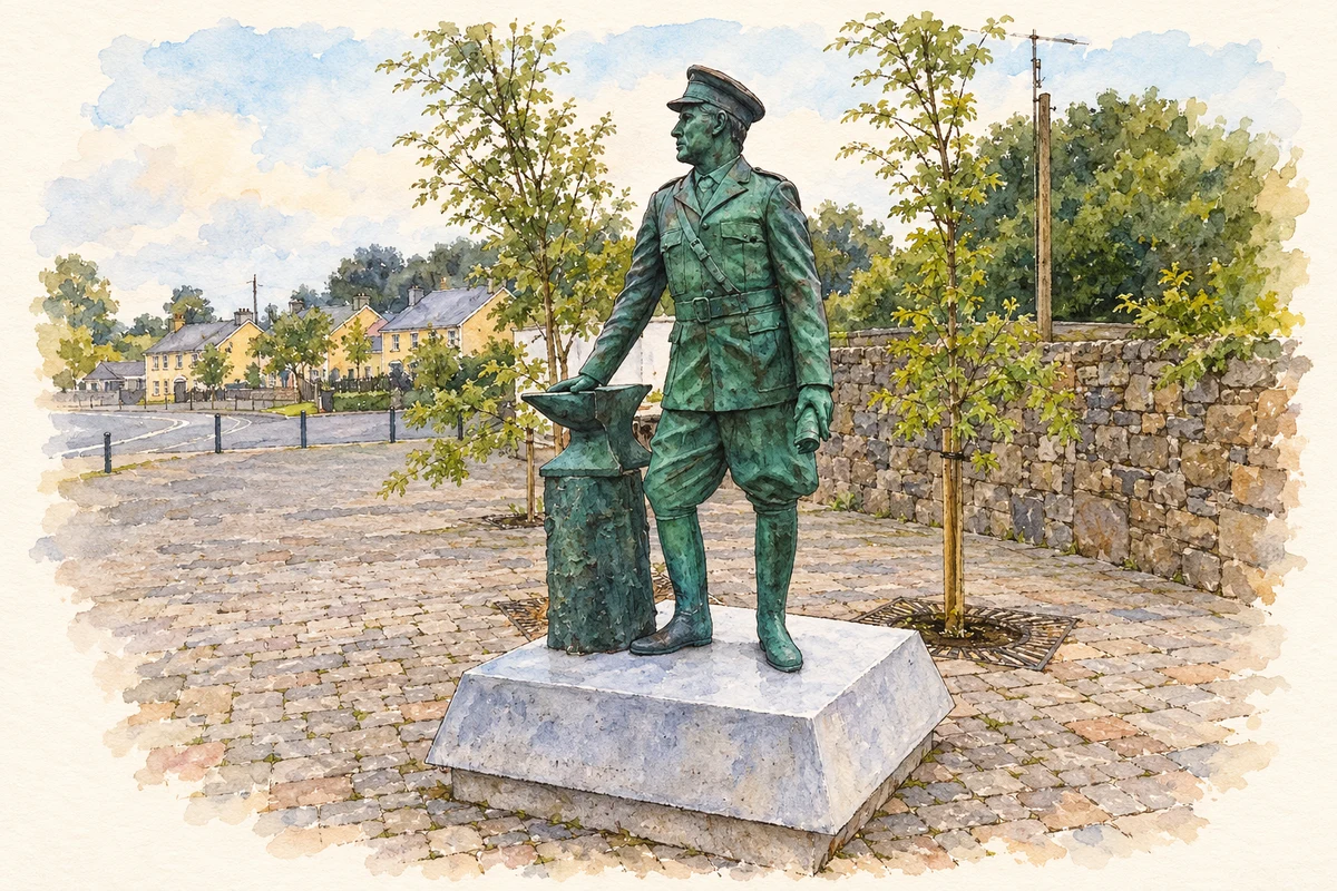
Illustration, Seán MacEoin memorial statue, Ballinalee
⊕Recorded locationBallinalee53.77548° N · 7.65730° WInteractive map supplied by OpenStreetMap.
These Irish name elements are associated with this record in the Logainm glossary.
An element’s translation is a clue, rather than a complete explanation of the name. Its form and meaning depend on local history and the full Irish name.
Recorded forms
Béal Átha na Lao· Irish · main form · validated name
Ballinalee· English · main form
Place & story
The burial ground of 1798
Bully's Acre at the northern end of Ballinalee is associated with Irish rebels executed after the Battle of Ballinamuck in 1798. The small, irregularly shaped graveyard contains mainly uninscribed upright stones and a table tomb dated 1763, indicating an earlier burial history as well. A memorial plaque added in 1998 marks the rebellion's bicentenary.[2]
Defence followed by destruction
In early November 1920, Seán MacEoin and the North Longford Flying Column prepared to defend Ballinalee against Crown-force reprisals following the killing of policemen in the district. Fighting prevented the village from being burned during that attack. The reprieve was temporary. Crown forces established a garrison, which the IRA attacked in December; reprisals then destroyed much of Ballinalee, principally on 13 December. MacEoin's family home and forge at Clooncoose were among the buildings burned. The village's defence and its later destruction belong to the same short, intense period of conflict.[3]
People & connections
The Blacksmith of Ballinalee
MacEoin's trade remains visible at the former forge at Clooncoose, east of the village. Its broad opening beside the road reflects the practical arrangement of a rural smithy, where horses and agricultural equipment could be brought for work. The restored structure recalls the occupation behind his familiar nickname, the Blacksmith of Ballinalee. His North Longford Flying Column became particularly associated with the village fighting and the Clonfin ambush of February 1921. The forge ties that military reputation to a specific working place in the countryside.[4]
Rose Cottage's new purpose
Rose Cottage served as MacEoin's headquarters during the Battle of Ballinalee. Longford County Council subsequently restored it as a War of Independence Centre, incorporating an exhibition and café. The project forms part of the Rebel Trail through north Longford, connecting places associated with 1798 and the later independence struggle. Its reuse preserves a domestic building at the centre of the village's revolutionary history and gives the story a permanent local home.[5]
Both counts use the 2016 settlement boundary, allowing like-for-like comparison. CSO supplies the 2022 count on this older boundary for comparison only. The official 2022 Built Up Area has different boundaries.
View population figures
Ballinalee — Census 2016 settlement footprint — census population
Ballinalee, Longford — Census town, CSO 2006 report
2002–2006: census town
151people · 2006
These are the historical areas published in the 2006 census report. Boundaries may differ between censuses and from modern settlements. Legal towns, environs and suburbs are shown separately; none has been combined into a modern settlement total.
View population figures
Ballinalee, Longford — Census town, CSO 2006 report — census population
These figures use different area definitions. Read the boundary note before comparing them.
Ballinalee, Longford
Published census settlement populations
347people · 2016
Settlement boundaries changed during this period. Differences may reflect boundary changes as well as population change. Where a 2011 legal-town-and-environs count is shown, it has not been recalculated onto the 2016 settlement boundary.
 placenames