These Irish name elements are associated with this record in the Logainm glossary.
An element’s translation is a clue, rather than a complete explanation of the name. Its form and meaning depend on local history and the full Irish name.
Recorded forms
Carraig Mhachaire Rois· Irish · main form · validated name
Carrickmacross· English · main form
Place & story
A town divided between estates
The town’s early-seventeenth-century layout developed under the Earls of Essex. A mill and castle belonged to that estate landscape. By the end of the century the main street formed a dividing line between the Shirley and Bath estates. Later growth added a courthouse, banks, hotel and new market space. The council’s historical assessment identifies the long main street and its relationship with estate grounds as enduring features of the town.[2]
People & connections
Margaret Grey Porter and Anne Steadman
Margaret Grey Porter and her maid Anne Steadman studied lace encountered in Italy and developed a local form of appliqué after returning to the Carrickmacross district. The national inventory dates the craft’s introduction to 1820. Classes offered women a means of earning income. The Guild of Irish Lacemakers identifies Steadman as an accomplished needlewoman, giving a working practitioner a place alongside the rector’s wife usually credited with promoting the craft.[3][4]
Cloth, net and the cut-away design
Carrickmacross lace is made by stitching fine fabric onto a net ground and cutting away unwanted material to reveal the pattern. Decorative fillings, small circular motifs and the distinctive looped edge complete the work. The technique depends on controlled sewing and cutting, producing delicacy from layers of cloth and net. It became one of the town’s most widely recognised products.[3]
Schools keep the skill alive
Lace schools expanded on the Bath and Shirley estates after the Famine. Later, the St Louis Sisters helped renew teaching and standards through their school in the town. A lace cooperative continued the organisation of the craft. Its survival depended on instruction, markets and makers passing on practical knowledge over successive generations.[2][4]
Both counts use the 2016 settlement boundary, allowing like-for-like comparison. CSO supplies the 2022 count on this older boundary for comparison only. The official 2022 Built Up Area has different boundaries.
View population figures
Carrickmacross — Census 2016 settlement footprint — census population
These are the historical areas published in the 2006 census report. Boundaries may differ between censuses and from modern settlements. Legal towns, environs and suburbs are shown separately; none has been combined into a modern settlement total.
View population figures
Carrickmacross Legal Town, Monaghan — Legal town, CSO 2006 report — census population
Carrickmacross Environs, Monaghan — Town environs only, CSO 2006 report
2002–2006: town environs only
2,414people · 2006
These are the historical areas published in the 2006 census report. Boundaries may differ between censuses and from modern settlements. Legal towns, environs and suburbs are shown separately; none has been combined into a modern settlement total.
View population figures
Carrickmacross Environs, Monaghan — Town environs only, CSO 2006 report — census population
These are the historical areas published in the 1996 census report. Boundaries may differ between censuses and from modern settlements. Legal towns, environs and suburbs are shown separately; none has been combined into a modern settlement total.
View population figures
Carrickmacross Legal Town, Monaghan — Legal town, CSO 1996 report — census population
Carrickmacross Environs, Monaghan — Town environs only, CSO 1996 report
1991–1996: town environs only
1,691people · 1996
These are the historical areas published in the 1996 census report. Boundaries may differ between censuses and from modern settlements. Legal towns, environs and suburbs are shown separately; none has been combined into a modern settlement total.
View population figures
Carrickmacross Environs, Monaghan — Town environs only, CSO 1996 report — census population
Figures cover the historical town area printed in the 1986 report. Boundaries may have changed between censuses. Legal town, environs and suburb totals remain separate and differ from modern settlement boundaries.
View population figures
Carrickmacross, Monaghan — Legal town, CSO 1986 report — census population
Carrickmacross, Monaghan — Town environs only, CSO 1986 report
1981–1986: town environs only
1,650people · 1986
Figures cover the historical town area printed in the 1986 report. Boundaries may have changed between censuses. Legal town, environs and suburb totals remain separate and differ from modern settlement boundaries.
View population figures
Carrickmacross, Monaghan — Town environs only, CSO 1986 report — census population
These figures use different area definitions. Read the boundary note before comparing them.
Carrickmacross, Monaghan — 2011 legal town and environs; 2016 census settlement
Published census settlement populations
5,032people · 2016
Settlement boundaries changed during this period. Differences may reflect boundary changes as well as population change. Where a 2011 legal-town-and-environs count is shown, it has not been recalculated onto the 2016 settlement boundary.
View population figures
Carrickmacross, Monaghan — 2011 legal town and environs; 2016 census settlement — census population
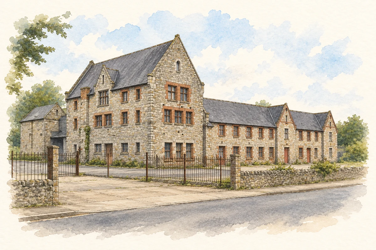
Restored Union Workhouse entrance block, Carrickmacross, County Monaghan illustration: based on a Union Workhouse, Carrickmacross, Co. Monaghan by Kieran Campbell. AI-assisted watercolour and ink adaptation; cream paper margins added, incidental clutter omitted and fine details simplified. Licence: CC BY-SA 2.0.
 placenames