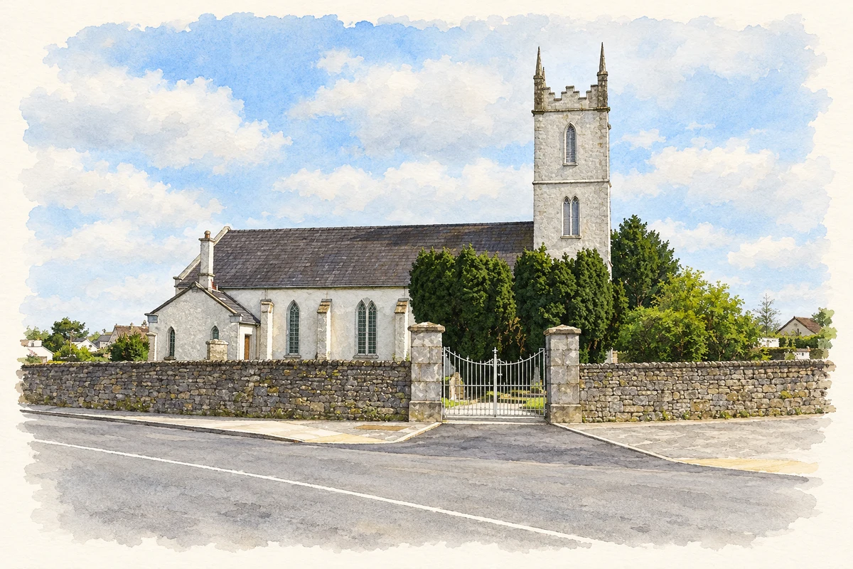
Borrisokane's buildings connect the town with early nineteenth-century church provision, post-Famine poor relief and a strikingly different church design of 1973.
Illustration, Borrisokane Church of Ireland church
⊕Recorded locationBorrisokane52.99466° N · 8.12660° WInteractive map supplied by OpenStreetMap.
These Irish name elements are associated with this record in the Logainm glossary.
An element’s translation is a clue, rather than a complete explanation of the name. Its form and meaning depend on local history and the full Irish name.
Recorded forms
Buiríos Uí Chéin· Irish · main form · validated name
Borrisokane· English · main form
Place & story
A church of 1812
Borrisokane's Church of Ireland church was built in 1812 under the Board of First Fruits. The tower's battlements and pinnacles give it a prominent outline above the graveyard. Carefully cut limestone also frames details on the gables and buttresses. The architectural survey draws attention to the survival of the original window arrangements, including small-pane timber sashes with Gothic tracery. These details give a familiar early nineteenth-century church plan a distinctive local character and preserve the work of the building's stonecutters and joiners.[2]
The workhouse and its later school
Borrisokane Poor Law Union was established in 1850, and its guardians' minutes record admissions that July. A permanent workhouse followed in the early 1850s, built to George Wilkinson's architectural system. Research published in the Tipperary Historical Journal identifies surviving windows, doors, gangways and stairs as evidence of the institution's arrangement. Borrisokane Community College now occupies the site. Its heritage committee and students have investigated the workhouse graveyard and the records of people who died there between 1878 and 1923, connecting the school's surroundings with an earlier institution of poor relief.[3][4]
A new Catholic church in 1973
Saints Peter and Paul's Catholic church was dedicated in 1973, replacing the church on the Birr Road that had served since 1837. McMahon and Hickey and Partners designed the new building, and Tom Hayes of Killaloe built it. The parish describes an A-frame roof, a large front window lighting the sanctuary and a wrought-iron reredos representing the Lamb of God. Objects moved from the old church included its bell and statues. The earlier stone baptismal font was placed outside, preserving a tangible connection between the two places of worship.[5]
Both counts use the 2016 settlement boundary, allowing like-for-like comparison. CSO supplies the 2022 count on this older boundary for comparison only. The official 2022 Built Up Area has different boundaries.
View population figures
Borrisokane — Census 2016 settlement footprint — census population
Borrisokane, North Tipperary — Census town, CSO 2006 report
2002–2006: census town
832people · 2006
These are the historical areas published in the 2006 census report. Boundaries may differ between censuses and from modern settlements. Legal towns, environs and suburbs are shown separately; none has been combined into a modern settlement total.
View population figures
Borrisokane, North Tipperary — Census town, CSO 2006 report — census population
Borrisokane, North Tipperary — Census town, CSO 1996 report
1991–1996: census town
850people · 1996
These are the historical areas published in the 1996 census report. Boundaries may differ between censuses and from modern settlements. Legal towns, environs and suburbs are shown separately; none has been combined into a modern settlement total.
View population figures
Borrisokane, North Tipperary — Census town, CSO 1996 report — census population
Borrisokane, Tipperary — Census town, CSO 1986 report
1981–1986: census town
837people · 1986
Figures cover the historical town area printed in the 1986 report. Boundaries may have changed between censuses. Legal town, environs and suburb totals remain separate and differ from modern settlement boundaries.
View population figures
Borrisokane, Tipperary — Census town, CSO 1986 report — census population
These figures use different area definitions. Read the boundary note before comparing them.
Borrisokane, North Tipperary
Published census settlement populations
942people · 2016
Settlement boundaries changed during this period. Differences may reflect boundary changes as well as population change. Where a 2011 legal-town-and-environs count is shown, it has not been recalculated onto the 2016 settlement boundary.
Borrisokane Church of Ireland church illustration: based on a Church of Ireland church (1), Borrisokane, Co. Tipperary by P L Chadwick. AI-assisted watercolour and ink adaptation; cream paper margins added, incidental clutter omitted and fine details simplified. Licence: CC BY-SA 2.0.
 placenames