These Irish name elements are associated with this record in the Logainm glossary.
An element’s translation is a clue, rather than a complete explanation of the name. Its form and meaning depend on local history and the full Irish name.
Recorded forms
Ros Cré· Irish · main form · validated name
Roscrea· English · main form
Place & story
Two periods within one enclosure
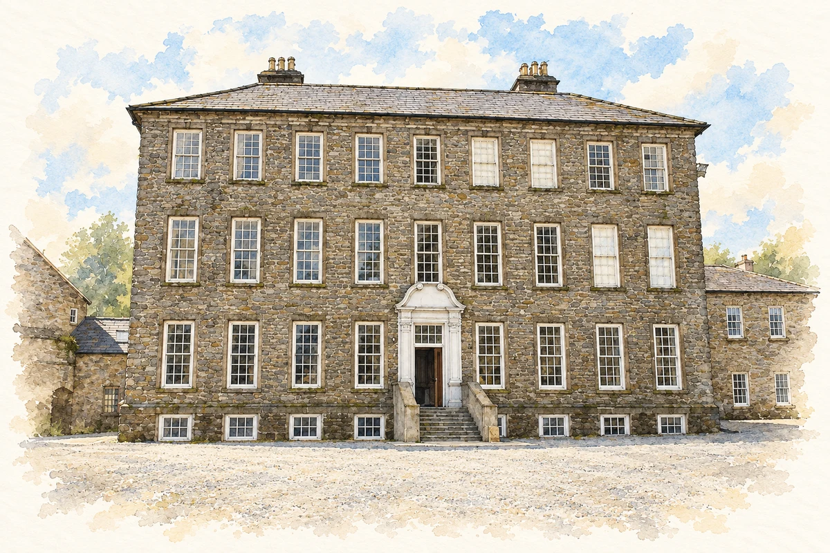
Roscrea’s castle dates from the 1280s. Its later uses included military barracks from 1798. Within the castle grounds stands Damer House, associated with merchant John Damer and distinguished by its pre-Palladian form. The juxtaposition places eighteenth-century domestic architecture inside medieval defences. Garden space and the nearby restored Black Mills add further settings to the group.[2]
The threatened house
In November 1973 the county council voted to demolish Damer House and use the site as a car park. A contemporary Irish Georgian Society appeal records the reversal that followed: in February 1974 the council agreed to lease the building to the society for ninety-nine years. The Irish Georgian Society and Old Roscrea Society proposed restoration as a European Architectural Heritage Year project. Their appeal singled out the carved staircase and surviving fireplaces as reasons to save the house.[3]
The Romanesque doorway
St Crónan’s medieval church survives principally through its decorated western gable. Chevron carving, blind arcades and a figure above the doorway remain visible. Other fabric was dismantled and reused for the later church in 1812. Across the street stands the round tower, with carvings including an axe, boat and cross on an eastern window. The original high cross is preserved in the Black Mills, with a replica marking its outdoor position.[4]
Folklore & tradition
A monastery easier to find
The OPW records a foundation tradition in which pilgrims struggled to find Crónan’s earlier monastery at secluded Sean Ross. The saint moved his community nearer the main road, the Slighe Dhála, where travellers could reach it more easily. The story gives accessibility a memorable place in the town’s religious origins.[4]
Both counts use the 2016 settlement boundary, allowing like-for-like comparison. CSO supplies the 2022 count on this older boundary for comparison only. The official 2022 Built Up Area has different boundaries.
View population figures
Roscrea — Census 2016 settlement footprint — census population
Roscrea, North Tipperary — Census town, CSO 2006 report
2002–2006: census town
4,910people · 2006
These are the historical areas published in the 2006 census report. Boundaries may differ between censuses and from modern settlements. Legal towns, environs and suburbs are shown separately; none has been combined into a modern settlement total.
View population figures
Roscrea, North Tipperary — Census town, CSO 2006 report — census population
Roscrea, North Tipperary — Census town, CSO 1996 report
1991–1996: census town
4,170people · 1996
These are the historical areas published in the 1996 census report. Boundaries may differ between censuses and from modern settlements. Legal towns, environs and suburbs are shown separately; none has been combined into a modern settlement total.
View population figures
Roscrea, North Tipperary — Census town, CSO 1996 report — census population
Figures cover the historical town area printed in the 1986 report. Boundaries may have changed between censuses. Legal town, environs and suburb totals remain separate and differ from modern settlement boundaries.
View population figures
Roscrea, Tipperary — Census town, CSO 1986 report — census population
These figures use different area definitions. Read the boundary note before comparing them.
Roscrea, North Tipperary
Published census settlement populations
5,446people · 2016
Settlement boundaries changed during this period. Differences may reflect boundary changes as well as population change. Where a 2011 legal-town-and-environs count is shown, it has not been recalculated onto the 2016 settlement boundary.
Damer House, Roscrea Castle grounds, County Tipperary illustration: based on a Damer House by Jonathan Thacker. AI-assisted watercolour and ink adaptation; cream paper margins added, incidental clutter omitted and fine details simplified. Licence: CC BY-SA 2.0.
 placenames