Templetouhy's history ranges from the surviving bank of a ringfort to disputes over famine relief and Moyne–Templetuohy's first senior county hurling title.
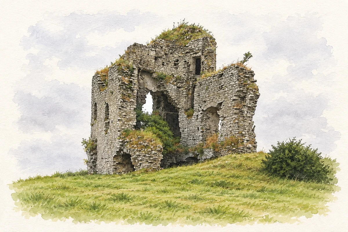
Illustration, surviving ruins of Tullow Castle near Templetouhy
⊕Recorded locationTempletouhy52.78858° N · 7.71765° WInteractive map supplied by OpenStreetMap.
These Irish name elements are associated with this record in the Logainm glossary.
An element’s translation is a clue, rather than a complete explanation of the name. Its form and meaning depend on local history and the full Irish name.
Recorded forms
Teampall Tuaithe· Irish · main form · validated name
Templetouhy· English · main form
Templetuohy· English · main form · local name
Place & story
The ringfort beside the houses
The urban archaeological survey recorded the surviving western half of a ringfort at Templetouhy. Its eastern side had been levelled between 1840 and 1904, and quarrying had affected the northern side. The first-edition Ordnance Survey map showed a circular enclosure about thirty-two metres across internally. Later housing reached the monument itself. At the other end of the village, the survey identified the site of the medieval parish church, but found no surviving church fabric there.[2]
The soup kitchen and the demand for meal
Templetuohy's famine-relief history includes resistance to the way food was distributed. An account researched by William J Hayes and George Cunningham records opposition when a soup kitchen opened in early April 1847. People sought uncooked meal instead of prepared soup. On 13 May, Rev Thompson wrote to the Lord Lieutenant that the district's arrangements were still meeting resistance, although people were starving. He pleaded for public works to continue. The correspondence reveals a local conflict over the form of relief as well as its availability.[3]
An elaborate bellcote at Sacred Heart
The Church of the Sacred Heart at Longorchard dates to about 1880. Its Gothic Revival design includes side aisles, stained glass and an elaborate front rose window. Above the gable stands an octagonal open bellcote, its limestone and marble columns supporting a small spire. Inside, a marble colonnade separates the aisles from the nave, while a timber scissors-truss roof spans the church. The building's detailed stone carving makes it a conspicuous village landmark.[4]
People & connections
Jim Fogarty and the 1971 champions
Moyne–Templetuohy won its first Mid-Tipperary senior hurling title in 1970 under captain Willie O'Grady. The following year brought the county championship. Captained by Jim Fogarty, the side defeated Roscrea by 2–8 to 0–6 in the final on 31 October 1971. Roscrea had won the preceding three county titles. The result therefore marked both a local breakthrough and the end of a powerful rival's championship run, remembered in the county final programme's retrospective account.[5]
Both counts use the 2016 settlement boundary, allowing like-for-like comparison. CSO supplies the 2022 count on this older boundary for comparison only. The official 2022 Built Up Area has different boundaries.
View population figures
Templetuohy — Census 2016 settlement footprint — census population
Templetuohy, North Tipperary — Census town, CSO 2006 report
2002–2006: census town
322people · 2006
These are the historical areas published in the 2006 census report. Boundaries may differ between censuses and from modern settlements. Legal towns, environs and suburbs are shown separately; none has been combined into a modern settlement total.
View population figures
Templetuohy, North Tipperary — Census town, CSO 2006 report — census population
Templetuohy, North Tipperary — Census town, CSO 1996 report
1991–1996: census town
293people · 1996
These are the historical areas published in the 1996 census report. Boundaries may differ between censuses and from modern settlements. Legal towns, environs and suburbs are shown separately; none has been combined into a modern settlement total.
View population figures
Templetuohy, North Tipperary — Census town, CSO 1996 report — census population
Templetuohy, Tipperary — Census town, CSO 1986 report
1981–1986: census town
242people · 1986
Figures cover the historical town area printed in the 1986 report. Boundaries may have changed between censuses. Legal town, environs and suburb totals remain separate and differ from modern settlement boundaries.
View population figures
Templetuohy, Tipperary — Census town, CSO 1986 report — census population
These figures use different area definitions. Read the boundary note before comparing them.
Templetuohy, North Tipperary
Published census settlement populations
282people · 2016
Settlement boundaries changed during this period. Differences may reflect boundary changes as well as population change. Where a 2011 legal-town-and-environs count is shown, it has not been recalculated onto the 2016 settlement boundary.
Tullow Castle near Templetouhy illustration: based on a Castles of Munster: Tullow, Tipperary (1) by Garry Dickinson. AI-assisted watercolour and ink adaptation; cream paper margins added, incidental clutter omitted and fine details simplified. Licence: CC BY-SA 2.0.
 placenames