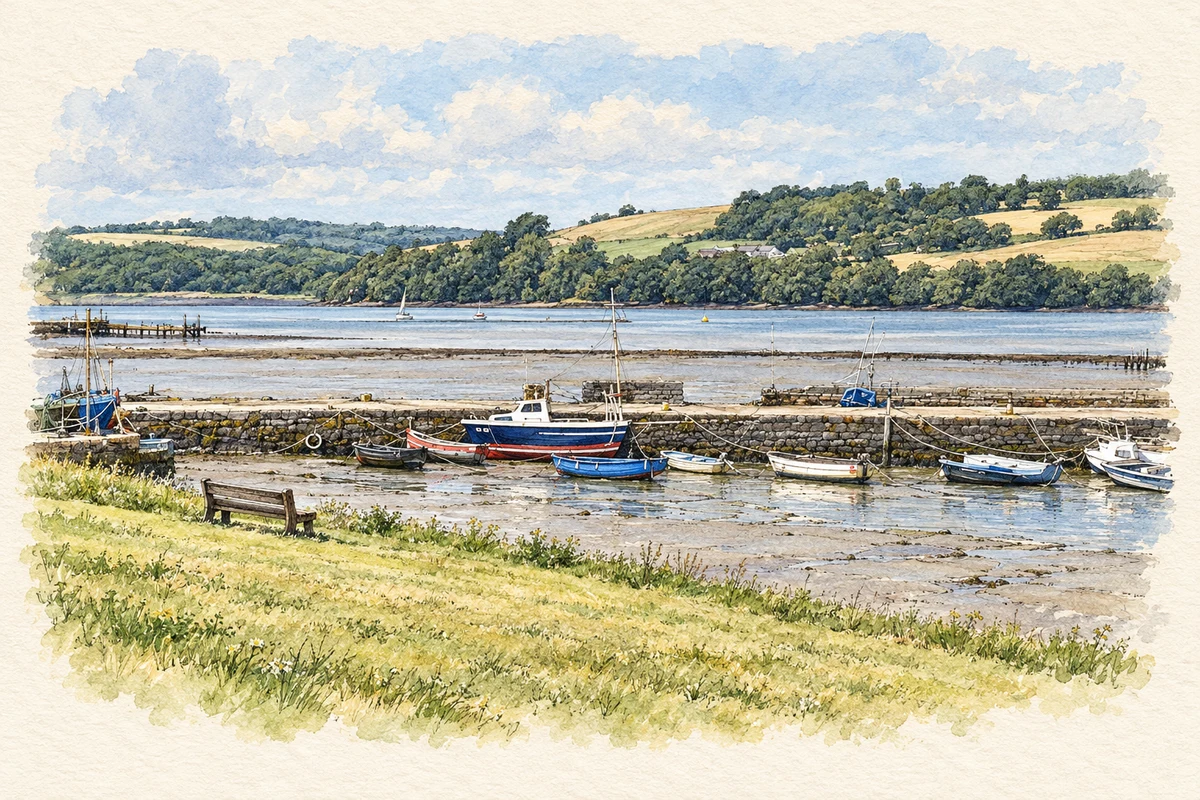
A reliable full-name meaning has not been established here. The recorded Irish and English forms are given without an unsupported translation.
Recorded forms
Pointe na Síge· Irish · main form · validated name
Cheekpoint· English · main form
Place & story
The streak in the river
Waterford’s placenames project explains Pointe na Síge as the point of the streak, referring to foam formed by water passing over a rock in the Suir. Its account draws on Canon Patrick Power’s description of the current leaving a trail downstream on the ebb and upstream on the flood. The rock is called Carraig na Síge. This locally documented explanation links the name to an observable tidal feature and corrects a widespread confusion between the Irish words for streak and fairy.[2]
A packet station’s changing fortunes
In 1837, Samuel Lewis described Cheekpoint as a former Waterford post-office packet station. Hosiery and cotton manufacture had operated here, along with limited rope-making, but he reported that the packet service had moved to Dunmore and manufacturing had failed. He placed the village on the Faithlegg estate at the confluence of the Suir and Barrow, noting the latter’s navigation to New Ross. His description captures a settlement whose industrial prospects had depended heavily on its role in cross-channel transport.[3]
Manning’s pier extension
The L-shaped pier dates from 1884–86. Robert Manning, chief engineer to the Board of Public Works, designed it, and Thomas Ingham Dixon carried out the construction. The architectural inventory records mass concrete on submerged foundations, with a rock-faced sandstone base. This facing moderated the contrast with the pre-existing stone pier. Mooring posts along the rounded coping and the battered walls reveal a carefully engineered addition to a much older working waterfront.[4]
People & connections
Charlie McGuinness and the Frieda
The architectural inventory also records an arms landing at Cheekpoint in November 1921. Captain Charlie McGuinness brought a cargo aboard the tug Frieda after an earlier shipment had been intercepted. Fog caused him to pass the planned landing place at Helvick, and the consignment was unloaded at Cheekpoint instead. Rifles and pistols were then taken towards the Comeragh Mountains. The episode gave the village pier a specific role in the movement of arms during the revolutionary period.[4]
Both counts use the 2016 settlement boundary, allowing like-for-like comparison. CSO supplies the 2022 count on this older boundary for comparison only. The official 2022 Built Up Area has different boundaries.
View population figures
Cheekpoint — Census 2016 settlement footprint — census population
Cheekpoint, Waterford — Census town, CSO 2006 report
2002–2006: census town
313people · 2006
These are the historical areas published in the 2006 census report. Boundaries may differ between censuses and from modern settlements. Legal towns, environs and suburbs are shown separately; none has been combined into a modern settlement total.
View population figures
Cheekpoint, Waterford — Census town, CSO 2006 report — census population
Cheekpoint, Waterford — Census town, CSO 1996 report
1991–1996: census town
320people · 1996
These are the historical areas published in the 1996 census report. Boundaries may differ between censuses and from modern settlements. Legal towns, environs and suburbs are shown separately; none has been combined into a modern settlement total.
View population figures
Cheekpoint, Waterford — Census town, CSO 1996 report — census population
Cheekpoint, Waterford — Census town, CSO 1986 report
1981–1986: census town
308people · 1986
Figures cover the historical town area printed in the 1986 report. Boundaries may have changed between censuses. Legal town, environs and suburb totals remain separate and differ from modern settlement boundaries.
View population figures
Cheekpoint, Waterford — Census town, CSO 1986 report — census population
These figures use different area definitions. Read the boundary note before comparing them.
Cheekpoint, Waterford
Published census settlement populations
318people · 2016
Settlement boundaries changed during this period. Differences may reflect boundary changes as well as population change. Where a 2011 legal-town-and-environs count is shown, it has not been recalculated onto the 2016 settlement boundary.
 placenames