These Irish name elements are associated with this record in the Logainm glossary.
An element’s translation is a clue, rather than a complete explanation of the name. Its form and meaning depend on local history and the full Irish name.
Recorded forms
Baile Átha Luain· Irish · main form · validated name
Athlone· English · main form
Place & story
Two banks of the Shannon
Athlone straddles the Shannon between Westmeath and Roscommon, and between Leinster and Connacht. Lewis’s 1837 account places it on the western road from Dublin to Galway.[2]
The castle and government
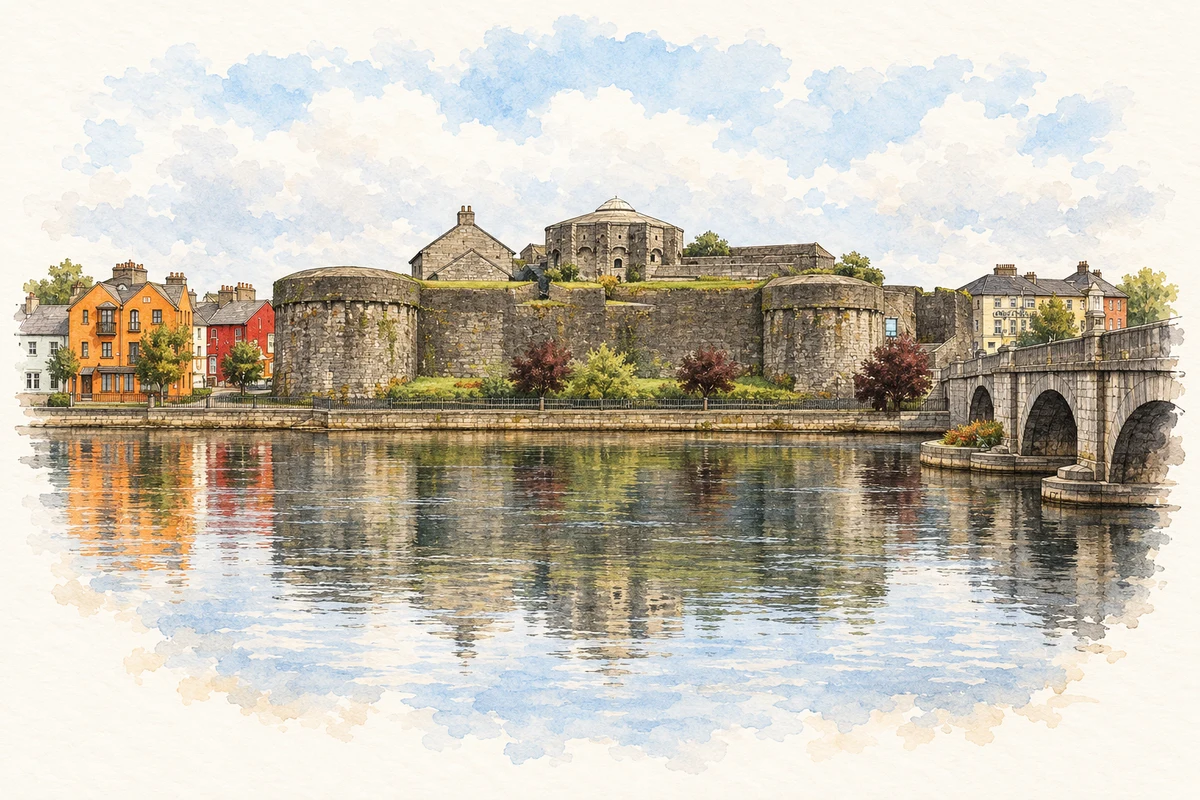
The castle guarded the river crossing and became a centre of the Connacht presidency. Lewis describes repeated strengthening of the military station and religious foundations on opposite banks.[2]
People & connections
John McCormack’s first stage
The tenor John McCormack was born in Athlone on 14 June 1884 to Scottish mill workers Andrew McCormack and Hannah Watson. His first schooling was with the Marist Brothers in the town. A scholarship took him to Summerhill College in Sligo in 1896; he subsequently joined Dublin’s Palestrina Choir and won the tenor gold medal at the Feis Ceoil in 1903.[3]
McCormack studied in Milan before making his operatic debut in Savona in 1906. His Covent Garden debut followed in 1907, and he first sang at New York’s Metropolitan Opera in 1910. Those international stages give the local connection its particular interest: a child of an Athlone industrial household became one of the best-known Irish voices of the recording age. The familiar story that James Joyce competed against him at the 1903 Feis is mistaken; Joyce entered the following year.[3]
Both counts use the 2016 settlement boundary, allowing like-for-like comparison. CSO supplies the 2022 count on this older boundary for comparison only. The official 2022 Built Up Area has different boundaries.
View population figures
Athlone — Census 2016 settlement footprint — census population
These are the historical areas published in the 2006 census report. Boundaries may differ between censuses and from modern settlements. Legal towns, environs and suburbs are shown separately; none has been combined into a modern settlement total.
View population figures
Athlone Legal Town, Westmeath — Legal town, CSO 2006 report — census population
Athlone Environs, Westmeath and Roscommon — Town environs only, CSO 2006 report
2002–2006: town environs only
3,197people · 2006
These are the historical areas published in the 2006 census report. Boundaries may differ between censuses and from modern settlements. Legal towns, environs and suburbs are shown separately; none has been combined into a modern settlement total.
View population figures
Athlone Environs, Westmeath and Roscommon — Town environs only, CSO 2006 report — census population
These are the historical areas published in the 1996 census report. Boundaries may differ between censuses and from modern settlements. Legal towns, environs and suburbs are shown separately; none has been combined into a modern settlement total.
View population figures
Athlone Legal Town, Westmeath — Legal town, CSO 1996 report — census population
Athlone Environs, Westmeath and Roscommon — Town environs only, CSO 1996 report
1991–1996: town environs only
7,853people · 1996
These are the historical areas published in the 1996 census report. Boundaries may differ between censuses and from modern settlements. Legal towns, environs and suburbs are shown separately; none has been combined into a modern settlement total.
View population figures
Athlone Environs, Westmeath and Roscommon — Town environs only, CSO 1996 report — census population
Figures cover the historical town area printed in the 1986 report. Boundaries may have changed between censuses. Legal town, environs and suburb totals remain separate and differ from modern settlement boundaries.
View population figures
Athlone, Westmeath — Legal town, CSO 1986 report — census population
These figures use different area definitions. Read the boundary note before comparing them.
Athlone, Westmeath — 2011 legal town and environs; 2016 census settlement
Published census settlement populations
21,349people · 2016
Settlement boundaries changed during this period. Differences may reflect boundary changes as well as population change. Where a 2011 legal-town-and-environs count is shown, it has not been recalculated onto the 2016 settlement boundary.
View population figures
Athlone, Westmeath — 2011 legal town and environs; 2016 census settlement — census population
Athlone Castle illustration: based on a reference photograph by Borvan53. AI-assisted watercolour and ink adaptation; warm cream paper margins; incidental modern clutter removed and fine details simplified. Licence: CC BY-SA 3.0.
 placenames