These Irish name elements are associated with this record in the Logainm glossary.
An element’s translation is a clue, rather than a complete explanation of the name. Its form and meaning depend on local history and the full Irish name.
Recorded forms
Baile Coimín· Irish · main form · validated name
Blessington· English · main form
Place & story
People & connections
Michael Boyle’s church
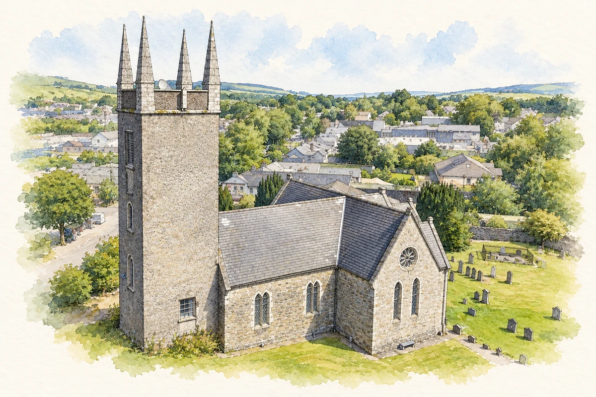
Archbishop Michael Boyle founded and funded St Mary’s Church, providing land for its cemetery as part of his development of Blessington. Consecrated on 24 August 1683, it has remained in regular use. The tower retains bells inscribed with the date 1682 and Boyle’s coat of arms. They preserve a direct material link between the church and its patron, whose career combined senior ecclesiastical office with service as Lord Chancellor.[2]
The valley becomes a reservoir
The River Liffey Scheme changed the country around Blessington during the 1930s and 1940s. Houses were demolished and bridges removed within the area to be flooded. Water rose in 1940 over farmland and bog, creating Poulaphouca Reservoir. The local plan describes the result as a transformation from a town beside the Liffey into a lakeside settlement. Former direct routes between neighbouring places disappeared beneath the new water.[3][4]
A survey before the water rose
Before flooding, researchers documented the valley’s homes, land and social life. Work under Liam Price produced photographs, house plans and surveys preserving a detailed record of communities facing displacement. At Burgage, human remains and historic carved stones were moved from the cemetery before inundation. The collection records a vanished landscape; its oral material remains a research resource rather than being retold here.[3]
Routes cut and routes remade
The reservoir severed the direct connection from the Burgage area towards Baltyboys and a route farther south between Russborough and Tulfarris. These changes altered everyday journeys as well as the view. The lake’s present outline belongs to a twentieth-century engineering project superimposed on a much older pattern of roads, fields and settlements.[4]
Both counts use the 2016 settlement boundary, allowing like-for-like comparison. CSO supplies the 2022 count on this older boundary for comparison only. The official 2022 Built Up Area has different boundaries.
View population figures
Blessington — Census 2016 settlement footprint — census population
Blessington, Kildare and Wicklow — Census town, CSO 2006 report
2002–2006: census town
4,018people · 2006
These are the historical areas published in the 2006 census report. Boundaries may differ between censuses and from modern settlements. Legal towns, environs and suburbs are shown separately; none has been combined into a modern settlement total.
View population figures
Blessington, Kildare and Wicklow — Census town, CSO 2006 report — census population
Blessington, Kildare and Wicklow — Census town, CSO 1996 report
1991–1996: census town
1,860people · 1996
These are the historical areas published in the 1996 census report. Boundaries may differ between censuses and from modern settlements. Legal towns, environs and suburbs are shown separately; none has been combined into a modern settlement total.
View population figures
Blessington, Kildare and Wicklow — Census town, CSO 1996 report — census population
Blessington, Wicklow — Census town, CSO 1986 report
1981–1986: census town
1,322people · 1986
Figures cover the historical town area printed in the 1986 report. Boundaries may have changed between censuses. Legal town, environs and suburb totals remain separate and differ from modern settlement boundaries.
View population figures
Blessington, Wicklow — Census town, CSO 1986 report — census population
These figures use different area definitions. Read the boundary note before comparing them.
Blessington, Kildare and Wicklow
Published census settlement populations
5,520people · 2016
Settlement boundaries changed during this period. Differences may reflect boundary changes as well as population change. Where a 2011 legal-town-and-environs count is shown, it has not been recalculated onto the 2016 settlement boundary.
View population figures
Blessington, Kildare and Wicklow — census population
Saint Mary's Church of Ireland, Blessington, County Wicklow illustration: based on a St Mary's Church of Ireland, Blessington - aerial - 2025-07-12 by 瑞丽江的河水. AI-assisted watercolour and ink adaptation; cream paper margins added, incidental clutter omitted and fine details simplified. Licence: CC BY-SA 4.0.
 placenames