These Irish name elements are associated with this record in the Logainm glossary.
An element’s translation is a clue, rather than a complete explanation of the name. Its form and meaning depend on local history and the full Irish name.
Recorded forms
An Caisleán Nua· Irish · main form · validated name
Newcastle· English · main form
Place & story
A royal settlement under pressure
Medieval Newcastle was a royal manor positioned to protect the coastal route between Bray and Arklow. Its castle existed by about 1210 and became a base for campaigns into the Wicklow uplands. Documents from 1304–05 record 191 burgages and two mills, evidence of a substantial organised settlement. Its history was also one of repeated destruction. The archaeological survey records burnings in 1295, 1315, 1370, 1376 and 1405. After the last of these, Newcastle passed into O'Byrne control and the borough disappears from the surviving documentary record.[2]
The marsh and the market garden landscape
Lewis's 1837 description distinguished Newcastle's lower village from the higher settlement around the church, with views across farmland to the sea. Agriculture supplied the Dublin market with early lamb and veal, and a long white potato called Bangor was widely grown. Along the coast, artificial drainage trenches protected cultivated ground from flooding. Peat from beside the Cooldross marsh was used for fuel, while further turf came from the mountains. His account places the village within a working coastal landscape of drainage, cultivation and connections to the capital.[3]
The church built in stages
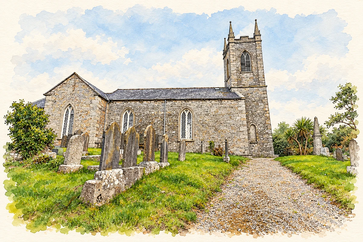
The Church of Ireland parish church was built between 1783 and 1788. Its three-stage tower followed in 1821 and the chancel in 1856, creating a building whose present outline reflects several generations of work. Rubble walls are finished with granite corner stones and dressings. The tower carries a clock, battlements and tall pinnacles, while pointed windows light the nave and transepts. The associated sexton's house and churchyard complete the group. Its elevated setting gives the late Georgian church a strong presence beside the remains of the medieval manor.[4]
Both counts use the 2016 settlement boundary, allowing like-for-like comparison. CSO supplies the 2022 count on this older boundary for comparison only. The official 2022 Built Up Area has different boundaries.
View population figures
Newcastle — Census 2016 settlement footprint — census population
These are the historical areas published in the 2006 census report. Boundaries may differ between censuses and from modern settlements. Legal towns, environs and suburbs are shown separately; none has been combined into a modern settlement total.
View population figures
Newcastle, Wicklow — Census town, CSO 2006 report — census population
These are the historical areas published in the 1996 census report. Boundaries may differ between censuses and from modern settlements. Legal towns, environs and suburbs are shown separately; none has been combined into a modern settlement total.
View population figures
Newcastle, Wicklow — Census town, CSO 1996 report — census population
Figures cover the historical town area printed in the 1986 report. Boundaries may have changed between censuses. Legal town, environs and suburb totals remain separate and differ from modern settlement boundaries.
View population figures
Newcastle, Wicklow — Census town, CSO 1986 report — census population
These figures use different area definitions. Read the boundary note before comparing them.
Newcastle, Wicklow
Published census settlement populations
924people · 2016
Settlement boundaries changed during this period. Differences may reflect boundary changes as well as population change. Where a 2011 legal-town-and-environs count is shown, it has not been recalculated onto the 2016 settlement boundary.
Newcastle Church of Ireland church, County Wicklow illustration: based on a County Wicklow - Newcastle Church - 20200917182830 by Jonathan Baker (Jonjobaker). AI-assisted watercolour and ink adaptation; cream paper margins added, incidental clutter omitted and fine details simplified. Licence: CC BY-SA 4.0.
 placenames