 placenames
Lisnadill
Lios na Daille
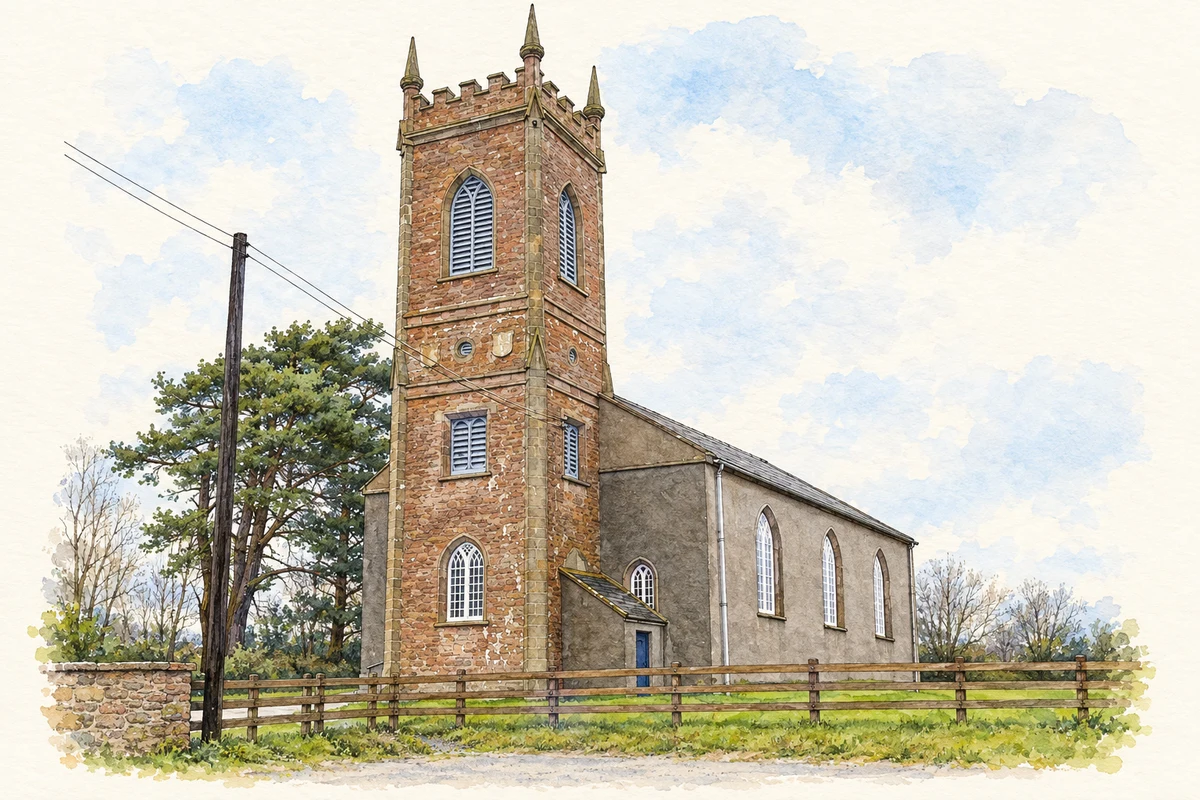
Lisnadill’s church and school preserve the local legacy of Archbishop Richard Robinson, alongside an older parish burial ground.
The name
These Irish name elements are associated with this record in the Logainm glossary.
An element’s translation is a clue, rather than a complete explanation of the name. Its form and meaning depend on local history and the full Irish name.
Recorded forms
- Lios na Daille · Irish · main form · validated name
- Lisnadill · English · main form
Place & story
A church and an older cemetery
Samuel Lewis’s 1837 account dates the church’s square, battlemented tower to 1772 and credits Archbishop Richard Robinson with its erection. The founder’s arms appeared above the entrance. Robinson also provided the glebe house and bought land to support the living. Lewis distinguished this church from an older one destroyed during the 1641 war, whose cemetery remained in use when he wrote. [2]
Schooling from 1780
Lisnadill Primary School traces its opening to 1780. A local school history credits Robinson with ordering its construction after establishing the church and rectory. Parishioners brought stone from a nearby quarry. The original building was a single-storey, whitewashed schoolhouse, with a wooden partition separating two classrooms; its schoolmaster lived in the attic until a permanent house was provided in 1908. [3] [4]
A replacement after the war
Plans for a new school were discussed during the 1930s, but war interrupted progress. A replacement opened in 1958 at the junction of the Newtownhamilton and Drumconwell roads. The red-brick building cost £10,000 and contained two classrooms, an office, dining room and meals kitchen, with grass and paved play areas outside. This was a new building in a much older educational institution. [4]
Geographic information
- Place type
- Population centre
- County
- Armagh
- Barony
- Fews Upper
- Civil parish
- Lisnadill
- Coordinates
- 54.30127, -6.66345 (approximate)
- Logainm ID
- 56382 ↗
Sources & further reading
- Logainm.ie — Lisnadill. Place names and geographic record, licensed under CC BY 4.0.
- A Topographical Dictionary of Ireland (1837): Lisnadill · Samuel Lewis
- Lisnadill Primary School: institutional foundation date · Lisnadill Primary School
- Lisnadill Primary School: local history and principals · Bygones and Byways local history project
- Saint John’s Church of Ireland at Lisnadill, as photographed in 2007 illustration: based on a St John's Church of Ireland, Lisnadill by Kenneth Allen. AI-assisted watercolour and ink adaptation; cream paper margins added, incidental clutter omitted and fine details simplified. Licence: CC BY-SA 2.0.
Name record retrieved 2026-10-25 · Source record modified 2021-12-20. How this page was prepared.