Kilkishen’s built heritage ranges from a medieval tower house to a reused nineteenth-century church, while a nearby lake carries an older storytelling tradition.
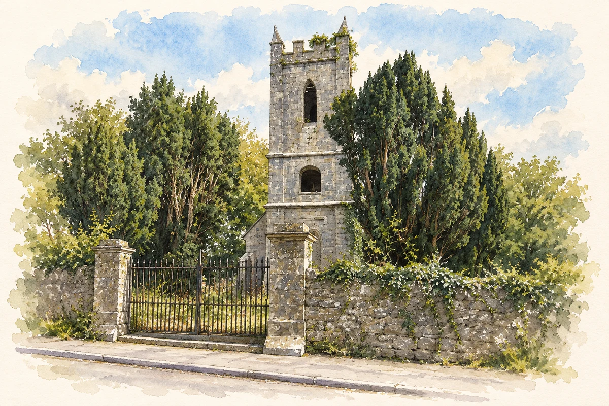
Illustration, Kilkishen church tower, 2007 view before restoration
⊕Recorded locationKilkishen52.80583° N · 8.74764° WInteractive map supplied by OpenStreetMap.
These Irish name elements are associated with this record in the Logainm glossary.
An element’s translation is a clue, rather than a complete explanation of the name. Its form and meaning depend on local history and the full Irish name.
Recorded forms
Cill Chisín· Irish · main form · validated name
Kilkishen· English · main form
Place & story
The MacNamara tower house
Clare County Council identifies Kilkishen Castle as a fifteenth- or sixteenth-century MacNamara tower house. The four-storey building had vaults over two floors; a substantial corner collapsed in the 1980s.[2]
A church adapted for community use
The former Church of Ireland church dates from 1811. Its rubble-stone building has a battlemented tower and stepped corner buttresses. After renovation, it opened as a cultural centre in 2014.[2]
Folklore & tradition
Sioda and the water horse
Thomas Johnson Westropp recorded traditions near Kilkishen about Sioda MacNamara and a captured water horse. After carrying the chieftain for years, the animal supposedly sprang into Cullaunyheeda Lake with him on its back, leaving hoof marks in a rock. Another version said Sioda slept beneath the water, awaiting a summons to a final struggle for Ireland. These are recorded variants of a local legend. They do not prove either a historical drowning or the origin of the lake's name, even where the story offers its own explanation for that name.[3]
Both counts use the 2016 settlement boundary, allowing like-for-like comparison. CSO supplies the 2022 count on this older boundary for comparison only. The official 2022 Built Up Area has different boundaries.
View population figures
Kilkishen — Census 2016 settlement footprint — census population
These are the historical areas published in the 2006 census report. Boundaries may differ between censuses and from modern settlements. Legal towns, environs and suburbs are shown separately; none has been combined into a modern settlement total.
View population figures
Kilkishen, Clare — Census town, CSO 2006 report — census population
These are the historical areas published in the 1996 census report. Boundaries may differ between censuses and from modern settlements. Legal towns, environs and suburbs are shown separately; none has been combined into a modern settlement total.
View population figures
Kilkishen, Clare — Census town, CSO 1996 report — census population
Figures cover the historical town area printed in the 1986 report. Boundaries may have changed between censuses. Legal town, environs and suburb totals remain separate and differ from modern settlement boundaries.
View population figures
Kilkishen, Clare — Census town, CSO 1986 report — census population
These figures use different area definitions. Read the boundary note before comparing them.
Kilkishen, Clare
Published census settlement populations
561people · 2016
Settlement boundaries changed during this period. Differences may reflect boundary changes as well as population change. Where a 2011 legal-town-and-environs count is shown, it has not been recalculated onto the 2016 settlement boundary.
Former Clonlea parish church tower, Kilkishen, 2007 view illustration: based on a Disused church at Kilkishen, Co. Clare by Jonathan Billinger. AI-assisted watercolour and ink adaptation; cream paper margins added, incidental clutter omitted and fine details simplified. Licence: CC BY-SA 2.0.
 placenames