 placenames
Ballyferriter East
An Buailtín
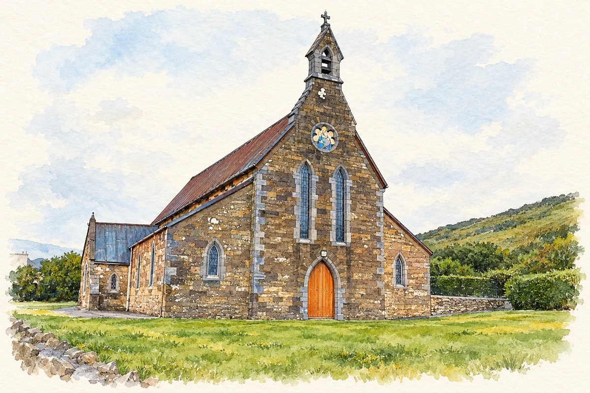
St Vincent’s church marks the eastern part of the village, while bilingual heritage walks connect An Buailtín with the surrounding peninsula.
The name
A reliable full-name meaning has not been established here. The recorded Irish and English forms are given without an unsupported translation.
Recorded forms
- An Buailtín · Irish · main form · validated name
- Ballyferriter East · English · main form
Place & story
J. J. McCarthy’s church
St Vincent’s Catholic Church, or Séipéal Uinseann Naofa, stands in Caherquin beside the eastern part of the village known as An Buailtín. The NIAH dates it to about 1865 and identifies J. J. McCarthy as its architect. Its high nave is flanked by lower aisles, with a bellcote above the entrance end. Stone surrounds frame the narrow lancet windows, and the chancel has a group of three lancets. [2] [3]
The interior and later changes
The church’s interior combines limestone columns and arcades with an open timber roof and a diagonally patterned red-and-black tiled floor. The NIAH records surviving benches in the aisles and a polished black limestone font, alongside later stained glass and a reordered chancel. These details distinguish surviving elements from subsequent alterations, rather than presenting the whole interior as unchanged since McCarthy’s time. [2]
A starting point for heritage walks
Oidhreacht Chorca Dhuibhne developed a series of self-guided walks beginning outside the village museum. The routes include Slí Ghallarais, Slí an Mháimín, Slí na nDúnta and Slí an Fheirtéaraigh. Bilingual maps designed by Dómhnal Ó Bric link this village starting point with the wider landscape, while the organisation’s language and walking weekends bring local heritage into practical use. [4]
Geographic information
Sources & further reading
- Logainm.ie — Ballyferriter East. Place names and geographic record, licensed under CC BY 4.0.
- Séipéal Uinseann Naofa, NIAH21304201 · National Inventory of Architectural Heritage
- An Buailtín / Ballyferriter East, canonical population centre · Placenames Branch
- Heritage maps · Oidhreacht Chorca Dhuibhne
- St Vincent's Church, Ballyferriter East illustration: based on a County Kerry - St Vincent's Church - 20180916194606 by Irina Guerin. AI-assisted watercolour and ink adaptation; cream paper margins added, incidental clutter omitted and fine details simplified. Licence: CC BY-SA 4.0.

Name record retrieved 2026-10-25 · Source record modified 2025-06-23. How this page was prepared.