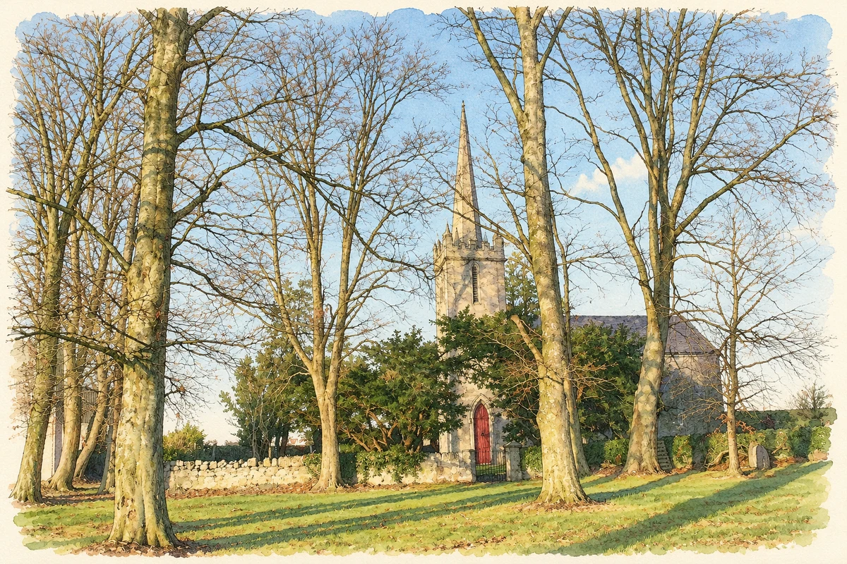
Kilberry's nineteenth-century church stands in the Barrow countryside north of Athy. The surrounding bog also became the setting for a peat industry whose products were intended for an American market.
Illustration, Kilberry Church, County Kildare
⊕Recorded locationKilberry53.03678° N · 7.01683° WInteractive map supplied by OpenStreetMap.
These Irish name elements are associated with this record in the Logainm glossary.
An element’s translation is a clue, rather than a complete explanation of the name. Its form and meaning depend on local history and the full Irish name.
Recorded forms
Cill Bhearaigh· Irish · main form · validated name
Kilberry· English · main form
Place & story
The parish beside the Barrow
Samuel Lewis described Kilberry in 1837 as a parish on the River Barrow, with arable and grazing land making up about two-thirds of its area and bog the remainder. He recorded Bert House as Lord Downes's residence and noted a school partly supported by him, alongside two private schools. Ruined castles and a well dedicated to St John were further features of the parish landscape. The description places country houses, education and farming beside the extensive peatlands that later attracted industrial investment.[2]
Kilberry church and its needle spire
The Church of Ireland building at Bert Demesne was constructed in 1833–34. A slender needle spire rises behind the battlements of its square tower, while lancet windows and pointed doorways establish its Gothic Revival character. The architectural inventory records surviving slate roofing and early timber windows. In the churchyard, a mausoleum stands in its own enclosed plot, with decorative Gothic ironwork at the entrance. Together, the church, grave markers and mausoleum preserve a substantial group of nineteenth-century religious and commemorative architecture.[3]
Peat moss for export
The Leinster Leader reported the formal opening of Bord na Móna's Kilberry peat-moss factory in July 1947 by industry and commerce minister Seán Lemass. The new works employed about 200 men at the time of the report and planned to export 150,000 bales annually to the United States. Peat from the upper bog layers was processed into different grades for uses including stable litter, horticulture and packing. The factory represented a new industrial use for the parish's bogland, with production aimed well beyond the local economy.[4]
People & connections
Karl Peterson's route to Kilberry
The same 1947 report identified the factory manager as Karl Peterson, a Latvian engineer who had graduated from University College Dublin in 1913. After leaving Latvia with his family during the Second World War, he reached Sweden and worked on peat research. Irish specialists visiting Sweden recruited him, and he supervised the erection of the Kilberry works using Swedish plant. His career linked the new factory with both earlier Irish technical education and wartime displacement in northern Europe.[4]
Both counts use the 2016 settlement boundary, allowing like-for-like comparison. CSO supplies the 2022 count on this older boundary for comparison only. The official 2022 Built Up Area has different boundaries.
View population figures
Kilberry — Census 2016 settlement footprint — census population
These are the historical areas published in the 2006 census report. Boundaries may differ between censuses and from modern settlements. Legal towns, environs and suburbs are shown separately; none has been combined into a modern settlement total.
View population figures
Kilberry, Kildare — Census town, CSO 2006 report — census population
These are the historical areas published in the 1996 census report. Boundaries may differ between censuses and from modern settlements. Legal towns, environs and suburbs are shown separately; none has been combined into a modern settlement total.
View population figures
Kilberry, Kildare — Census town, CSO 1996 report — census population
Figures cover the historical town area printed in the 1986 report. Boundaries may have changed between censuses. Legal town, environs and suburb totals remain separate and differ from modern settlement boundaries.
View population figures
Kilberry, Kildare — Census town, CSO 1986 report — census population
These figures use different area definitions. Read the boundary note before comparing them.
Kilberry, Kildare
Published census settlement populations
400people · 2016
Settlement boundaries changed during this period. Differences may reflect boundary changes as well as population change. Where a 2011 legal-town-and-environs count is shown, it has not been recalculated onto the 2016 settlement boundary.
 placenames