A reliable full-name meaning has not been established here. The recorded Irish and English forms are given without an unsupported translation.
Recorded forms
Cathair Saidhbhín· Irish · main form · validated name
Cahersiveen· English · main form
Cahirciveen· English · main form · local name
Place & story
A town beside the new road
Lewis recorded only five houses in Cahersiveen in 1815, followed by rapid growth after a new road opened through the Iveragh mountains. By 1837 the town had a long main street and side streets leading towards its quay and older settlement. A pier and small quay built in 1822 served imports of timber, salt and iron, alongside exports of grain and flour. Fishing and farming overlapped in the local economy, with Lewis counting about four hundred people involved in the fishery.[2]
The rebuilt Old Barracks
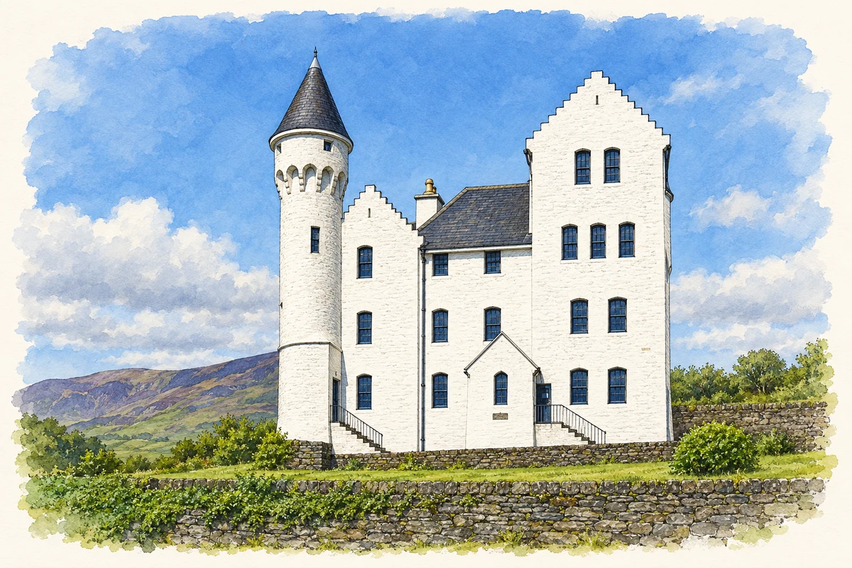
The Old Barracks, designed by E. T. Owen and built in 1870–75, housed the Royal Irish Constabulary. Its Scottish Baronial design combines crow-stepped gables, a round turret and smaller projecting corner features. Pale stone dressings contrast with the rubble masonry. Burned in 1922, it underwent extensive reconstruction between 1991 and 1996 for use as a heritage centre. The restored roofline now gives the town a particularly recognisable landmark and preserves the ambitious appearance of this nineteenth-century government building.[3]
People & connections
A church named for Daniel O'Connell
The Daniel O'Connell Memorial Church of the Holy Cross commemorates a lay politician whose campaign for Catholic emancipation mobilised large numbers of supporters. Its name required special papal permission, giving Cahersiveen's parish church a distinctive dedication. O'Connell's memorial here joins religious life to the political history of nineteenth-century Ireland. Although the church honours him locally, his burial place is Glasnevin Cemetery in Dublin, where his remains became the focus of a separate national commemoration.[4]
Both counts use the 2016 settlement boundary, allowing like-for-like comparison. CSO supplies the 2022 count on this older boundary for comparison only. The official 2022 Built Up Area has different boundaries.
View population figures
Cahirciveen — Census 2016 settlement footprint — census population
These are the historical areas published in the 2006 census report. Boundaries may differ between censuses and from modern settlements. Legal towns, environs and suburbs are shown separately; none has been combined into a modern settlement total.
View population figures
Cahirciveen, Kerry — Census town, CSO 2006 report — census population
These are the historical areas published in the 1996 census report. Boundaries may differ between censuses and from modern settlements. Legal towns, environs and suburbs are shown separately; none has been combined into a modern settlement total.
View population figures
Cahirciveen, Kerry — Census town, CSO 1996 report — census population
Figures cover the historical town area printed in the 1986 report. Boundaries may have changed between censuses. Legal town, environs and suburb totals remain separate and differ from modern settlement boundaries.
View population figures
Cahirciveen, Kerry — Census town, CSO 1986 report — census population
These figures use different area definitions. Read the boundary note before comparing them.
Cahirciveen, Kerry
Published census settlement populations
1,041people · 2016
Settlement boundaries changed during this period. Differences may reflect boundary changes as well as population change. Where a 2011 legal-town-and-environs count is shown, it has not been recalculated onto the 2016 settlement boundary.
The Old Barracks, Cahersiveen illustration: based on a Former RIC Barracks, Cahersiveen, Kerry by Garry Dickinson. AI-assisted watercolour and ink adaptation; cream paper margins added, incidental clutter omitted and fine details simplified. Licence: CC BY-SA 2.0.
 placenames