These Irish name elements are associated with this record in the Logainm glossary.
An element’s translation is a clue, rather than a complete explanation of the name. Its form and meaning depend on local history and the full Irish name.
Recorded forms
Oileán Ciarraí· Irish · main form · validated name
Castleisland· English · main form
Place & story
The castle and the trading street
A thirteenth-century castle gave Castleisland its name, appearing in medieval references as the Castle of the Island or simply the Island. A surviving tower behind Killarney Road remains part of the castle grounds. The town developed as a commercial centre for its agricultural hinterland, and its unusually broad Main Street preserves the scale of a market street. Its protected buildings include the Carnegie building, Presentation Convent and older commercial premises, recording several phases of that development.[2]
People & connections
Pádraig O'Keeffe's teaching system
Pádraig O'Keeffe came from Glountane near Castleisland. After leaving school teaching in 1920, he travelled through Sliabh Luachra teaching fiddle and accordion. He devised notation suited to his pupils: fiddle strings corresponded to spaces on the staff, with numbers indicating fingering, while accordion notation included bellows directions. Manuscripts preserved by former pupils and their families now form part of the Irish Traditional Music Archive. They record the practical methods by which an influential regional musician passed tunes to another generation.[3]
A church built in stages
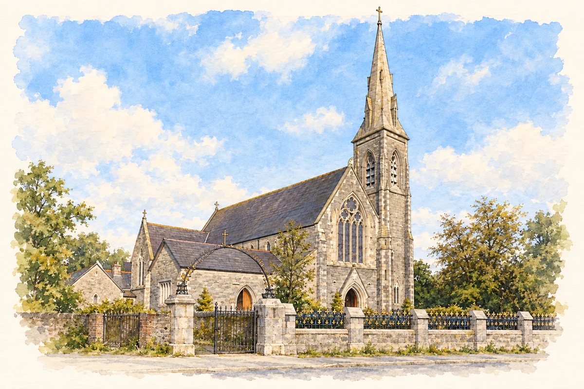
The Catholic church of Saints Stephen and John began in 1880. Its Gothic Revival design combines a cruciform plan, slate roofs and carefully worked limestone. Inside, pointed arcades rest on polished granite columns with marble bases. Around 1910 a three-stage tower and broach spire were added, giving the church a more prominent skyline. Later sacristy and mortuary-chapel additions extended the building again, leaving several generations of work within the same ensemble.[4]
Both counts use the 2016 settlement boundary, allowing like-for-like comparison. CSO supplies the 2022 count on this older boundary for comparison only. The official 2022 Built Up Area has different boundaries.
View population figures
Castleisland — Census 2016 settlement footprint — census population
Castleisland, Kerry — Census town, CSO 2006 report
2002–2006: census town
2,300people · 2006
These are the historical areas published in the 2006 census report. Boundaries may differ between censuses and from modern settlements. Legal towns, environs and suburbs are shown separately; none has been combined into a modern settlement total.
View population figures
Castleisland, Kerry — Census town, CSO 2006 report — census population
Castleisland, Kerry — Census town, CSO 1996 report
1991–1996: census town
2,233people · 1996
These are the historical areas published in the 1996 census report. Boundaries may differ between censuses and from modern settlements. Legal towns, environs and suburbs are shown separately; none has been combined into a modern settlement total.
View population figures
Castleisland, Kerry — Census town, CSO 1996 report — census population
Castleisland, Kerry — Census town, CSO 1986 report
1981–1986: census town
2,281people · 1986
Figures cover the historical town area printed in the 1986 report. Boundaries may have changed between censuses. Legal town, environs and suburb totals remain separate and differ from modern settlement boundaries.
View population figures
Castleisland, Kerry — Census town, CSO 1986 report — census population
These figures use different area definitions. Read the boundary note before comparing them.
Castleisland, Kerry
Published census settlement populations
2,486people · 2016
Settlement boundaries changed during this period. Differences may reflect boundary changes as well as population change. Where a 2011 legal-town-and-environs count is shown, it has not been recalculated onto the 2016 settlement boundary.
St Stephen and St John's Church, Castleisland illustration: based on a Castleisland Parish Church by David Dixon. AI-assisted watercolour and ink adaptation; cream paper margins added, incidental clutter omitted and fine details simplified. Licence: CC BY-SA 2.0.
 placenames